Shannon KalahanExplorer
I am an avid traveler, adventurer, dog owner, chapstick user, professional photographer, teacher and author based out of New England. I love to meet new people, so please, reach out to say hi!
Hike Pulpit Rock Conservation Area
Bedford, New Hampshire
4.8
2.4 mi
/ 0 ft gain
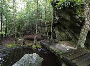
We began our hike at Kennard Trailhead, which is easy to miss if you aren’t looking for it. The approximate GPS address is 596 New Boston Road, Bedford, NH, though in reality the parking area is about 0.2 miles west of the junction of New Boston Rd and Esther Drive.These trails are very well maintained and labeled, with color coded arrows on the trees to keep you on the correct path.The first ...
Hiking at Pondicherry Wildlife Refuge
Jefferson, New Hampshire
4.5
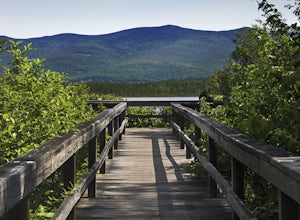
As hiking in the White Mountain area goes, this is a pretty easy one. This is a family friendly hike along a rail trail and well maintained forest trails. The main attraction here isn't the difficultly. The main attraction here is the spectacular views and the abundant wildlife.This trail begins on Airport Road in Jefferson, NH. If you are coming from Rt 116, the trailhead parking lot is ac...
Hike the White Dot-White Cross Loop at Mount Monadnock
Jaffrey, New Hampshire
4.5
4.2 mi
/ 1771 ft gain
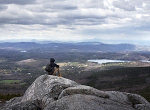
The White Dot trail is the shortest, steepest ascent to the summit, while White Cross has a slightly easier grade down with very little difference in distance. Therefore, per the park's rangers, the best way to conquer this loop is White Dot up, White Cross down.The White Dot Trail begins at Monadnock State Park Headquarters, and starts as a mild, well-worn trail through the woods. At 0.6 mil...
Explore Block Island
New Shoreham, Rhode Island
5.0
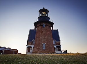
Block Island, a small island off the coast of the Rhode Island mainland, is well-known as a local summer playland. Tourists typically go to the quaint New England island in the summer months for the biking, hiking, sailing, kayaking, fishing and 17 miles of beaches.Although you can bring a car over on the ferry or rent a moped while on the island, I have always preferred to travel by bike. If...
Hiking Enders Falls
Granby, Connecticut
4.3
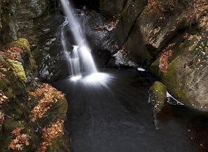
Enders State Forest sprawls over approximately 2000 acres, and is found within the towns of Granby and Barkhamsted in Connecticut. Enders has a good sized parking lot directly on Route 219. From the junction of Route 219 and Route 20, visitors will proceed west on Route 219 for 1.2 miles and turn into the Forest on the left. The main trail is directly off the parking lot.Enders Falls is coll...
Photograph Nubble Lighthouse
York, Maine
4.8
Officially named Cape Neddick Light, though more commonly known as Nubble Light, this lighthouse is part of the National Register of Historic Places and is a local favorite for photography. The lighthouse park is located just over the New Hampshire / Maine state line in New England, in York, ME.For photography purposes, Nubble Light has a lot of great characteristics. The mainland Sohier Park...
Hike the Ragged Mountain Memorial Preserve
Berlin, Connecticut
4.5
5.5 mi
/ 560 ft gain
Ragged Mountain main loop is approximately 5.5 miles long, and is known for its expansive bare-rock vistas, vertical cliff faces, and scenic views overlooking cliff-side reservoirs and ponds. The trail is rated moderate, with some flat stretches among the trees, mixed with some uneven rocky footing, especially closer to the preserve’s cliff faces. The main loop can be traveled in either direc...
Hike to the Heublein Tower on Talcott Mountain
Simsbury, Connecticut
4.3
2.54 mi
/ 404 ft gain
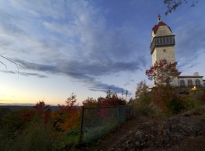
The Heublien Tower Trail, located just inside the Talcott Mountain State Park entrance off of Route 185 in Simsbury CT, is a short 1.25 miles. While the hike isn't long, the first 1/3 of a mile is a steep incline that will get your heart pumping.
The trail itself it very well kept, and although it is steep, it is not technical. It is a family friendly hike through typical Connecticut deciduous...
Hike Monument Mountain
Great Barrington, Massachusetts
4.0
2 mi
/ 720 ft gain
At 1642 feet (with a total elevation gain of 720 feet), Squaw Peak is a great spot to see both Mt Greylock along the Vermont border, and the Catskills in New York. There are several trail options here to get to the summit, but no matter which combination you choose, you can keep your trip under 3 miles round trip.Personally, I chose to take the Hickey Trail for the bulk of the elevation gain, ...
Explore the Parker River National Wildlife Refuge
Newbury, Massachusetts
4.6
6.5 mi
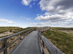
Located just north of Boston, Parker River National Wildlife Refuge was established in 1941 to provide feeding, resting, and nesting habitat for migratory birds. The refuge lands are both scenic and diverse, with approximately 4700 acres of habitats including sandy beach and dune, cranberry bog, maritime forest and shrub land, and both salt water and freshwater marsh.Although the primary functi...
Hike Pike Creek Trail in the Steens Mountains
Princeton, Oregon
5.4 mi
/ 1500 ft gain
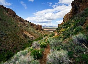
Starting at approximately 4300’, Pike Creek trail is about 5.4 miles RT to Pike’s Knob, out and back, however the entire hike is stunning and there is no wrong place to turn back.
The road for the Pike Creek Trail is a few miles north of the Alvord Hot Springs, on an unmarked, heavily rutted turn off. Look for a dirt road with a cattle guard on the west side of the road, about 1.9 miles nort...
Hike to Owl's Head Trail Overlook
Groton, Vermont
3.0
3 mi
/ 200 ft gain
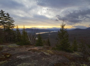
Starting at 1746 ft of elevation, this easy 3 mile hike (RT) pays off with a dramatic view of Lake Groton, Kettle Pond and the Green Mountains of Vermont. The trail head begins in New Discovery Park, along the dirt road to Osmore Pond. There is room to pull off the dirt road and park near the trail head sign.Ultimately, this trail only has about 200 ft of elevation change as it threads its wa...
Badlands Loop in Death Valley
DEATH VALLEY, California
4.6
2.56 mi
/ 463 ft gain
The Badlands Loop is a surreal 2.5 mile walk down into the gullies and gulches below Zabriskie Point in Death Valley. The loop takes you past distinct rock formations, through mud tiled washes, past old abandoned borax mines and finally up above the eroded arteries to a fantastic view of an otherworldly landscape.
The trailhead for the Badlands Loop begins at the base of Zabriskie Point, just ...
Hike the John Dellenback Dune Trail
Lakeside, Oregon
1 mi
/ 100 ft gain
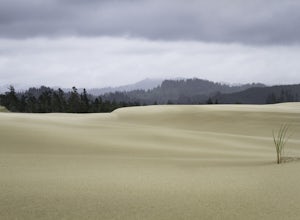
I think the greatest appeal of the John Dellenback area is its diversity. The varied coastal ecosystems, including a creek and forest with moisture-loving souls like the newts and gigantic slugs contrasts significantly with the expansive sand dunes just beyond the edge of the tree line. In one direction, there is a coniferforest and rare red fescue community. In the other, you’llfind empty d...
Mt. Mansfield via the Long Trail
Stowe, Vermont
5.0
5.27 mi
/ 2743 ft gain
There are several options to reach the summit of Mount Mansfield. The Toll Road (which, appropriately, has a toll to use it), the Laura Cowles trail, the Sunset Ridge trail, Haselton Trail, the Hellbrook Trail… The most popular trail from the east side of the mountain, however, is the section of the Long Trail that I hiked. Starting at approximately 1600 feet of elevation, the trail head lo...
Hike the Mill River Trail to the Blue Trail at Sleeping Giant SP
Hamden, Connecticut
5.0
3 mi
/ 518 ft gain
Since I was a child, I’ve always enjoyed hiking the Giant. As Connecticut parks go, this terrain is some of the most challenging (and unfortunately, the most dangerous) in the state. The actual ridge is approximately 2.75 miles long by 1.75 miles wide, and offers approximately 24 miles of hiking trails, from hard, steep climbs all the way to leisurely strolls. The park also has horse friendly t...
Hike the White Rocks Ice Beds Trail
Wallingford, Vermont
1.6 mi
/ 180 ft gain
This 1.6 mile round trip hike starts from the Ice Beds parking lot in the Green Mountain National Forest in Vermont. The trailhead is close to the parking lot entrance, following the blue-blazed trail. Be sure to read the signs, as the far trailhead is a hike to the cliffs, not the ice beds. After crossing over a brook, the trail climbs several switchbacks to the top of a knoll at 0.2 miles. ...
Hike to Blackledge Falls
Glastonbury, Connecticut
3.7
1.5 mi
Although the park contains hiking trails, a pond and a streambelt, the primary draw of this parcel of land is the 25 foot waterfall. The falls flow varies depending on the volume of precipitation, from a trickle in the dry months to a three-pronged vertical drop after some consistent snow melt or rain fall.Blackledge Falls Park by itself is an easy, family-friendly hike or single track mountain...
Falls Trail Loop in Ricketts Glen State Park
Benton, Pennsylvania
4.9
6.29 mi
/ 938 ft gain
Ricketts Glen State Park in Pennsylvania sprawls over 13,050 acres in the Luzerne, Sullivan and Columbia counties. The park boasts a lake, 21 named waterfalls, diverse wildlife and old growth timber. There are two Falls Trails alternatives – a long and short loop.
The long loop is 7.2 miles long and begins of Highway 118, below the glens. For the long trail, park at the Evergreen Parking Area....
Camel's Hump Summit via Monroe Trail
Duxbury, Vermont
4.8
6.22 mi
/ 2572 ft gain
You'll begin your Monroe Trail hike at approximately 1500', parking in one of three designated gravel lots along Camel's Hump Road in Duxbury. This trail is 6.8 miles round trip, and gains approximately 2583' in elevation. It is located on the east side of the mountain.
Much of your hike will be through a deciduous forest (mainly maple and birches) along a well maintained trail that gains el...
Hike Tuckerman's Ravine Trail on Mt. Washington
Jackson, New Hampshire
4.9
9 mi
While this trail is open year round with winter hiking/skiing down the ravine walls, this entry will focus on hiking in the warmer months.Your hike starts behind the Pinkham Notch AMC Center in Jackson, NH at an elevation of approximately 2050 ft. There is plenty of parking at the visitors center, as well as bathrooms and access to load up on food / water before you being.The first 2.4 miles o...
Sterling Pond Trail
Cambridge, Vermont
5.0
2.28 mi
/ 876 ft gain
Sterling Pond trail begins across the street from a parking area on Route 108, about 3 miles south of Smugglers' Notch Resort. Keep in mind that the road is closed to vehicles once the snow falls, so if you want to hike this area in the winter, you'll have to park about 40 minutes away and hike in to the trailhead.
This trail is a short 1.1 miles each way, with a 1000' gain in elevation. It'...
Community
© 2023 The Outbound Collective - Terms of Use - Privacy Policy

