Brandon DeweyExplorer
I am a Father, Photographer, Adventurer, and World Explorer (26 countries and counting). I'm from the Bay Area but I'm currently living outside of Richmond, Virginia.
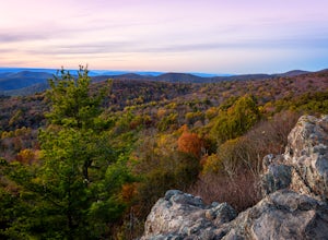
Photograph The Point Overlook
Elkton, Virginia
4.0
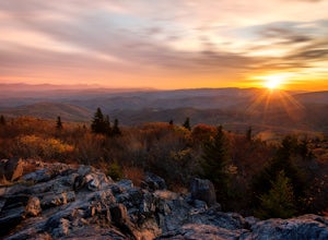
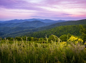
The Point is the best overlook off of Skyline Drive to watch the sun set behind the Blue Ridge Mountains. The Point Overlook is one of 72 overlooks for people to enjoy the beauty of Shenandoah National Park as they drive along Skyline Drive. Skyline Drive is the road that winds through the heart of Shenandoah National Park, starting at Front Royal in the north and ending at Rockfish Gap in th...
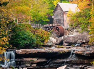
Camp at Babcock State Park
Danese, West Virginia
5.0
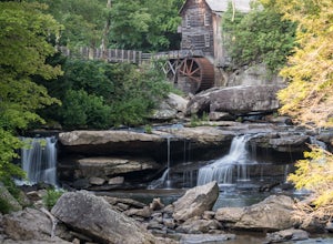
Babcock State Park is one of 36 state parks in West Virginia and is located just Southeast of Fayetteville, WV. Babcock State Park has over 4,000 acres, making it a great place to camp while you explore the beautiful area. The campground has 51 campsites for tents and is open from the last weekend in April through October 31. The campground is dog friendly, making it ideal to bring the whole...
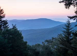
Red Spruce Knob
Marlinton, West Virginia
5.0
1.91 mi
/ 348 ft gain
To reach Red Spruce Knob trailhead from Marlinton, West Virginia, take HW 219N for about 7 miles then turn left onto HW150. Follow HW150 for about 5 miles, and the parking lot and trailhead will be on the left side of the road. The Red Spruce Knob trail is easy to follow and is well marked with blue diamond blazes. During the summer there are a few areas of the trail that become overgrown, but ...
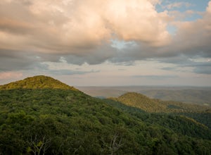
Hike High Rocks
Hillsboro, West Virginia
5.0
3.1 mi
/ 376 ft gain
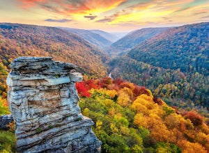
To reach High Rocks trailhead, drive about 3.3 miles along West Virginia’s Highland Scenic Highway (HW150) from Cranberry Mountain Nature Center. The parking lot and trailhead will be on the right side of the road. The High Rocks trail is 3.1 miles out and back and is fairly flat as it follows a ridge line most of the way. The dirt trail is well marked with blue diamond blazes and is very easy ...
Hike Big Meadows
Stanley, Virginia
4.7
1 mi
/ 30 ft gain
Big Meadows is located in the middle of Shenandoah National Park and a great place for the whole family to explore, including your four legged friends.
There is a small parking area that can hold about 10 vehicles, but don't worry if it’s full. There is a very large parking area across Skyline Drive, located in front of the Big Meadows Wayside Station and the Visiter Center. There is no offici...
Hike Skyline Trail at Babcock State Park
Danese, West Virginia
5.0
4 mi
/ 300 ft gain
The skyline trail is a 4 mile out and back trail that allows you to start from either end. I prefer to start from the lower trail head near Cabin 5. To get to this trailhead: enter the park, and follow the narrow road the leads to cabins 1-6. Drive down the road until you reach cabin 5, and find a place to pull off the road and park. The trailhead will be on your righthand side. If you do not l...
Hike the Shenandoah River State Park Loop
Bentonville, Virginia
5.0
8 mi
/ 650 ft gain
Shenandoah River State Park is located in the heart of the Shenandoah Valley. The park is full of well-maintained trails great for hiking and mountain biking. The trails both parallel the banks of the river as it snakes through the Shenandoah Valley and through the rolling hills, which provides great views of the river and surrounding mountains. Shenandoah River State Park is nestled between ...
Camp at Day Run Campground
Marlinton, West Virginia
5.0
Located in West Virginia’s Monongahela National Forest about half way between Snowshoe and the Cranberry Glades makes this campground an ideal place to set up a base camp while you explore the surrounding area. It is located about five miles from Highland Scenic Highway (HW150), which makes it just far enough away to not hear any vehicles driving on the road but close enough to easily hop on an...
Photograph Sugarland Overlook
Mouth of Wilson, Virginia
Located just inside the park entrance of Grayson Highlands State Park in Virginia, Sugarland Overlook provides an outstanding easterly view of the surrounding Blue Ridge Mountains.
The Sugarland Overlook is located about a mile up from the ranger station and is on the righthand side of the road. Sugarland Overlook is easy to access and has a lot of parking spots for visitors to enjoy the amaz...
Photograph Hazel Mountain Overlook
Luray, Virginia
4.0
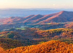
Skyline Dive runs through the heart of Shenandoah National Park. Consisting of 72 overlooks over 105 miles, Skyline Drive offers great views of the surrounding Blue Ride Mountains and valleys. Hazel Mountain Overlook is located at mile marker 33 along Skyline Drive and is one of a handful of overlooks that looks due east. Located in the northern part of the Central District of Shenandoah one...
Twin Pinnacles via Big Pinnacles Trail
Mouth of Wilson, Virginia
5.0
2 mi
/ 525 ft gain
To reach the Big Pinnacle Trail Head, park at the Massie Gap Day Parking area, and then follow the road west (away from Massie Gap) until you reach the trail head located on the left side of the road. Follow the Big Pinnacles Trail for 0.4 miles until it intersects with the Twin Pinnacles Trail. The trail to the right will lead you to the Outlooks faster. From the junction, follow the trail ...
Photograph Spilter Knoll Overlook
Stanley, Virginia
5.0
The Spitler Knoll is one of 72 overlooks for people to enjoy as they travel through Shenandoah National Park along Skyline Drive. Skyline Drive is the road that winds through the heart of Shenandoah National Park, starting at Front Royal in the north and ending at Rockfish Gap in the south. This 105 mile long road offers great views of the surrounding Blue Ridge Mountains and valleys while sim...
Three Falls Hike
Stanley, Virginia
8.3 mi
/ 2200 ft gain
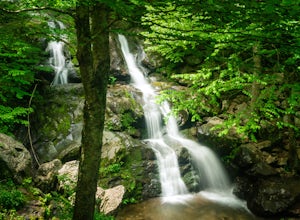
The Three Falls Hike in Shenandoah National Park will take you past three beautiful waterfalls all found within the central district of the park: Lewis Spring Falls, Dark Hollow Falls, and Rose River Falls. You are able to start the loop from any of the waterfalls’ trailheads, but I prefer to start at the Lewis Spring Fall Trailhead because it has the largest parking area and a bathroom. To re...
Photograph Devils Knob Overlook
Roseland, Virginia
4.5
Located next to Wintergreen Resort, Devils Knob is super easy to get to and has an amazing 180 degree panoramic view. Looking Southwest over the Blue Ridge Mountains and the Blue Ridge Parkway, this 3,800 foot overlook had a great view of Three Ridge Mountain and the Priest. Located on Devils Knob Loop, the overlook is not marked, but it is a very obvious turn off and has plenty of parking. Th...
Photograph Bodie Island Lighthouse
Nags Head, North Carolina
5.0
Bodie Island Lighthouse is one of five lighthouses located on the Outer Banks in North Carolina. Located just 10 miles south of Nags Head, NC. To reach the lighthouse follow Cape Hatteras National Park Rd (HWY 12) from the intersection of HWY 158 for 5.2 mile then turn right onto Bodie Island Lighthouse Rd and follow the road for 1 mile until you reach the parking lot. It is free to park in t...
Photograph 20 Minute Cliff Overlook
Vesuvius, Virginia
4.5
Located at mile marker 19 along the Blue Ridge Parkway, 20 Minute Cliff Overlook is super easy to access and has an amazing 180 degree panoramic view. Looking West over the Blue Ridge Mountains, this 2,715 foot overlook has a great view of the Priest to the South, Maintop Mountain and Fork Mountain to the West, and Round Mountain to the Northwest. 20 Minute Cliff Overlook is located 19 miles s...
Camp at Blackwater Falls State Park
Davis, West Virginia
5.0
Blackwater Falls State Park is one of 36 state parks in West Virginia and is located just north of the Canaan Valley less than two miles from Davis, WV. Blackwater Falls State Park has over 2,000 acres, making it a great place to camp while you explore the beautiful area. The campground has 65 spots for tents and is open from the last weekend in April through October 31. The campground is do...
Island in the Sky Trail
Danese, West Virginia
5.0
0.8 mi
/ 108 ft gain
To reach the trailhead, park at the main parking area near Glade Creek Grist Mill. Cross the bridge toward the grist mill, and the trailhead is directly behind the mill. Even though the Island in the Sky trail is only a mile long out and back, it is lined almost the whole way with rhododendron bushes that, at times, canopy over the trail. The trail leads passed the base of the rock cliffs that ...
Photograph Moormans River Overlook
Grottoes, Virginia
5.0
Moormans River Overlook is one of the few eastern facing overlooks in Shenandoah National Park’s Southern District, which makes this a prime location for watching the sun rise when in this part of the park. At mile post 92 off of Skyline Drive, Moormans River Overlook offers photographers a 180 degree view of the eastern most Blue Ridge Mountains and rolling hills surrounding Charlottesville, ...
Photograph Range View Overlook
Bentonville, Virginia
5.0
Range View Overlook in Shenandoah National Park is an amazing spot to watch the sunrise and sunset where the Blue Ridge Mountains meet the rolling hills.
Range View Overlook has views of Jenkins Mountain to the south, Pignet Mountain and Mary’s Rock to the southwest, and Hogback Mountain to the west. Range View Overlook is one of 72 beautiful overlooks along Skyline Dive. 105 miles long, Skyli...
Photograph Jewell Hollow Overlook
Luray, Virginia
One of Shenandoah National Park’s 72 overlooks, Jewell Hollow is a great place for people to stop while they are traveling through the park along Skyline Drive. Skyline Drive is the road that winds through the heart of Shenandoah National Park, starting at Front Royal in the north and ending at Rockfish Gap in the south. This 105-mile long road offers great views of the surrounding Blue Ridge ...
Photograph Dana Fork
Tuolumne County, California
Yosemite is filled with some amazing views but rarely do you get to experience these views by yourself. This hidden treasure is located off of Tioga Pass, is near some of Yosemite’s most popular hikes, and offers an outstanding sunrise and sunset views without the crowds.
Located 2.5 miles South of the Yosemite National Park East Entrance and less than 6 miles East of Tuolumne Meadows, Dana F...
Photograph Lake Tahoe’s Inspiration Point
South Lake Tahoe, California
4.7
Lake Tahoe’s Emerald Bay is a national natural landmark and is one of the prettiest parts of the lake. Inspiration Point is located along route 89 on the Southwest side of Tahoe about 10 miles from South Lake Tahoe or about 33 miles South from Truckee. It is very easy to get to, and its high vantage point allows photographers to see all of Emerald Bay as it leads into Lake Tahoe. Inspiration...
Beauty Mountain Trail
Edmond, West Virginia
5.0
1.1 mi
/ 279 ft gain
The Beauty Mountain Trail Head is located less than 10 miles form Fayetteville, WV. To reach the trail head, you will have to travel down some very narrow roads, and I recommend going old school and printing out the directions because cell service in the area is not the best. Once at the trail head, park along the side of the road; there is no formal parking area. There is also no sign marki...
Community
© 2023 The Outbound Collective - Terms of Use - Privacy Policy

