Nathan Szwarc Explorer
Avid hiker, backpacker, and aspiring photographer living in east Tennessee.
Ozone Falls
Rockwood, Tennessee
4.2
0.35 mi
/ 43 ft gain
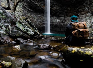
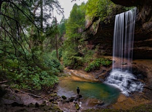
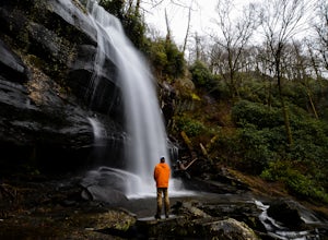
This beautiful, 110-foot waterfall is an easy 15-minute walk from the parking area. Note that the walk down to the falls, although short, is steep and there isn’t a well-marked trail down. It’s more about choosing the path of least resistance. Also, it can get quite busy in the summer time especially mid-day, however in the other seasons and early in the morning and at dusk, it's generally not...
Hike to Debord and Emory Gap Falls in Frozen Head SP
Wartburg, Tennessee
4.3
3.2 mi
/ 465 ft gain
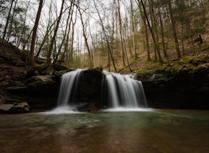
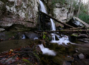
The trail head begins just over the bridge and is labeled as the Panther Branch trail head. To began you will continue straight and within .6 miles of hiking you will come to the first waterfall on a branch off on the right side of the trail. This first waterfall is Debord Falls and it can be easily reached by going down the wooden stairs to the bottom where you will get an unobstructed view of...
Waterrock Knob Trail
Sylva, North Carolina
5.0
1 mi
/ 407 ft gain
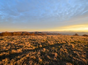
The trail begins paved and quickly climbs up into a heavily forested area. Once at a 1/4 of a mile in, you will come to a nice overlook that will give you your first real good view of the surrounding mountains. The trail then continues on, though now unpaved, with great views off to your left as you ascend. At the top you have a few different areas to overlook the layers of mountains that surro...
Hike to Courthouse Falls
Balsam Grove, North Carolina
4.7
0.07 mi
/ 40 ft gain
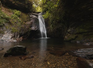
First off, I want to say although the road is gravel it is accessible for 2WD cars you do not need a 4WD car to access this hike. The trail begins just over the bridge that crosses Panther Branch Creek. Just over the bridge there is a pullout where you can park that should fit at least 3 cars. The trail then is just right across from you on the right side of the bridge and is labeled Summey Cov...
Spruce Flats Falls
Townsend, Tennessee
4.8
1.64 mi
/ 495 ft gain
To get to Spruce Flats Falls, you will want to drive down 2.2 miles down the scenic Tremont Road to the Great Smoky Mountains Institute and park in the visitor center parking area. You will then want to ascend up the gravel road past the sign that says restricted to unrestricted traffic (meaning cars). Once you have climbed a very short distance you will see a trail sign and map to your right w...
Hike to Northrup Falls
Jamestown, Tennessee
4.2
2 mi
/ 500 ft gain
Truly a hidden gem, this trail seems to get little to no attention, yet is absolutely amazing. To get to the trail from I-40 near Crossville, Tennessee, take Highway 127 north toward Jamestown. Before getting to Jamestown, turn right on State Route 296 east, toward the town of Allardt. In Allardt, take State Route 52 east. Just outside of town, but still within a residential area, turn right on...
Huckleberry Knob
Lake Santeetlah, North Carolina
4.8
1.77 mi
/ 295 ft gain
Huckleberry Knob is the highest point in the Cheoah Ranger District at 5,560 feet, and it offers expansive views of the surrounding Cherokee and Natahala National Forest.
The hike is 2.4 miles roundtrip and begins at the parking lot between mile 8 and 9 up an old dirt road. You will go up the dirt road for about half a mile till you reach Oak Knob. Once you reach Oak Knob, which offers decent ...
Hike to Stinging Fork Falls
Spring City, Tennessee
3.5
3 mi
/ 400 ft gain
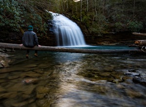
The trail begins on the right side of the parking lot. The first part is flat with no elevation change and easy walking. About half a mile in you will reach a trail split. The right trail will take you to the falls and the left trail will take you to an overlook of the gorge below. I was not able to go to the overlook due to the late hour; however, I definitely would because I have read in many...
Hike to Baskins Creek Falls
Gatlinburg, Tennessee
5.0
3.28 mi
/ 953 ft gain
The trail begins with a short climb, and after around a quarter of a mile, flattens out and you can get decent views to your west when the leaves are of the trees. At around one mile you will have descended to a small creek crossing. I would suggest getting your shoes a bit wet and just walking through since there are few stepping stones. However, if you are adamant about keeping your feet dry,...
Hike to Howe Lake
West Glacier, Montana
4 mi
/ 240 ft gain
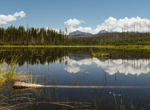
The hike begins along the Inner North Fork road across from a small parking area. The trail meanders up a slight incline most of the way through areas of a recent fire, as well as some areas with spectacular wildflowers when it gets a bit more lush. Around 1.7 miles in you will go up a relatively steep ridge and once your on top you will be able to see Howe lake. The trail goes straight down to...
Andrews Bald
Bryson City, North Carolina
5.0
3.55 mi
/ 1200 ft gain
The trail begins at the Clingmans Dome parking lot, just to the left of the paved walkway up to Clingmans Dome. You will start the hike at an elevation of 6130 feet which is only 334 feet less than Clingmans Dome which is the highest point in The Great Smoky Mountain National Park, and the second highest point east of the Mississippi. You will began the trail left of the Clingmans dome walkway ...
Wesser Bald Fire Tower
Franklin, North Carolina
4.7
2.36 mi
/ 807 ft gain
The road leading to the trailhead is rough the last mile, but doable in any car. Just make sure to take it easy going up and be careful, especially if there has been any rain or snow. You will have reached the parking area for the hike once you see a large green Appalachian trail sign and a few parking spaces. The parking lot splits the Appalachian trail, so even though you will be hiking on ...
Hike Doe Mountain
Sedona, Arizona
5.0
1.4 mi
/ 400 ft gain
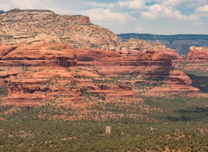
The trail begins almost immediately with some gradual switchbacks that climb up the mesa at a moderate incline. As you climb you will come to a trail junction with the Aerie trail about .3 in. At this junction just make sure to stay on the trail marked towards Doe Mountain and not on the Aerie trail. The trail continues to climb up gradual switchbacks basically all the way to the top. The very ...
Hike to Douglas Falls
Barnardsville, North Carolina
5.0
1 mi
/ 240 ft gain
The trail begins at the back of the parking area, and is marked by a trail sign. Once on the trail it is a straight shot to the waterfall with no turnoffs. Overall the trail is very easy and is a slight descent all the way down. Around .3 miles into the trail you enter a forest of now dead hemlocks this will let you know that you are closing in on the waterfall. From here continue down the tra...
Take in the View at Lilly Bluff Overlook
Lancing, Tennessee
5.0
0.6 mi
/ 0 ft gain
Honestly this is hard to even call a trail, but that doesn't mean it lacks beauty. Once you take the right or left of off ridge Ridge Road make sure to go past the first parking lot and into the second larger parking lot. The trail starts near the front of the parking lot on the right side of the parking lot next to the board with trail maps and notices. Continue straight on the trail with no t...
Hike to Falls Branch Falls
Tellico Plains, Tennessee
5.0
2.6 mi
/ 540 ft gain
To get to the trailhead, drive 22.5 miles on the Cherohala Skyway from Tellico Plains, Tennessee. If you are coming from the North Carolina side, drive 20.5 miles to the trailhead. The trailhead parking area is marked by a large green sign saying West Rattlesnake and is surrounded by a low stone wall. The trail starts on the left side of the parking lot and immediately descends to a trail split...
Hike to Horsetrough Falls
Blairsville, Georgia
5.0
0.4 mi
/ 10 ft gain
To get to the trail head you will follow Wilks road five miles to Upper Chattahoochee River Campground. The five miles down the gravel road should be doable for a majority of cars as the gravel road is in good condition. Pretty much if you feel comfortable driving your car on a regular gravel road you should be fine to make it down and back. Once you have gone the approximate five miles and hav...
Hike to Conasauga Falls
Tellico Plains, Tennessee
4.5
1.5 mi
/ 400 ft gain
Getting to the trailhead can be a challenge if there has been any heavy precipitation or icy conditions due to the fact the last two miles are one mile of broken pavement and the last mile a dirt road. You should be fine in good conditions in any car; however, just make sure to take it easy on the dirt road because it can be rough. Now, when you reach the end of the dirt road, you will come to ...
Hike to Margarette Falls
Greeneville, Tennessee
5.0
2.7 mi
/ 715 ft gain
To reach the trail head, take exit number 39 to Erwin/Jonesborough and turn onto State Route 81/107 west and stay on this for 6.5 miles. Then you will turn left to stay on Route 107 and continue on for 16 more miles. Then you will take a left on Route 351 and drive 4.5 miles. Then you will take another left on Greystone Road and continue 3.8 miles and then you will take a right on Shelton Missi...
Community
© 2023 The Outbound Collective - Terms of Use - Privacy Policy

