Jacob Moon
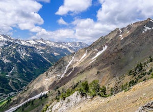
Hike and Climb the S. Ridge of Mt. Superior
Sandy, Utah
4.5
4.5 mi
/ 1800 ft gain
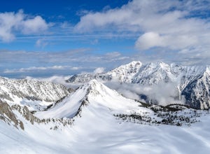
Approach: Start by parking on the side of the road just above the Snowbird Cliff Lodge. Then there will be some bushwhacking as you work your way up the southern slopes of Mount Superior following the path of least resistance until reaching the winter avalanche path under the south face and to the left of the ridge (as shown in one of the pictures above). From the avalanche path continue up and...
Kings Peak
Evanston, Utah
4.8
28.56 mi
/ 5213 ft gain
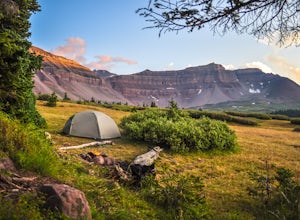
From the Henry Fork Trailhead (approx. 9400 feet elev.) the trail gains very little elevation during the first 5.5 miles with several lakes to camp by along the way. The first lake reached is Alligator Lake. At just under 3 miles from the trailhead, this beautiful lake is an excellent choice for those who are looking for a nice, easy introduction to the altitude and rigors of backpacking. After...
Climb Mt. Shuksan via The Fisher Chimneys
Deming, Washington
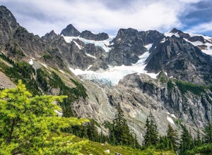
Out of all of the ruggedly beautiful, non-volcanic mountains in the Pacific Northwest, Mt. Shuksan is the center piece. Rising to a height of 9,131 feet, Mt. Shuksan is one of the most photographed mountains in the world with its jagged ridges, hanging glaciers, steep rocky faces and ease of access.The most popular route to reach the summit of Mt. Shuksan is by taking the Sulfide Glacier Route....
Diamond Fork (Fifth Water) Hot Springs
Utah County, Utah
4.3
4.63 mi
/ 663 ft gain
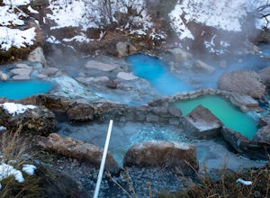
When you hike out to Diamond Fork aka Fifth Water hot springs, get ready for an amazing experience! The lower fall is visible from the main pool. If you want to continue to go further up the creek, you will run into the second fall, which is the most photogenic of them all. There are also two pools en route to the second fall. If you choose to continue a bit further, you’ll run into the last wa...
Snowshoe or Ski to Mt. Tahoma High Hut
Ashford, Washington
5.0
4.5 mi
/ 2400 ft gain
Make the 3.2 - 4.5 mile hike up groomed trails to the Mt Tahoma High Hut (4750 feet) for the perfect winter getaway. Spend the day outside sledding, skiing, snowshoeing and playing in the snow with a spectacular view of Mount Rainier, Mount Adams, and Mount St. Helens. Afterwards go inside and enjoy a relaxing evening by the fire place playing games, cooking dinner and reading a good book.Route...
Mount Nebo via North Rim Trail
Payson, Utah
4.5
8.6 mi
/ 2897 ft gain
Mount Nebo is the tallest of all the mountains in the Wasatch, and also one of the easiest to hike, due to the fact that the trail begins at an elevation of ~9300 ft. The parking area for the trailhead is along a short dirt road, which is precisely marked on the location map.
The trail itself is easy to follow. The dirt road leading to the trailhead is called Mona Pole Rd. The trail leaves the...
Winter Hike the Pfeifferhorn
Sandy, Utah
5.0
9 mi
/ 3600 ft gain
Rising to a height of 11,326 feet, the Pfeifferhorn is one of the most majestic and iconic peaks in the Wasatch Mountains, and also one of the most popular mountains to hike. During the summer and fall, there is a well beaten trail all the way to the summit, but during the winter and spring, this trail is covered up by snow, thus making a map of the area in indispensable.This hike begins at the...
Winter ascent of Trappers Peak
Marblemount, Washington
9.78 mi
/ 3448 ft gain
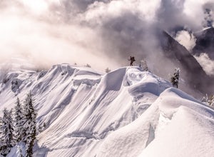
North Cascade National Park is home to some of the most rugged and remote mountains in the lower 48 states. Because of this, the area is rarely seen up close and personal in the winter, but there are a few spots where you can see these wild mountains that will defy all imagination. In terms of locations, relative ease of access and jaw dropping 360° views, Trapper's Peak has to be one of the be...
Community
© 2023 The Outbound Collective - Terms of Use - Privacy Policy

