Hike the Aileen Getty Ridge Trail
Los Angeles, California
5.0
3 mi
/ 1972 ft gain
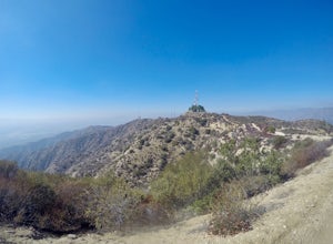
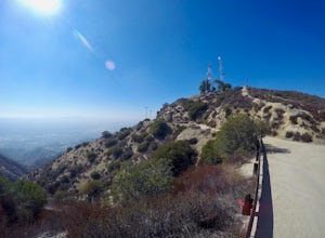
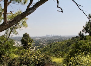
The Aileen Getty Ridge Trail is a singletrack trail that runs between Mt. Lee and Burbank Peak (the location of the Wisdom Tree). Though there are many options to access this trail, the most direct route is from the west via the Wonder View Trailhead. Start by parking on Lake Hollywood Drive near the Lake Hollywood Reservoir. Begin walking east along Wonder View Drive passing the yellow gate, a...
Scuba Dive at Mike's Beach Resort
Lilliwaup, Washington
Located in Washington State on the west shore of the Hood Canal, Mike's Beach Resort is a unique family run establishment offering waterfront cabins and rooms. Perfectly placed between the popular shore dives to the south like Octopus Hole, and Jorsted Creek, and the dynamic boat dives to the north such as The Pinnacle and Pulali Point, Mike's can be the ideal basecamp for a full array of divin...
HIke the Brand Library Loop
Glendale, California
5.0
6.2 mi
/ 2371 ft gain
Your adventure will start at the Brand Library parking lot. Walk behind the library towards the gated day use area and you will find the start of the trail on your right, Las Flores MTWY.The first half-mile rises over 500 feet to a plateau, equipped with benches, a park map and views of Griffith Park and Downtown LA. Next is the grueling 1000 foot/1-mile climb to the first in a string of radio ...
Hike the East Temple Saddle Loop
Hurricane, Utah
5.0
2.56 mi
/ 2500 ft gain
This adventure is a strenuous 4-mile (3-5 hour) loop into the backcountry of ZNP and is not recommended for families or those with a fear of heights. It begins at the Canyon Overlook Trailhead located on the east side of the Zion-Mount Carmel Tunnel. Parking in the area is very competitive and I recommend trying to park closer to your exit point of Upper Pine Creek, located 0.7 miles northeast ...
Ice Climb Pumphouse Falls in Vail
Vail, Colorado
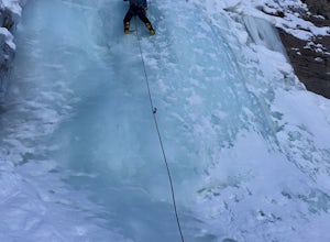
To get to Pumphouse Falls take Interstate 70 toward East Vail, Colorado, get off at exit 176 S. Frontage Road headed east. At the traffic circle take the third exit and continue on South Frontage Rd. for 2.5 miles, turn right into the small parking lot next to the Nordic ski track. Follow the signs from the parking lot showing the footpath across the Nordic track and walk straight toward the gu...
Paddle Victoria Harbour's Waterways
Victoria, British Columbia
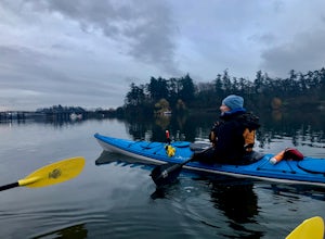
Victoria Harbor located on the southwestern tip of Vancouver Island, British Columbia is the southernmost port in Canada. Enjoying a moderate climate year round, one will quickly see why it is also known as Canada's busiest port. Pleasure boats, water taxis, large car and passenger ferries, tugboats with barges, cruise ships and lots of seaplanes operate throughout the immense harbor everyday. ...
Hike Verdugo's North Ridge Trail
Los Angeles, California
13 mi
/ 3221 ft gain
The Verdugo Mountain Range is a small, rugged range spanning across the northeast end of the San Fernando Valley from Sun Valley to Glendale. With close to 50 miles of graded and well maintained trails, the Verdugos are surprisingly underutilized and make a great place for someone looking to escape the crowds of surrounding Griffith Park and Runyon Canyon.
The Chandler Fire Road is located in ...
Kayak the Marina Del Rey Harbor
Los Angeles, California
5.0
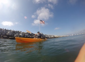
The Marina Del Rey harbor covers 1.5 square miles making it the world’s largest small-craft harbor. Located southwest of Los Angeles, it is the homeport to nearly 6,500 local boats, ranging from small fishing boats, large private yachts, and even a multitude of unique houseboats. The harbor is easily accessed via Admiralty Way, one street west of Lincoln Blvd. Renting a kayak in the harbor is e...
Hike to Glendale Peak via Henry's Trail
Los Angeles, California
4.0
0.5 mi
/ 70 ft gain
While not really a full hiking trail and more of a small detour, Henry's Trail is worth the small uphill climb to Glendale Peak.
The trail is accessed via the East Ridge Trail, about 2.6 miles from the Griffith Park Merry Go Round, on the east side of the bridge. The junction is clearly marked by a large sign commemorating Henry Shamma, a former local leader for the Sierra Club who frequently ...
Hike Mt. Thom and Tongva Peak
Glendale, California
6.2 mi
/ 1460 ft gain
Mount Thom and Tongva Peak are accessed by using the 6.2 mile out and back trail, Las Flores Motorway located in the north part of Glendale, CA. Roadside parking is not allowed near the trailhead, you will need to park in the nearby residential area along Sunshine Drive about 0.15 miles away from the starting mark. Now that you have legally parked, begin walking up Sunshine Drive to the start o...
Bike along the Galloping Goose Trail
Victoria, British Columbia
34 mi
The Galloping Goose Regional Trail connects downtown Victoria, Canada to the former town of Leechtown. Part of the Trans Canada Trail (which traverses the entire country) the Galloping Goose follows the path of the former Canadian National Railway passing through the communities of Sooke, Metchosin, Colwood, Langfod, and Saanich.
There are many options for adventures along the Galloping Goose f...
Hike to the William Wallace Statue
Scottish Borders, United Kingdom
1 mi
/ 500 ft gain
Finding the statue of William Wallace is a fun and worthwhile adventure suitable for the whole family. To get there begin by finding a small dirt parking lot located off B6356 between the towns of Bemersyde and Dryburgh. Be sure to not leave valuable belongings in your car, the area has historically been a target of thieves, (there is a sign posted by local police warning you), but don’t let th...
Snowshoe to Grand View Point
Big Bear Lake, California
6.1 mi
/ 1200 ft gain
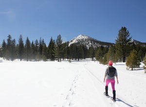
Grand View Point is accessed via Pine Knot Trail, a 6.5 mile out and back hiking trail located at the Aspen Glen Picnic Area, 1 mile from Big Bear Village. With its close proximity to town, Pine Knot Trail is popular in the summer with mountain bikers and the trailhead is often crowded in the winter with young families paying and sledding in the snow. But not to worry once on the trail you will...
Hike Wildwood Canyon Loop
Burbank, California
4.5 mi
/ 1800 ft gain
The Vital Link Trail is a steep and narrow out-and-back trail accessed though the Wildwood Canyon Park located in Burbank, CA. Parking at Wildwood Canyon is free and easy, and will be determined by which of the four trailheads you choose to start from.
For the shortest and most direct route you can drive to the top of Wildwood Canyon where you will find a fire road that takes you directly to t...
Summit Mount Hollywood via the Fern Canyon Trail
Los Angeles, California
5.0
6.5 mi
At 1,625 feet Mt Hollywood is the second highest point in Griffith Park and provides picturesque views of the Hollywood Sign, Griffith Park Observatory, Downtown Los Angeles and the San Gabriel Mountains.
The hike to the Mt Hollywood Summit begins on the northeast side of Griffith Park near the famed Griffith Park Merry Go Round. Start in the merry go round parking area and head toward the fire...
Hike the Verdugo Mountain Traverse
Verdugo Mountains, California
5.0
12.3 mi
/ 1540 ft gain
The Verdugo Mountain Range is a small, rugged range spanning across the northeast end of the San Fernando Valley from Sun Valley to Glendale. With close to 50 miles of graded and well maintained trails, the Verdugos are surprisingly underutilized and make a great place for someone looking to escape the crowds of surrounding Griffith Park and Runyon Canyon.
Hiking the Verdugo Mountain Traverse ...
Summit Verdugo Peak
Los Angeles, California
5.0
7.5 mi
/ 1838 ft gain
Verdugo Peak, at 3000 feet, is accessible from multiple directions and trails along the Verdugo Range. The most direct route to the top is Hostetter Fire Road, a 3.6 mile hard packed dirt trail that climbs 1600 feet to the 3,126 foot summit. The hike begins at the dirt parking lot off of La Tuna Canyon Rd next to the I-210 entrance ramp. Start by crossing the yellow gate and hiking up a paved r...
Snowshoe Shady Rest Park
Mammoth Lakes, California
2 mi
/ 100 ft gain
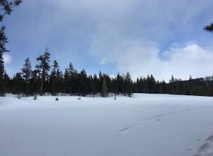
Shady Rest Park is located on Sawmill Road just minutes from the Mammoth Lakes town center. Start off by crossing through the parking lot headed north towards the large open field covered in snow. The open field is a great place to walk around and become comfortable with wearing and walking in snowshoes, and to test new gear if you've got it. For those that are feeling more adventurous, you can...
Snowshoe the Obsidian Dome Trail
Mono County, California
6 mi
/ 300 ft gain
The Obsidian Dome Trailhead provides access to a large network of winter hiking trails through Inyo National Forest. These are marked trails that are groomed on an intermittent basis by the National Forest Service. To find the trailhead and parking area, drive north on highway 395 from Mammoth Lakes turning left (west) at Bald Mountain Rd. The trailhead is clearly visible from the parking lot a...
Kayak at George L Smith State Park
Twin City, Georgia
3 mi
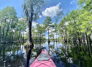
George L. Smith is a Georgia State Park located about an hour west of Savannah in the town of Twin City, GA. Originally the site of a combination gristmill, saw mill, covered bridge and dam built in 1880, the now refurbished and still working Parrish Mill and “pond” boast a multitude of new facilities. These include a group shelter near the bridge used for family reunions and parties, a full ho...
Paddle Castaic Lake State Recreational Area
Castaic, California
6 mi
Castaic Lake is a man made reservoir located 41 miles north of downtown Los Angeles, CA in the town of Castaic. Made up of two bodies of water, separated by a 425-foot dam, Upper and Lower Castaic Lakes have a combined 29 miles of shoreline forming the Castaic Lake State Recreational Area. The small “lower lake”, also known as Castaic Lagoon, is open seasonally and reserved for swimming, and s...
Run the Old Youth Camp Loop
Burbank, California
2.6 mi
/ 700 ft gain
The Old Youth Camp Loop is a 2.6-mile loop with over 700 feet of elevation gain that can be ran, hiked, or even mountain biked if you prefer. While not completely empty the area receives very little visitors and is a great place to enjoy a little more solitude than near by hiking locations. The loop begins at Stough Canyon Nature Center, a free and easy parking area, located a quarter mile nort...
Hike the Towsley Canyon Loop
Stevenson Ranch, California
4.7
5.1 mi
/ 1340 ft gain
The Towsley Canyon Loop can be done in either a clockwise or counter-clockwise loop. The clockwise path starts with a gradual ascent through Wiley Canyon and steep descent into the Towsley Gorge while a counter-clockwise route starts with a steep climb out of Towsley Canyon and a gradual descent back to the parking area. I recommend the clockwise route, after parking in one of the free parking ...
Trail Run to Beacon Hill
Los Angeles, California
5.0
3.2 mi
/ 600 ft gain
The starting point for your run is at the Griffith Park Southern Railroad. From the parking lot walk east crossing Crystal Springs Drive and find the Coolidge Hiking Trail. Begin running up Coolidge Trail toward Upper Beacon Trail making sure to stay straight at the first intersection (0.2 miles). You will pass a golf course driving range on your right before coming to a second intersection (0....
Community
© 2023 The Outbound Collective - Terms of Use - Privacy Policy

