Sassy ResuelloExplorer
Spending time outdoors and seeing the beauty of nature is my way of fueling my passion for life. Taking photos is my way of sharing the inspiration with the rest of the world.
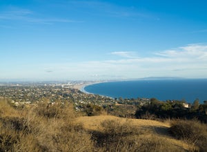
Hike to the Parker Mesa Overlook
Los Angeles, California
4.2
5.4 mi
/ 1200 ft gain
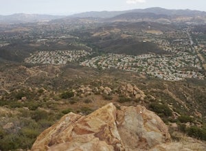
This 5.4-mile out-and back trail takes off from the end of the residential area of Paseo Miramar. Once you hike a little less than a quarter mile in, you'll connect with Los Liones Canyon Trail. Continue on Paseo Miramar Trail, which in another 2.5 miles, will connect you with the Parker Mesa Overview. If you're looking for a bit of a longer hike, head to the Los Liones Canyon Trailhead On Los ...
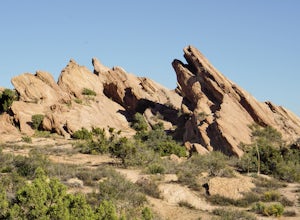
Vasquez Rocks
Agua Dulce, California
5.0
2.42 mi
/ 367 ft gain
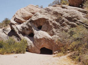
This is a Natural Park Area located in Santa Clarita, within the Sierra Pelona Mountains. It features amazing diagonal rock formations, created because of the force between two tectonic plates pushing against each other.
This place is a photographer's paradise, and every spot in this 900+ acre land has a different look. Vasquez Rocks is also known for the locations' appearance in several famou...
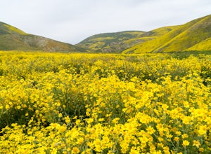
Photograph Wildflowers at Carrizo Plain National Monument
Santa Margarita, California
5.0
Driving in from Hwy 58 East, you will be passing through a grapevine, and through some hills. Once you hit the Seven Mile Road, you will start to see fields of yellow flowers all around you - this is where the adventure starts. Just continue to drive along the road until you find a great spot to take photos of the wildflowers.
Continue along Seven Mile Road, until you hit Soda Lake Road, then ...
Hike the Top of Topanga Overlook
Topanga, California
1 mi
/ 1613 ft gain
The Top of Topanga Overlook is where you can simply park your car, and sit in one of the benches to view the San Fernando Valley. But there is one hiking trail in that area which lets you get better vantage points, as well as a quick workout.Once you get to the overlook, park your car and safely cross the street. There are no stoplights, so be aware of the cars passing by.Directly across you wi...
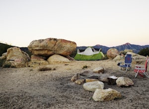
Camp at Manzanita Loop in Chilao Campground
Palmdale, California
5.0
Chilao Camp is located at an elevation of 5,300 feet, in the San Gabriel Mountains, and is divided into two different loops called the Manzanita and Pine.This specific adventure is for the Manzanita Loop, which is pretty much known as the more scenic loop, mainly because the area overlooks the Big Tujunga Canyon. Grab a site here to get a great view of the beautiful sunset.Daytime adventures co...
Castle Rock Trail at Big Bear Lake
Fawnskin, California
4.5
2.7 mi
/ 719 ft gain
Follow the directions to the trail head, and park on the side of the road. You will see a sign that says Castle Rock Trail, and the path is directly behind that sign.
The hike up to the peak is steep, sandy, and very rocky, so shoes with good traction is recommended. There are also lots of oak and pine trees in this trail, which offered ample shade.
Just keep following the trail until you rea...
Hike up Chatsworth Park North
Los Angeles, California
1 mi
From the parking lot, make your way through the park until you reach the bottom of a hill filled with huge rocks and boulders. It is very hard to miss.From here, you can pick any trail you wish. They will all lead up to the top. There's a lot of rock scrambling involved, as well as boulder hopping, but the trail is mostly easy to follow. Once you reach the top, enjoy the views and (if you come ...
Hike Mugu Peak Loop via Chumash Trail
Malibu, California
5.0
6.5 mi
/ 1255 ft gain
From the parking lot at the trailhead, follow the steep trail going up the mountain. This part is quite challenging, so I recommend stretching out your legs before starting the hike.
Once you reach the top, you will see your first junction. Go right if you want to go straight for the peak, and then go back the same way. To take the full loop, go left on to Chumash Trail.
The trail is very much...
Hike to the Top of Point Dume
Malibu, California
4.8
1 mi
/ 100 ft gain
From the parking lot, make your way towards Point Dume. You will find the entrance to the trail at the end of the lot. The trail is a bit sandy, but fairly easy. Be careful of the cactus plants along the trail!Make your way up towards the cliff and you'll notice ropes hanging on the edge. Don't be surprised if you see someone pop up on the edge, this oceanside cliff is famous among rock climber...
Stand Up Paddle (SUP) in Huntington Harbor
Huntington Beach, California
4.5
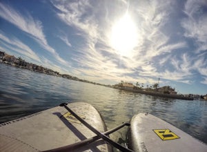
Huntington Harbor is the perfect location for an easy and relaxing stand up paddle board session. Here you will get to enjoy the view of the houses by the harbor, some boats sailing by, and some low bridges you'll have to paddle through while ducking on your board (fun!).There are several stores close to the harbor, which offer board rentals as well as classes. If you're a beginner, I highly re...
China Flat Trail to Simi Peak
Oak Park, California
5.0
5.03 mi
/ 1398 ft gain
From the trailhead, simply follow the trail headed up the mountain. The first 2 miles is the hardest part of the hike, because of the steep ascent.
Continue on until you hit a junction. Turn left, and you will eventually see an old rusty gate, and a sign which says "China Flat Trail". You will hit a couple more junctions along the way, just stay left until you find yourself slightly descendin...
Hike Red Rock Canyon to Calabasas Peak
Topanga, California
4.0
4.2 mi
/ 1066 ft gain
When you get to the parking lot be sure to pay the $5 parking fee. You will need to place this in the provided envelope and drop it in the iron ranger. Start the hike by following the fire road behind the gate. About a couple of yards in, you will see a trail on your left which leads to a ghoulish looking cave. On a hot day, you will appreciate the cool temps inside the cave.After exploring, co...
Hike the Creamery Meadow Trail to Molera Beach
Big Sur, California
2 mi
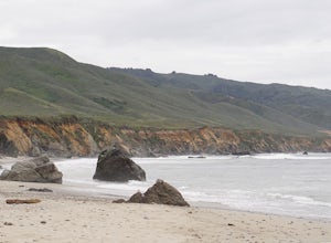
Entrance to the parking lot is $10 per car, and once you get in be sure to use the restroom before you head for the trail, since you will likely spend a good amount of time out there.Look for the sign that says Creamery Meadow Trail. You'll know it's right when the very first thing you'll need to do is to cross the Big Sur River. (Sidenote: It had rained the day before we came, so the water was...
Catch a Sunrise or Sunset at Palisades Park in Porter Ranch
Los Angeles, California
4.0
From the 118 FWY, exit Reseda and head north until you pass by Calle Vista Circle. Once passed, make a U-turn and park on the side of the street.Here you will find the trailhead for the Palisades Trail Hike. To get to the scenic lookout, simply walk up the short trail leading up the hill, and head towards the left. You will immediately see the gorgeous views of the city from here, but walk all ...
Hike the Santa Paula Punch Bowls
Santa Paula, California
3.6
8.5 mi
/ 700 ft gain
This is an 8.5 mile trail, out and back. Parking is available along Ojai St, and the trail starts at the entrance of Thomas Aquinas College. Follow the paved road which goes around the school, until you reach a fork on the road, then stay right. The trail will take you through Ferndale Ranch, just keep going straight and the trail will end once you see a fenced gate, with several oil pumps insi...
Stoney Point Park Loop
Los Angeles, California
4.0
0.73 mi
/ 141 ft gain
Once you've parked along Topanga Canyon Blvd, make your way down the street and start the trail off near the steel gate, close to the horse stables. As you make your way in, you will notice some rock climbers practicing on the lower elevation rocks.
Make your way around this rocky park, counter-clockwise, and soon enough you will notice multiple trails headed for the peak. Feel free to choose ...
Community
© 2023 The Outbound Collective - Terms of Use - Privacy Policy

