Michael GrawExplorer
I'm a landscape and adventure photographer based out of Corvallis, Oregon. Backpacker, triathlete, and skiier - always with a camera in hand. Look for me in the mountains or online @WanderingSolePhotography.
Opal Creek Pools Loop
Lyons, Oregon
4.6
6.6 mi
/ 663 ft gain
Note: this trail is closed due to fire damage. For more updates, please visit the Forest Service website.
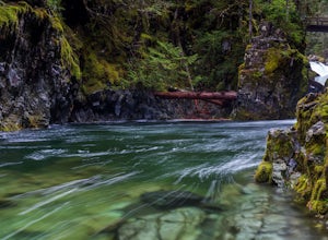
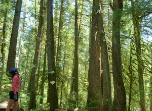
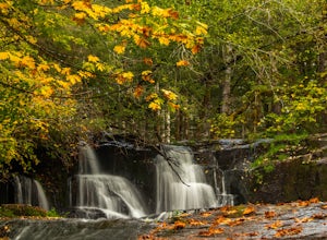
The Opal Creek pools are a wonderful place to visit year-round, but they’re a true oasis on a hot summer day. With a variety of rock outcroppings and ledges to jump off of, and plenty of room to spread out for a picnic, this is a summertime magnet.
Accessing the pools is a gift in and of...
The Sisters to Smith Rock Ride
Sisters, Oregon
5.0
36.6 mi
/ 597 ft gain
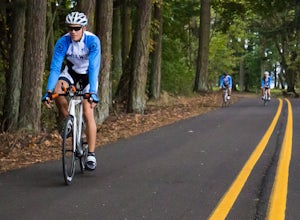
Starting in the "Old West" town of Sisters, Oregon and ending at Smith Rock State Park outside the small town of Terrebonne, this route takes riders past a variety of historical sites, shows the gentle curves of the Deschutes River and frames spectacular views of the Cascade Mountains, and ends with the dramatic walls of Smith Rock State Park.
You can plan to do this in two hours one-way if you...
Devil's Rest-Wahkeena Falls Loop
Bridal Veil, Oregon
4.0
9.82 mi
/ 2779 ft gain
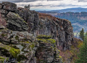
This loop takes advantage of the western Columbia River Gorge's vast network of trails - hidden behind the roadside waterfalls - to allow you to visit several popular attractions without fighting traffic along the historic highway. All told, the loop hits 3 named waterfalls (Coopey Falls, Fairy Falls, and Wahkeena Falls) and 2 spectacular viewpoints (Angel's Rest and Devil's Rest). The only dow...
Hunt's Cove via Pamelia Lake Trail
Idanha, Oregon
14.74 mi
/ 3150 ft gain
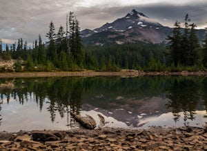
This loop through the Pamelia Lake Limited Entry Area is one of the premier backpacking trips in the Mount Jefferson Wilderness. The trail offers sustained up-close views of Mount Jefferson and several lookout points provide panoramic views of the western Oregon Cascades. The several large backcountry lakes that the loop accesses are also destinations in their own right, offering swimming, fi...
Mountain Bike the McKenzie River Trail
Linn County, Oregon
26 mi
/ -2200 ft gain
Mountain biking the McKenzie River Trail should be on every serious mountain biker's to-do list, since this trail has repeatedly been cited as the best mountain biking in the United States. The whole trail is an all-day, 26 mile epic, losing 2200 feet of elevation as it parallels the McKenzie River through the heart of the western Oregon Cascades.While the first half of the trail is technical ...
Hike to Alsea and Green Peak Falls
Monroe, Oregon
4.3
4.2 mi
/ 230 ft gain
This is a great and easy day hike that features two waterfalls - Alsea Falls and Green Peak Falls - amid beautiful Oregon Coast Range scenery. This hike is perfect for a family trip as the trail is dog-friendly, the Alsea River serves as a swimming hole on hot days, and there is a picnic area just across from the trailhead. Campsites are also available for those looking to spend a weekend expl...
Bike the Wild Rivers Scenic Bikeway
Port Orford, Oregon
60 mi
/ 3000 ft gain
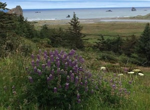
The Wild Rivers Scenic Bikeway starts and ends in Port Orford, and includes stops at Port Orford Heads, the Wild and Scenic Elk River, and Cape Blanco. It's a perfect ride for anyone looking to see the highlights of the section of coast around Port Orford without spending the whole day in the car.
While the ride can be done as prescribed (it is an official bike route set up by the state), I'd s...
Mary's Peak
Corvallis, Oregon
4.4
52 mi
/ 4020 ft gain
This ride takes you from the banks of the Willamette River at the Corvallis waterfront to the top of Mary's Peak, 26 miles and 4,000 vertical feet away. While it starts out with a warm-up through the flats of the Willamette Valley, it quickly starts climbing up around the west side of Mary's Peak. The views from the summit are well worth the effort - but the best part is the ride down at full ...
Tam McArthur Rim, Green Lakes, Park Meadow Tie Loop
Bend, Oregon
3.3
22.58 mi
/ 3675 ft gain
This loop trip around Broken Top is one of the premier backpacking loops in Oregon. The trail winds past numerous alpine lakes, including the popular Green Lakes area, and offers near-constant views of Broken Top, the Three Sisters, and Mount Bachelor. To top it all off, the clear skies typical of central Oregon in the summer allows views as far as Mount Adams in southern Washington and east to...
Winter Backpack to Diamond View Lake
Crescent, Oregon
9.8 mi
/ 1000 ft gain
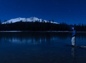
Diamond View Lake is relatively unknown compared to many of the other lakes in the Oregon Cascades, yet the views it delivers of Diamond Peak are top-notch. While it can also be done as a summer backpack, winter brings out the best aspects of the scenery - low-angle light on Diamond Peak, long nights and crisp skies for star gazing, and complete solitude only 5 miles into the wilderness.The tr...
Ski or Snowshoe to Fuji Shelter
Lane County, Oregon
8 mi
/ 1400 ft gain
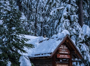
This is a great and relatively easy winter overnight trip for cross-country skiiers and snowshoers alike into the crest of the Oregon Cascades. The route offers tremendous views of Diamond Peak, Willamette Pass, and the western Oregon Cascades. While it can be done in a day, take advantage of the US Forest Service's Fuji Shelter and spend the night warming up next to the wood stove. Because o...
Hidden Lake via East Eagle Trailhead
Halfway, Oregon
5.0
18.52 mi
/ 3789 ft gain
The Wallowa Mountains are one of Oregon's best-kept secrets, and this overnight backpack into the Eagle Cap Wilderness will deliver you into the heart of the range. Following the East Eagle Creek through a valley filled with meadows and the occasional aspen, you will be surrounded by towering granite peaks on either side. The lake itself offers a tremendous vantage point of the valley and Jacks...
Ski or Snowshoe to Midnight Lake
Crescent, Oregon
6.2 mi
/ 600 ft gain
The trip to Midnight Lake is a great way to spend a winter day and explore an otherwise overlooked lake in the central Oregon Cascades. Although the lake does see winter visitors, it is often empty and very few people bother to hike to the far end of the lake. The route to the lake is through beautiful fir forest and is often well-tracked. Start out at the Gold Lake Sno-Park, just west of the ...
Hike Coyote Wall
White Salmon, Washington
3.5
7.5 mi
/ 800 ft gain
Coyote Wall is a relatively uncrowded trail system in the Columbia River Gorge that provides outstanding views of the Columbia River. The trail system is made up primarily of user-created mountain biking trails, allowing hikers a choose-your-own-adventure approach to exploring the area.Start out at the Coyote Wall Trailhead, which is just north of Highway 14 on the Washington side of the gorge...
Backpack around Mount Adams
Skamania County, Washington
1.0
32 mi
/ 7000 ft gain
Under 2 hours from Portland, Mount Adams sees a sizable crowd of visitors - but get beyond the first mile of the South Climb trail, and you're unlikely to encounter another person until you circle around all the way to the PCT. This loop around the mountain doesn't put you quite as high up as the climbing route, but what it lacks in elevation it makes up for in ruggedness and sheer immensity o...
Summit Diamond Peak
Lane County, Oregon
9 mi
/ 3600 ft gain
At 8,743 feet, Diamond Peak is almost as tall as the other iconic volcanoes of the Oregon Cascades, but sees just a fraction of the people. Outside the range of casual Portland day hikes and hard to see from the highway and from other peaks, Diamond Peak and the spectacular wilderness surrounding it tend to pass under the radar. But, thanks to its position just west of the Cascade range crest,...
Photograph the Pemaquid Lighthouse
Bristol, Maine
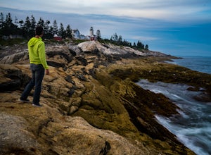
Pemaquid Lighthouse is situated above a spit of granite jutting out into the Atlantic, and it has all the look and feel of a classic Maine lighthouse. For photographers, it's hard to go wrong.
The granite is grained such that all the rocks seem to be pointing towards the lighthouse, so there are leading lines everywhere. Bring a wide angle lens (24mm or wider) and hike towards the tip of the po...
Fuji Mountain Summit via Waldo Road
Crescent, Oregon
11.3 mi
/ 2329 ft gain
Background
Fuji Mountain has been known by mountain bikers for years, since it sits just off the circuit of popular biking routes around Waldo Lake and makes for a notoriously difficult climb on a bike. Word hasn't spread to the hiking community yet, despite the spectacular views from the summit.
The peak has unimpeded views to the east, where the Three Sisters, Broken Top, and Mount Bachelo...
Bike from Hood River to The Dalles
Hood River, Oregon
2.0
40 mi
/ 2800 ft gain
The ride from Hood River to The Dalles is one of the best 20 mile stretches of road biking in Oregon, and arguably the best. The ride starts out in the wonderful town of Hood River - a tourist and adventure destination in its own right - and follows the historic Columbia River Gorge highway (US-30) east. The ride features stunning, in-your-face views of the Columbia River Gorge for most of its ...
Lookout Mountain via High Prairie Trailhead
High Prairie Trailhead, Oregon
2.69 mi
/ 531 ft gain
Lookout Mountain should be the most popular destination in Oregon given its views to effort ratio. Mount Hood seems close enough to reach out and touch from the open, rocky summit, and views extend from the Three Sisters in the south to Mount Rainier to the north. While the hike is popular in the summer, Lookout Mountain sees far fewer people than nearby Elk Meadows or Mirror Lake. The Lookout ...
Community
© 2023 The Outbound Collective - Terms of Use - Privacy Policy

