Jackson SmithExplorer
Salt Lake City born and raised, frequenter of the Wasatch Mountains. backcountry skiing, trail running, mountain adventurer. Backcountry.com Gearhead. #ChaseYourGOAT
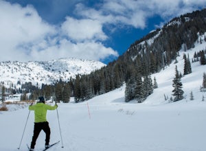
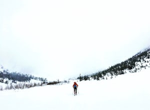
Cross Country Ski Alta Ski Area's Nordic Track
10230 East Little Cottonwood Lane, Utah
Drive up Little Cottonwood Canyon until the first entrance into Alta. Park in the Collins lift parking lot, throw your boots on, and head over to the nordic track. Its just next to the tow rope that runs through Albion Basin. Now thats left to do is to step into your skis and ski. The track has a lot of different variability in the terrain, so you'll find flat, uphill, and downhill. Grooming of...
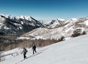
Backcountry Ski Willow Fork
Salt Lake City, Utah
3 mi
/ 1700 ft gain
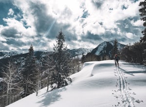
Willow Fork is just across the mountain from Solitude Ski Resort in Big Cottonwood Canyon. You can access Willow Fork from a few different trailheads; either from the Willow Heights Trailhead or across the street from both the lower and upper Solitude parking lots. The Willow Heights Trailhead will take you up to the Beaver Pond Basin where you can either keep left and tour up through West Will...
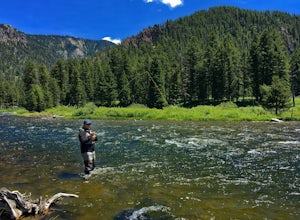
Fly Fish the Madison River (Hebgen Lake to Earthquake Lake)
West Yellowstone, Montana
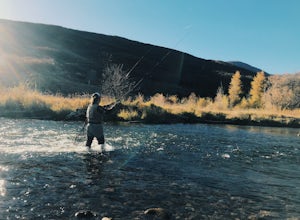
The Madison River runs for 183 miles through Wyoming and Montana; however, this section of the Madison is between Hebgen Lake and Earthquake Lake. You get there by driving along Hebgen Lake Road to the Campfire Lodge Resort. Turn into here and head down the dirt road to your right (Ghost Village Rd). You can park anywhere along this road where there is space.
The kinds of flies that are going ...
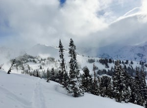
Backcountry Ski Grizzly Gulch
Alta, Utah
1.5 mi
/ 1400 ft gain
To get to the Grizzly Gulch trailhead, drive up Little Cottonwood until you reach Alta Ski Resort. Keep left along the road and park in the upper Alta parking lot. Head up the cat track with all the cats and snowmobiles parked to the side. About 100 yards up, you'll take a left and head up the steep cat track. Follow this until you reach the part that wraps left around the mountain. You can fol...
Hike Days Fork
Salt Lake City, Utah
5.0
7.5 mi
/ 2494 ft gain
To get to the trailhead drive up Big Cottonwood Canyon to Spruces Campground. Once in the parking lot, walk to the southwest corner of the parking lot and go up the road past the bathrooms. The trailhead will be next to the overgrown baseball field.
The trail is awesome single track the whole way up to the top and never branches off so it's really easy to follow, you can't get lost. The trail ...
Hike or Trail Run Butler Fork
Brighton, Utah
5.0
7.2 mi
/ 1964 ft gain
To get to the trailhead, drive up Big Cottonwood Canyon 8 miles. The parking lot is on the left side of the road. The first half mile is the steepest of the whole trail so don't get too intimidated by it, it mellows out a lot after. You will come to fork in the trail about a mile in, you can either take the left trail towards Mill A Basin and head through some amazing aspen switchbacks, or take...
Backcountry Ski Cardiff Fork
Salt Lake City, Utah
4 mi
Drive up Big Cottonwood Canyon until you reach the Mill D South parking lot (aka Donut Falls parking). Head up the main road until you reach the bathrooms at the Donut Falls trailhead. Here you can either keep straight past the bathrooms, but the best way to go is to keep right along the road. You will follow this skin track and along the way you will pass a cabin and an old abandoned mine. Onc...
Spring Backcountry Ski Alta Ski Area
Alta, Utah
5 mi
/ 1800 ft gain
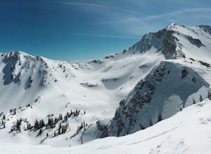
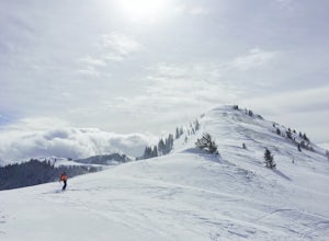
Still have the skiing itch but it's late in the spring and the resorts have closed and the other backcountry skiing areas have melted? No problem, just head up to Alta Ski Area and get some amazing backcountry corn skiing laps in.
Drive up Little Cottonwood Canyon all the way to the top and park either in the Collin's or Albion parking lot at Alta. Throw the skins on the skis and head up the m...
Backcountry Ski Mineral Fork
Salt Lake City, Utah
4.2 mi
Mineral Fork is on the right side of the road about 5.8 miles up Big Cottonwood Canyon next to a cell tower and a giant brown Forest Service gate. There is room on the side of the road to park your car and throw your gear on. Once on the trail, you'll do a few switchbacks up the side of the mountain. You'll will come along a small stream that passes through the trail twice, so you'll need to ta...
Backcountry Ski White Pine Fork
Sandy, Utah
7 mi
The White Pine Trailhead is up Little Cottonwood Canyon on the south side of the road just before you get to Snowbird Ski Resort. The parking lot fills up very quickly so an early start is recommended. The skin track starts in the southwest corner of the parking lot near the bathrooms. You will follow the gradual trail around the bend until you reach a hard left trail that takes you into White ...
Backcountry Ski Butler Fork
Brighton, Utah
2 mi
The trail head for Butler Fork is 8 miles up Big Cottonwood Canyon on the left side of the road. Throw your gear on and head up the trail. Continue along the skin track and after about 20 minutes you'll come upon a fork in the trail. The right trail will take you up the East Fork towards Butler Basin and Dog Lake; however, the left fork is most often traveled and will take you up the West Fork ...
Backcountry Ski Short Swing, Mill D North
Salt Lake City, Utah
4 mi
/ 1900 ft gain
Drive up Big Cottonwood Canyon until you reach the Spruces Campground on the right. You will park here and prep your gear for the day. Walk back out to the canyon road and cross the street to the trail head. As you hike up the trial, you'll pass some cabins, once you've passed all the cabins, you'll eventually come to a fork in the skin track going to your right up the mountain and through the ...
Backcountry Ski Days Fork
Salt Lake City, Utah
3.2 mi
Days Fork is on the south side of Big Cottonwood Canyon behind the Spruces parking lot. The trail head begins on the south west corner of the parking lot. The approach to Days Fork is long, but gradual. Continue south along the skin track until you reach the end of the Days Fork Basin. Here you can make a right and head up the ridge line to Peak 10,561. From this peak you can either ski Upper D...
Hike Jenny's Canyon in Snow Canyon State Park
Dammeron Valley, Utah
3.5
0.3 mi
/ 42 ft gain
To get here from St George, you take Bluff Street heading north until you reach the Snow Canyon Parkway exit that heads west. Follow this road until you reach Snow Canyon Drive, turn right here. This road will take you into the south entrance of the park. You will come upon a small fee station where you will need to pay a fee of $6.00 to enter the park. Bring cash for this! The Jenny's Canyon t...
Trail Run Burch Hollow Trail
Salt Lake City, Utah
5.3 mi
/ 2412 ft gain
The Burch Hollow trailhead is about a quarter mile up the Pipeline trail in Millcreek Canyon. After hiking along the switchbacks of the Pipeline trail, you'll see a sharp turn in the trail that leads you up the side of the mountain. This turn can easily be missed so keep a good look out for it. Continue along this relatively steep trail up the Burch Hollow drainage to the mountain ridge line. T...
Hike or Trail Run Mount Van Cott
Salt Lake City, Utah
4.0
3 mi
/ 1400 ft gain
There are many different trailheads that will take you to the top of Mount Van Cott, but the main trailhead is up Red Butte Canyon. Drive up the canyon until you reach the parking lot where the canyon gate is blocking the road. After parking your car here, head up the dirt road on foot until you come to a wide open field to your left, the trailhead starts here. The trail splits after a few minu...
Trail Run or Hike Lambs Canyon
Salt Lake City, Utah
4.0
4 mi
/ 1531 ft gain
Take I-80 East through Parley's Canyon and get off at the Lambs Canyon Exit. Stay right off the exit and start heading up the canyon. You will follow the road 1.5 miles. You will see the trail head on the right side of the road with a small area to park on the left next to the bathrooms.The trail is pretty gradual but gets slightly steep at some points. After traveling 2 miles to the top of Lam...
Hike or Run Mount Wire
Salt Lake City, Utah
3.5
4.5 mi
/ 2082 ft gain
This 4.5 out-and-back trail starts just south of the Natural History Museum at the University of Utah. Park in the museum parking lot and walk up the stairs to the Bonneville Shoreline Trail. Then head south along the BST for a few minutes until you reach a big yellow sign with 174 on it. Turn left here and start heading up the mountain. After about a mile up the trail, you will hit a split in ...
Backpack the Pole Creek Trail, Wind River Range
Pinedale, Wyoming
5.0
18 mi
/ 2687 ft gain
Backpacking in the Wind River Range Requires a permit, so make sure you go through the process of getting that before you set out on this adventure.
https://www.fs.usda.gov/detail...
Getting to the trailhead from the town of Pinedale, WY, you drive to the east side of town and turn left onto Fremont Lake Rd. Then keep left along Skyline Dr and follow this road until you reach the Elkhart parkin...
Backcountry Ski Beartrap Fork
Salt Lake City, Utah
5.0
4 mi
/ 2016 ft gain
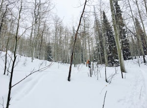
You can access the trailhead to Beartrap by driving up Big Cottonwood Canyon 10.4 miles and parking on the right side of the road. You will see the "Bear Trap Fork Rd" sign on the left side of the road, this is where the trailhead begins. Make your way up the skin track through the dense aspens until you reach the fork in the trail. Here you can either make a right and make your way up to the t...
Backcountry Ski USA Bowl
Salt Lake City, Utah
1.6 mi
/ 1700 ft gain
To get the the trailhead, drive up Big Cottonwood Canyon until you reach the upper entrance into Solitude Ski Resort. You can park on the road just below the entrance to the resort. Across the street is a road called Old Stage Road, this is where the trail head begins. The road is covered in snow in the winter so you can put your skis on here and follow it up. Eventually the skin track splits o...
Hike Bowman Fork to Baker Pass
Salt Lake City, Utah
5.0
8.3 mi
/ 3375 ft gain
To get to the trailhead, drive up Millcreek Canyon about 4.5 miles until you reach the Terraces Picnic area. Turn here and drive up the small road until you reach the parking lot by the bathrooms. You'll see the Bowman Fork trailhead marker next to the parking lot.
The trail climbs steadily and is easy to follow. You can bring the dog along, just remember that if you are going all the way up to...
Trail Run Upper Big Water Trail to Dog Lake
Salt Lake City, Utah
4.0
6.2 mi
/ 1267 ft gain
Drive all the way to the top of Millcreek Canyon until you can't drive any further. (They close the road further down the canyon in the winter so this trail is not accessible to cars in the winter.) There is a small parking lot at the end of the road, park here. The trail head is going to be on the south side of the parking lot. Mountain bikers frequent this trail, but are not allowed on odd-nu...
Fly Fish the Middle Provo River
Heber City, Utah
The Middle Provo River runs from Jordanelle Reservoir to Deer Creek Reservoir through the Heber Valley. To get there from Salt Lake City, head southeast on I-80. Take exit 146 and merge onto US-189/US-40 toward Heber. Travel 17.1 miles; turning right onto W 100 South/River Road. 0.3 miles down River Road, turn right and follow the gravel road to a parking lot.
Trails to the west will take you ...
Community
© 2023 The Outbound Collective - Terms of Use - Privacy Policy

