Jason HorstmanExplorer
Na Pali Coast via the Kalalau Trail
Kilauea, Hawaii
4.9
20.55 mi
/ 7562 ft gain
This hike begins at the parking lot of Ke'e Beach at the Northern most point you can drive to on the island. This is where the Kalalau Trail begins. From there, you immediately start hiking upward, with great views of the beach down below. The first two miles of the trail are the busiest, as no permits are required to hike this section, and often many families like to hike this stretch to ge...
Hike to Oyster Dome
Bow, Washington
4.3
6.5 mi
/ 1900 ft gain
The trail begins on the Pacific Northwest Trail, which ascends quickly up the side of Blanchard Mountain. The trail contains several switchbacks which wind through second-growth alder, Western red cedar, and Douglas fir forest.
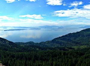
After about one mile there is an overlook with a bench that offers a great glimpse of the San Juan Islands (a great preview of the view to come), which is a great place ...
Chain Lakes Loop
Deming, Washington
4.0
8.35 mi
/ 2005 ft gain
Driving Directions:
Travel east on Mt. Baker Highway 542 to the road's end and the Mount Baker Ski area. Follow the signs to the upper parking lot and the Bagley Lakes/Chain Lakes trailhead. The trail can also be accessed from Austin Pass and Artist Point.
Trail:
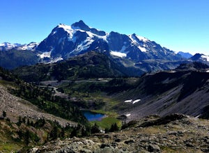
From the Bagley Lakes trailhead, follow the trail to the Bagley Lakes and admire the crystal clear water with Table Mountain in...
Glass Beach
Eleele, Hawaii
3.7
The shoreline of Glass Beach is covered with millions of brown, aqua, clear and blue sea glass pebbles, but also consists of other remnants from what looks to be a former salvage yard (do not walk barefoot in this area). Although that may be the case, there is a lot of beauty to be captured here, and it is often drier than other parts of the islands which is ideal for capturing a sunset.
This...
Hike along Short Beach, Oregon
Tillamook, Oregon
5.0
0.25 mi
/ 200 ft gain
Hike: The trail is basically a handmade wooden staircase that takes you all the way down to the beach, so once you locate it, just keep following the stairs all the way down until you've reached the beach.Directions: Drive North along Cape Meares Loop Rd just past Oceanside until you reach the point where it intersects Short Creek. You'll most likely see other cars parked along the road. There'...
Take a Stroll to Tunnel Beach, Oregon
Tillamook, Oregon
5.0
0.5 mi
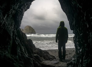
The main beach is located adjacent to Oceanside Beach State Park, which can be accessed via Cape Meares Loop/Netarts Oceanside Hwy.Once you arrive at the park, head down towards the beach and start walking North. You'll notice a little hole-in-the-wall past a small group of rocks which you'll have to step over. Take precaution during storm season, as rocks above the tunnel entrance have been kn...
Hike to Mt. Walker North & South Viewpoints
Brinnon, Washington
3.0
4 mi
/ 2000 ft gain
Directions: From the Quilcene Ranger Station drive 4.6 miles south on US 101. Watch for the signs for Mount Walker View Point. Turn left onto Mount Walker Road. The trail head is about a quarter mile up the road with pull over parking on the left side of the road. In the winter and early spring, the road is closed and gated very close to US 101. Park near the gate and walk the road to the trail...
Hike to Pheasant Creek Falls
Beaver, Oregon
4.0
4 mi
/ 800 ft gain
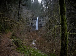
Hike: The hike to Pheasant Creek Falls is just short continuation of nearby Niagara Falls. After reaching Niagara Falls, continue on the trail for about another 300 feet and you'll reach the more impressive, Pheasant Creek Falls.For more detailed information including a trail map and directions to the trailhead, visit fs.usda.gov.Directions: Getting to the trailhead can be a bit tricky, as one...
Hike Mount Storm King in Olympic NP
Port Angeles, Washington
4.7
3.91 mi
/ 2251 ft gain
The trailhead is located right next to the Storm King ranger station adjacent to Lake Crescent right off Hwy 101 just past Port Angeles if heading West.
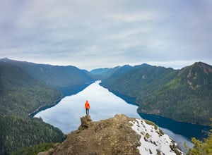
It shares the same trail as, and breaks off left from the Marymere Falls trail (also worth seeing) about a quarter mile in (look for signage). From there, the path wastes no time heading straight up for almost the entire way. The trail itself ...
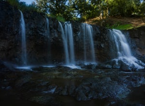
Hike to the Waterfalls at Kauai's Secret Beach
Kilauea, Hawaii
4.0
2 mi
Disclaimer - as I was shown this spot by a local, I would suggest asking for the exact location of the trail from a local. It can be reached by one of the nearby neighborhood roads in Kilauea.The boot path is fairly short (approximately a mile or so), and involves a short stream crossing, which can be a bit tricky if there have been any recent rain storms. The lava formations are located to t...
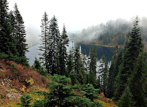
Day Hike to Lake Valhalla
Leavenworth, Washington
4.5
7 mi
/ 1500 ft gain
The Smith Brook trail starts off with several switchbacks, then continues up to Union Gap where it meets the Pacific Crest Trail. Turn south (left) at Union Gap and continue hiking until you reach the gap between Mount Lichtenberg and McCausland, where you get a first glimpse of Lake Valhalla.Just before reaching the gap, a boot trail follows the ridge up to an old lookout site at Mount McCausl...
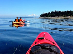
Kayaking at Point Doughty State Park
Eastsound, Washington
The easiest way to explore this area is through Outer Island Excursions, which offers a 3-hour kayaking tour from Smuggler’s Villa Resort on Orcas Island (they also offer various tours of the surrounding islands).The tour begins with a paddle down the North Shore of Orcas Island to Point Doughty State Park. During the paddle to the park, you will have a great opportunity to see harbor seals, ba...
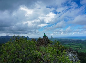
Hike to the nose of Sleeping Giant
Kapaa, Hawaii
4.5
4 mi
/ 1000 ft gain
There are a few different approaches for this hike - you can take either the East route, West route, or the Kuamoo-Nounou route. The East route is closest to nearby towns of Kapa'a and Wailua, so for convenience I chose this route.The trail quickly begins with several switchbacks, all of which are pretty gradual. You begin to gain elevation steadily past .75 miles. Once you reach about halfwa...
Day Hike to Lake Ingalls
Leavenworth, Washington
4.3
9 mi
/ 2500 ft gain
From the parking lot you start out on an old miners road that leads to the trail. Keep right at the first fork (left lead to Esmeralda Basin), then in about 2 miles, go left at the next fork (right leads to Ingalls Pass). The trail will climb steadily as you continue. In about another mile you will reach a nice viewpoint where you get stunning views of Esmeralda Peak and Mount Rainier in the ba...
Snowshoe to Huntoon Point
Deming, Washington
5.0
6 mi
/ 1200 ft gain
This strenuous but rewarding hike takes you first to Austin Pass, where there is a great view of Mount Shuksan. Look out for skiers and snowboarders heading the opposite direction as you start out.The second major push heads further up to Kulshan Ridge, leading first to Artist Point, then Huntoon Point, with beautiful views of Mount Shuksan, the Border Peaks, and Mt. Baker.The trailhead is loca...
Community
© 2023 The Outbound Collective - Terms of Use - Privacy Policy

