Nick TortExplorer
I love to share what I find along the way so that others may experience the same joys. Sometimes my words fall short, but a photo can tell the story for me.
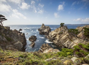
Point Lobos Natural Preserve Loop
Carmel, California
4.7
7.14 mi
/ 640 ft gain
Point Lobos contains headlands, coves and rolling meadows, and its offshore area forms one of the richest underwater habitats in the world, popular with divers. Wildlife includes seals, sea lions, sea otters, migrating gray whales (from December to May), and thousands of seabirds, who also make the reserve their home.
Hiking trails follow the shoreline and lead to hidden coves. The area used t...
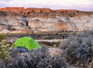
Desert Camp at White House Campground
Kanab, Utah
4.0
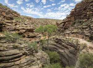
White House Trailhead & Campground sits just north of the Vermillion Cliffs National Monument. There are only 5 walk-in sites ($5 per night), very clean bathrooms, and grilled firepit/picnic tables in each site. The camping area is surrounded by beautifully sculpted and colored sandstone cliffs that make for fun quick hikes and gorgeous views of the area.The Paria River cuts the desert land...
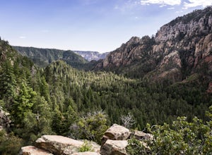
Hike up Cookstove Trail
Sedona, Arizona
1.6 mi
/ 800 ft gain
Either a compliment to a night spent at the Pine Flat Campground or a quick day hike to top of your Sedona/Oak Creek adventure, this short hike will give you an alternative, but comparatively gorgeous view of the Sedona Area.This trail starts just north of Pine Flat Campground near milepost 387 and climbs steeply up through a forested area filled with conifers and a mix of juniper trees offerin...
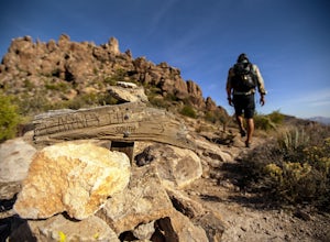
Superstition Peak 5057 via Carney Springs
Gold Canyon, Arizona
5.0
7.71 mi
/ 2831 ft gain
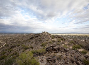
This is the true beast hike of the Superstitions. If you think Flatiron is a toughy, give this a whirl! You will be poked, prodded, slapped, smacked, jolted, tripped and stabbed the entire way, but rewarded with arguably the finest sights the valley of the sun has to offer: the entire Superstition Ridgeline, Flatiron and the sprawling city to your west, Gold Canyon and Hieroglyphics to the Sout...
South Lykken Trail to Simonetta Kennett Viewpoint
Palm Springs, California
3.6
6.45 mi
/ 1654 ft gain
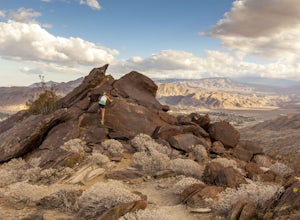
The South Lykken Trail is the south half of the 9.5-mile Carl Lykken Trail, which weaves along a series of mountain ridges above downtown Palm Springs. Dogs are not permitted on this trail.
This section of the trail runs 3.2 miles one-way. You will gain just over 1600ft of elevation at the highest point and descend down. It’s a moderate out-and-back hill of a hike - enough to get the blood fl...
Weavers Needle
Gold Canyon, Arizona
8.02 mi
/ 2602 ft gain
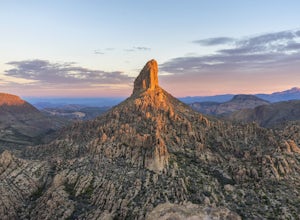
Lace up your boots, stock up your gear, bid farewell to civilization and head out to the wild. This adventure is not one for the faint of heart. It will scrape, snag, trip and stumble you. It will scare, taunt and tantalize you. You will need to earn this one, and it is more than worth the effort.
On a serious note, the actual climb of Weavers Needle, though not very technical, should only be ...
Hike Incinerator Ridge to Leopold Point
Mount Lemmon, Arizona
5.0
3.2 mi
/ 800 ft gain
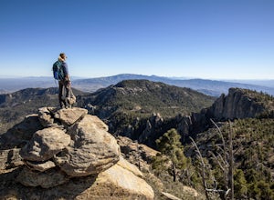
Starting out at San Pedro Vista Trailhead, located just off the shoulder of the Catalina Highway, this trail follows along the ridgeline, drops to a small saddle, and terminates at a gorgeous vista: Leopold Point. There is only 1 sign that you will come across that actually designates it as Incinerator Ridge which is halfway through your hike, but don't let that deter you. Keep on keeping on al...
Quartz Ridge Trail
Phoenix, Arizona
4.5
2.29 mi
/ 509 ft gain
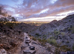
Quartz Ridge in the Phoenix Mountain Preserve (also known as Trail 8A) is a great escape getaway trail that can be done as a single track or combined with many intersecting trails. It is a very popular trail for hikers, trail runners, pet walkers, sky gawkers and more!
The trailhead sits in a small cul-de-sac where 32nd St dead ends at the intersection of Lincoln Drive. It is a very small park...
Hike Fatman's Loop
Flagstaff, Arizona
5.0
2.5 mi
/ 690 ft gain
Sitting on the eastern slope of Mt Elden is a super fun multi-use trail called Fatman's Loop. It's a perfect spot for hiking, trail running, day strolling, or walking the pup. All the while, treating you to glimpses of the eastern suburbs of Flagstaff, beautiful wild flowers, and cool rock formations that hint back to Mt Elden's volcanic origins. Along the trail you will come through a narrow g...
Mojave Connector Trail #202
Phoenix, Arizona
2.18 mi
/ 820 ft gain
The best starting point to access this hike is parking at the Mojave Picnic Area and heading up the Mojave Trail #200. At .4 miles, you will hit the junction and stating point for the Mojave Connector Trail. Head left at the saddle and begin a rapid ascent up switchbacks to a small flattened summit area.
The beauty of this hike is the different viewpoints you are awarded with around each bend....
Raft The Grand Canyon
Marble Canyon, Arizona
5.0
If rafting the Grand Canyon is not towards the top of your bucket list, make room. There are only so many experiences that are so incredible and grand that they can humble, amaze, and awe you day after day during, as well as for the years that follow. This adventure has the ability to strip a person to their bare bones, allowing the wilderness to work its magic on the soul. Cheesy as it sounds,...
Mojave Trail #200
Phoenix, Arizona
4.5
1.88 mi
/ 430 ft gain
The entrance for the Piestewa Peak area is located at 2701 E. Squaw Peak Drive. The Mojave Picnic Area & Trailhead is the first parking area on the right. This is a very popular trail when the outside temps drop a bit so get there early for sunset hikes to ease parking.
The trail begins on the north side of the Mojave parking area and heads east from there. After a short distance the trail...
MTB the Hart Prairie Loop
Flagstaff, Arizona
15.2 mi
/ 1198 ft gain
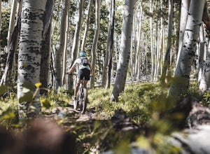
This outstanding loop takes in high altitude meadows, aspen glades, fabulous evergreen forest, and unbelievable views in the San Francisco Peaks. The ride lacks any technical challenges, but long and consistent uphill grades (at high elevation) make for a good workout. The reward is an ending that includes miles of fast flowing downhill on some of Arizona’s finest singletrack.
Go Against the Cl...
Hike Mount LamLam
Umatac, Guam
2.7 mi
/ 830 ft gain
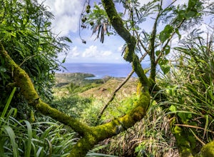
Mount Lamlam is 1,332 ft above sea level at its highest point, but, since it rises from the Mariana Trench, it is technically the highest mountain on Earth. It isn't the highest mountain above water, but if you dropped Everest in the Mariana Trench, there would be about 6,000 feet of sea water above its peak. Just know that if you run around boasting that you hiked the tallest mountain in the w...
Broken Arrow Trail to Chicken Point
Sedona, Arizona
4.6
2.79 mi
/ 420 ft gain
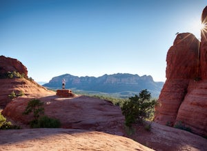
Start your hike at the Broken Arrow Trailhead, just .2 miles past the end of Morgan Rd. You will be immediately greeted by Sedona slickrock trails and red rock views for days! Take a minute to sneak a peek at Devil's Dining Room Sinkhole around 0.6 miles in. It has a sign and is just of to the right of the trail.
The trail continues coursing through some pristine Pinyon pine, juniper and cypre...
Picnic at Banjo Bill
Sedona, Arizona
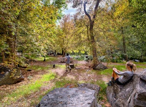
Nestled in Oak Creek Canyon, and throughout the Red Rock District are several picnic and day-use areas. Popular sites include; West Fork, Red Rock Crossing, Banjo Bill and Grasshopper, which provide unique hiking, creek side picnicking, swimming and fishing opportunities. All Oak Creek Canyon campgrounds are also available for day-use sites.Banjo Bill is a scenic, lush area cut by a bubbling ri...
Hike Pine Mountain
Cartersville, Georgia
4.6
2.11 mi
/ 597 ft gain
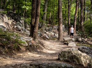
The Pine Mountain Trail winds and climbs its way to awesome summit views, along massive granite outcrops and serene forest. Hike over wooden bridges, across sparkling streams, past misty waterfalls & rock outcroppings, varied forest, scenic overlooks, & leaping deer. This local gem is tucked away near Cartersville (under 40 miles from midtown Atlanta).
Take the West Spur Trail out of ...
Bright Angel Trail to Indian Garden and Bright Angel Campgrounds
Grand Canyon Village, Arizona
5.0
18.26 mi
/ 4314 ft gain
The Bright Angel Trail is considered the park’s premier hiking trail. Well maintained, graded for stock, with regular drinking water and covered rest-houses, it is without question the safest trail in Grand Canyon National Park. There is a ranger station located at the trail’s halfway point (Indian Garden) and one at the bottom of the canyon (Bright Angel Campground). Particularly during hot we...
Hike Marcos de Niza Ridgeline / National Loop
Phoenix, Arizona
5.0
2.8 mi
/ 640 ft gain
This is somewhat of a hidden gem in South Mountain Park, the largest municipal park in the United States, even though it's right there for all to see. The best way to take advantage of this trail is to attack the ridgeline with an intense hiking pace or trail run, connecting it to the National Trail (fire road) and jogging it home to complete the loop.At the east side of the park, Pima Canyon T...
Enchanted Rock Loop
Fredericksburg, Texas
4.9
5.13 mi
/ 344 ft gain
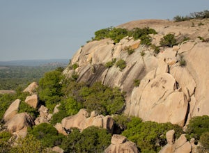
Once inside the park, you can't miss either parking lots that are surrounded by picnic tables and well marked signs pointing towards the trails. There are also some public restrooms and a truck with some snacks. Once geared up, head straight towards the Summit Trail and begin your adventure!
The trail is incredibly easy to follow - there are signs at every turn along the way. You are making yo...
Community
© 2023 The Outbound Collective - Terms of Use - Privacy Policy

