🌟PRO
Scott KranzExplorer
Full-time commercial and editorial photographer specializing in outdoor sports, lifestyle, landscapes, and travel photography.
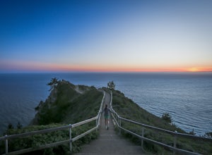
Muir Beach Overlook
Muir Beach, California
4.9
The Muir Beach Overlook is one of the most convenient spots to take in an amazing view of the entire coastline, and one of the best places to catch a dramatic sunset. It’s conveniently located one mile north of Muir Beach and parking is easy. It’s a 5 minute walk down the trail to the Overlook. On a clear day, you can see San Francisco’s Sutro Tower, Mount Tam, and out to the Farallon Islands.
...
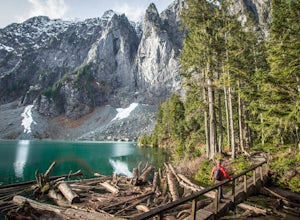
Lake Serene and Bridal Veil Falls
Gold Bar, Washington
4.8
7.74 mi
/ 2569 ft gain
Consider this a must-do if you are in Seattle and feel like knocking out two amazing hikes AND getting to see a hidden lake all along US 2.
The trail starts out on an old road with the typical amazing forest surrounding you. After roughly 2 miles the road will end and you can go right (signage is easy to see) to Bridal Veil Falls or you can keep going and go straight to Lake Serene. This is wh...
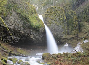
Horsetail Falls Loop
Cascade Locks, Oregon
4.7
2.56 mi
/ 610 ft gain
Start off on this loop from Horsetail Falls Trailhead. It never hurts to start a hike with a view of Horsetail Falls. This 2.5 mile loop will start you off on Gorge trail #400 up Horsetail Falls Trail. You’ll encounter a few switchbacks before the trail flattens out and leads you into the valley toward Ponytail Falls. As you continue on this loop, you’ll get to hike behind the falls.
After con...
Melakwa Lakes via Denny Creek Trail
North Bend, Washington
4.6
8.84 mi
/ 2615 ft gain
This hike has it all: old-growth forests, rivers, waterfalls, alpine lakes, views, peaks, and so on. The hike starts from near Denny Creek Campground in between the separate I-90 viaducts. Almost immediately, you will cross over a walk bridge over Denny Creek's waterfalls, and then eventually under the westbound I-90 viaduct, which, from the old-growth forest underneath, is a cool, almost-post-...
Hike to Kendall Katwalk via the PCT
North Bend, Washington
5.0
11 mi
/ 2700 ft gain
Starting near Snoqualmie Pass, hike the historic Pacific Crest Trail (PCT) through old-growth forests and boulder fields to the "Kendall Katwalk," a high ledge of rock carved out of a mountain side many years ago using dynamite.The hike to the Katwalk gradually gains elevation using switchbacks with occasional views of surrounding peaks, such as Guye Peak to the west, Red Mountain to the north,...
Hike to Rattlesnake Ledge
North Bend, Washington
3.9
4 mi
/ 1160 ft gain
If you’re looking for a fairly easy hike with a great view at the top, the hike to Rattlesnake Ledge is just for you. The Ledge is located on the eastern end of Rattlesnake Ridge, and is the perfect spot to enjoy panoramic views of Rattlesnake Lake, the Cascades, Mt. Si, and Snoqualmie Pass.
But it’s not just the summit that’s wonderful - you’ll spend the entirety of your gradual 1.9-mile ascen...
Upper Wildcat Lake
North Bend, Washington
1.0
14.43 mi
/ 4370 ft gain
Although this hike is possible if you’re looking for an all-day training hike, it’s much more enjoyable if it’s an overnight backpacking trip.
Head up the trail past Snow Lake toward Gem Lake. En route to Snow Lake will be a little crowded, but should lighten significantly as you continue hiking. The hike from Snow to Gem Lake is relatively level with only a few fluctuations. Once you get to G...
Mount Pilchuck Lookout
Granite Falls, Washington
4.8
5.22 mi
/ 2113 ft gain
Hike the well-maintained Mount Pilchuck Lookout trail through a variety of terrain: old-growth forest and granite boulder fields. At the top, you'll reach a lookout tower perched on Mount Pilchuck. Pilchuck sits on the western edge of the Cascades, which offers up amazing panoramic views once you reach the summit of Mt. Baker, Glacier Peak, Mt. Rainier, the Olympic Peninsula, Puget Sound, the a...
Hike to the Summit of Mt. Erie
Anacortes, Washington
4.0
5 mi
/ 900 ft gain
To start this hike, jump on trail 215 for a short distance of about a 1/4 mile. From here, continue until you cross trail 320 and head left onto it. Stay on 320 until you come across trail 230.Take 230 uphill (resembles an old fire road) toward the ravine just above a creek. From here, head onto trail 207, charging up a series of switchbacks until you encounter another junction. At the junction...
Explore Diablo Lake
Rockport, Washington
5.0
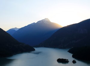
Diablo Lake is a reservoir in the North Cascades created by Diablo Dam. The hue of the lake is created by ground up rocks from local glaciers, which end up drifting down streams into the lake.If you’ve decided to take in the viewpoints driving Hwy 20 through the park, be sure to check out Liberty Bell as well.If you’re up for being more active and moving around, check out Trappers Peak / Thornt...
Double Arch
Castle Valley, Utah
4.4
0.56 mi
/ 135 ft gain
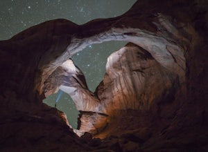
The hike to Double Arch is a relatively flat and easy hike of 0.5 miles roundtrip. You can add this to the rest of the quick spots you may want to visit on your visit to Arches.This arch is created by two arches that shares the same stone as the foundation for their outer legs. This arch was formed by downward water erosion as opposed to the more common side-to-side erosion.
The good news is t...
Explore Ruby Beach
Forks, Washington
5.0
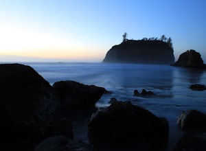
If you’re looking for a mellow day at the beach, this is a great spot! There’s an easy path from the parking area down to the beach that’s less than 0.25 miles, so it’s not too difficult to the things you may want or need. Just north of the parking area, there’s a series of tide pools to explore. If you’re really excited about checking out the sea life, be sure to come during lower tides as mor...
Hike to Rachel Lake
Snoqualmie Pass, Washington
4.8
8 mi
/ 1600 ft gain
This hike is 8 miles roundtrip, with 1600 feet of elevation gain. Once you're on the trail, it starts heading uphill to help get your heart rate up on the hike. As you enter the Alpine Lakes Wilderness, the trail starts to level out. You'll cross a few streams and hike through a fair amount of vegetation, so if there's been recent rain or dew, prepare to get a little wet.At a little shy of 3 mi...
Hike to Elowah Falls
Cascade Locks, Oregon
4.8
1.4 mi
/ 280 ft gain
Multnomah Falls, which is about 5 miles from Elowah takes a large portion of the crowd due to its visibility from the highway. With that said, you may get a much more deserted Elowah Falls if you decide to take the 15 minute hike to its base.When you’re on the trail, keep an eye out for the fork in the trail at about 0.4 miles. There has been a sign in place indicating which direction you shoul...
Thornton Lakes & Trappers Peak
Marblemount, Washington
3.7
10.57 mi
/ 3885 ft gain
To get to your campground or to Trappers Peak, hike roughly five miles along the trail to ridge, where the trail divides. If you head left you'll go down into lake basis where you can drop your gear. Come back to the divide and head right, which will lead you up to trappers peak.
Something to keep in mind, the trailhead is unreachable for most of year. Best time to do this hike is mid-summer t...
Summit Mt. Defiance
North Bend, Washington
5.0
11 mi
/ 3300 ft gain
This hike offers some of the best views one can see in the area. On a clear day, you'll get amazing views of Mt. Rainier. The best part is that as you start heading uphill in the first half mile, you'll get great views of McClellan Butte. Once you reach the summit of Defiance at 5584 feet, you'll be towering over McClellan by roughly 400 feet.Early in the hike, you'll cross Mason Creek. During ...
Scramble up Mt. Persis
Gold Bar, Washington
4 mi
/ 2658 ft gain
There isn’t a clearly designated trail to start this scramble/hike. Look for the trail that more resembles a boot path. The trail won’t be well marked, but there might be some orange tape or markers to help you find your way.During the first mile of the hike, you’ll see the most elevation gain, so be prepared to get into it right from the start. Once you reach the ridge, the trail will level ou...
Discovery Park Beach
Seattle, Washington
4.3
2.39 mi
/ 535 ft gain
Discovery Park and its beach area great for walking, running, photography, and taking in a sunset. If you want to put your feet in the sand, head down to the western most part of the park. This beach is a sand beach with an iconic lighthouse at the end. Dirftwood also washes up on the beach providing some cool contrast.
If you need a bite after the beach, head to the Ballard neighborhood, whic...
Foggy Lake via Gothic Basin
Granite Falls, Washington
4.5
9.78 mi
/ 3179 ft gain
Drive the Mountain Loop Highway to Barlow Pass and park at the pass using your Northwest Forest Pass. (In early or late season, be aware of snow conditions at the pass and, more importantly, along the trail up to Gothic Basin.)
From Barlow Pass, start hiking south past the trail gate and in the direction of the old abandoned mining town, Monte Cristo.
After about one mile of easy hiking along...
Photograph Liberty Bell
Winthrop, Washington
4.0
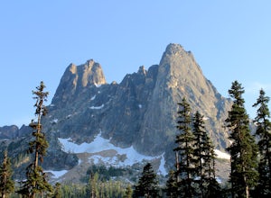
Liberty Bell is just one mile south of Washington Pass. This peak is part of a group of spires, which include North and South Early Winters Spires, Concord Tower, and Lexington Tower.
If you’ve decided to take in the viewpoints driving Hwy 20 through the park, be sure to check out Diablo Lake as well.
If you’re up for being more active and moving around, check out Trappers Peak / Thornton Lake
Sahale Arm via Cascade Pass
Skagit County, Washington
4.3
12.34 mi
/ 5230 ft gain
To get to this hike, go to Marblemount, WA. Then, drive ~23 miles east on Cascade River Road until the end, the Cascade Pass trailhead. Even before you hit the trail, you'll get an amazing view of Johannesburg Mountain.
Once you're ready to get going, the initial 3.7 miles of this hike to Cascade Pass are moderate in difficulty. If you're headed out with the family, this is a doable day hike a...
Scramble up Kaleetan Peak
North Bend, Washington
9 mi
/ 2200 ft gain
Initial note: because this is an alpine scramble, do your research before tackling this adventure, including learning the correct route and the current conditions (such as any early- or late-season snow).From the Denny Creek Trailhead, take the Denny Creek trail just over 4 miles to Melakwa Lakes. (See separate adventure for Melakwa Lakes, which describes several beautiful features along the tr...
Backpack at Wing Lake (North Cascades)
Chelan County, Washington
5.0
12 mi
/ 2652 ft gain
From Rainy Pass, take the trail to Ann Lake (pictured with island and wildflowers). About 1 mile into hike, you'll reach a fork. Take the right trail to Heather Pass. From Heather Pass, take boot trail through talus field to Lewis Lake (pictured with green water and drift wood in foreground). Once you hit Lewis Lake, ascend up ridge to west to finally reach beautiful Wing Lake, just below Black...
The Subway - Top-Down
Springdale, Utah
5.0
7.78 mi
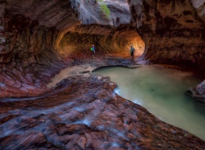
The Subway (rated 3B III), also known as the Left Fork of the North Creek, is the most popular backcountry hike in Zion. It is one of the most diverse and beautiful canyons, as well as a fun and challenging day trip canyoneering adventure. There are two ways to explore the Subway: from the bottom up or the top down. The top-down route is a strenuous 6-12hr, 9.5+ mile hike that requires rappell...
Community
© 2023 The Outbound Collective - Terms of Use - Privacy Policy

