Danielle Tourigny Explorer
Maine resident and Emergency Medicine PA-C with a love of all things nature. Traveling around to find the most beautiful spots and most delicious eats.
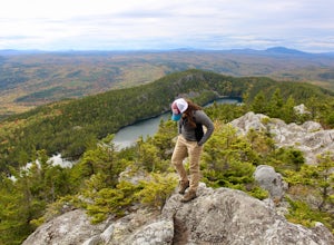
Hike Borestone Mountain
Guilford, Maine
3.6 mi
/ 2000 ft gain
Important notes about this hike:
REQUIRES A FEE: $6 per adult, $3 per student - they don't collect the fee until you get to the visitor center about a mile in, so don't get caught like I did without cash!Does NOT allow dogs.
Drive towards the Audubon Sanctuary and come to a parking lot just outside the gate.
The Base Trail begins just beyond the gate at the trailhead next to a kiosk. The trail...
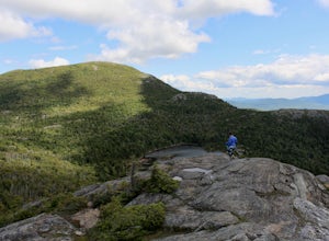
Hike Tumbledown Mountain
Weld, Maine
5.6 mi
/ 2300 ft gain
To keep the hike as short as possible, the hike can be an out and back at 5.6 miles, but if you wanted to make it a loop that is possible and adds only an additional 2 miles or so. We took the Brook Trail up to the summit (which passes by the alpine lake) and then followed it back down. To hike the loop, continue driving down Byron Rd to the second parking area to take the Loop Trail up. You wo...
Avery Peak and West Bigelow
New Portland, Maine
8.96 mi
/ 3291 ft gain
Begin on East Flagstaff Rd and follow the Safford Brook Trail until you reach the junction with the Appalachian Trail. Turning left or north bound will bring you, shortly to the side trail for the Safford Brook Campsite; turning right (or southbound) on the A.T. will begin the climb to Avery Peak. The trail becomes very steep as it climbs up through boulders, and about halfway to the peak, ther...
Cross Country Ski the Trails at Harris Farm
Dayton, Maine
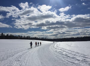
Harris Farm is a great place for beginner cross country skiing or to hone in on already developed skills. They provide rentals ($15pp) and the network of trails is several miles long. The trails range from green (easy) to red/black (more difficult). I personally love hanging out on the blue trails that are moderately difficult and have plenty of hills winding through forest and meadows. The ent...
Hike Mount Megunticook in Camden Hills State Park
Camden, Maine
2.9 mi
/ 1000 ft gain
After driving in to Camden Hills State Park, there is a fork where you can go straight (to the campgrounds) or left (to head up Mount Battie). Take a left and then park in the parking lot immediately on your right. That is the trailhead to Mount Megunticook!
The trail itself winds through the trees, slowly gaining elevation. There is a point where the trail forks into two. Both options will get...
Run the Jamaica Pond and Victorian Jamaica Plain Loop
Boston, Massachusetts
5.0
1.5 mi
/ 95 ft gain
Park in the Jamaica Pond parking area. You can go either direction on this loop trail, which is highly trafficked and dog-friendly. Keep a lookout for (and a respectful distance from) the wildlife that live here. The loop around Jamaica Pond itself is 1.5 miles. The best part about running in this area is that it links up to so many other running trails. It is a part of the Emerald Necklace whi...
Off-season Camp at Blackwoods Campground
Mount Desert, Maine
0.75 mi
When we saw that the weather in Acadia was going to be mid 40's and sunny in March, we decided we had to go. However, when you go in March there are a lot of different things about Acadia National Park that are helpful to know.First of all, it is recommended that you camp at Blackwoods Campground if you are planning on camping. The road into the campground is closed though, so plan on backpacki...
Summit Mount Hancock and South Hancock
Lincoln, New Hampshire
9.8 mi
/ 2220 ft gain
The Hancock trailhead is located at the infamous hairpin turn of the Kancamagus Highway in the White Mountains. The trail itself crosses the road and starts at 2000 feet of elevation on the Hancock Notch trail. It remains fairly flat for the first 3 miles of the trail. After 1.8 miles you will hit the first junction with the Cedar Brook Trail where you will take a left. Continue for another 0.7...
Hike Eyebrow Trail to Old Speck Mountain Loop
Maine 26, Maine
7.8 mi
/ 3000 ft gain
The first time I attempted this trail was in mid April, and the slush and mud I encountered was absolutely unbelievable. Snowshoes were useless. Crampons were useless. Boots alone meant dirty, wet, muddy feet. So, I had to bail. But I came back in October and I’m so glad I did because the views of the foliage were amazing!
The Old Speck Trail very quickly hits an intersection with the Eyebro...
Snowshoe Mount Jackson
Crawford Notch Road, New Hampshire
5.2 mi
/ 2300 ft gain
The hike starts across the street from the AMC Highland Center on route 302, which means there is plenty of parking and when you finish there is a fireplace and snacks to warm up with! It starts at the Webster Jackson trailhead and after 1.4 miles breaks off onto the Jackson trail. At that point you could take the Webster trail to create a loop that summits Webster and Jackson, but after the 3 ...
Hike Sargent Mountain via South Ridge Trail
Mount Desert, Maine
4.4 mi
/ 1400 ft gain
This has been one of my favorite winter adventures that I have had in a long time. There were gorgeous views of Somes Sound, we saw three snowy owls and there is a gorgeous frozen waterfall on the way up to the summit!
Because much of the Park Loop Road is closed in winter, we started our hike from a Parking area off of Route 3 (It's the one just north of Upper Hadlock Pond and you have to cr...
Hike Paradise Park
Government Camp, Oregon
5.0
12 mi
/ 2300 ft gain
The hike begins at Timberline Lodge, which sits on Mount Hood at 6,000 feet of elevation. Find the Timberline trail behind the lodge by following any of the maze of trails heading east and you will be on your way! After 1.2 miles, you reach Little Zigzag Canyon where you will descend approximately 1000 feet to reach the bottom before heading straight back up again. This portion of the trail is ...
Run the Arnold Arboretum Trail
Boston, Massachusetts
5.0
2.6 mi
/ 150 ft gain
Park in the lot off of Arborway to access the trail. This place is gorgeous year round. The winter offers a quiet solitude, fall boasts bright colors, spring is the most beautiful as the flowers start to burst and cherry blossoms take over, and summer is overwhelmingly green. There are dozens of spots around the arboretum where you can just nestle under some trees and have a private picnic or m...
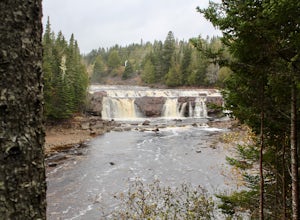
Photograph Lepreau Falls
Lepreau, New Brunswick
The interpretive trail offers several different vantage points of the falls, and they are all equally beautiful. It was pouring rain while we were there, but it didn't stop me from running around for almost 45 minutes taking pictures and enjoying the views because these falls are so beautiful.
There is a daytime picnic area near the water that is nice, and there is also an option for overnight ...
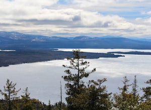
Hike Bald Mountain in Rangeley
Bald Mountain Road, Maine
2.3 mi
/ 931 ft gain
The trail itself has a gradual incline over the course of the 1.15 miles to get to the top. There are a few steeper sections near the top, but completely manageable even for a beginner. There is another trailhead off of route 4, which would lead to a longer hike, around 4 miles. When coming from Bald Mountain Rd, the intersection with the trail on route 4 is the only intersection you will come ...
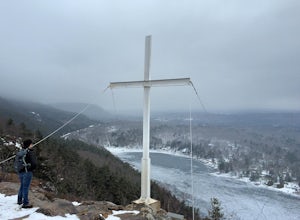
Hike up to Maiden's Cliff
Camden, Maine
2 mi
/ 1000 ft gain
With a total elevation gain of 1000 feet in one mile to the top, the entire hike is uphill. The whole hike is within tree line until the very top, but there is a beautiful stream to hike next to for at least half. At the top, the view opens up to the Maiden's Cliff, and the view is spectacular. The one mile back is not difficult, but if you hike it in winter, it can get pretty icy, so be carefu...
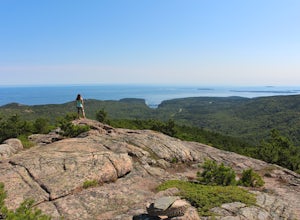
Summit Dorr Mountain via the Ladder Trail
Bar Harbor, Maine
5.0
3.6 mi
/ 1100 ft gain
To find the trail head, drive out of Bar Harbor down Route 3. There are no signs for the trailhead or for parking, so as soon as you pass Tarn Lake on the right, you can pull off and park on the side of the road.
Elevation on the ladder trail starts immediately and doesn't let up until you reach the summit, which is the downside of summiting a 1200ft mountain in one mile. The trail is 90% rock...
Hike to Kinsman Pond
Lincoln, New Hampshire
8 mi
/ 2500 ft gain
Our hike began at the Basin, which is a clearly marked exit directly off 93. If you are coming from the Northbound side, walk under the bridge beneath 93 to get to the beginning of the trail. We enjoyed the Basin for a while before hiking 1.0 mile to the Cascade Brook Trail where we took a right. We took that trail for a 0.5 mile, and then took a left to meet up with the Kinsman Pond Trail for ...
Snowshoe to Carter Notch Hut
Gorham, New Hampshire
7.8 mi
/ 2200 ft gain
The nineteen mile brook trail is a winding path up approximately 2200 feet of elevation over the course of 3.9 miles. That distance feels a lot farther when you are breaking trail in 18-24 inches of snow and you are carrying 35 lb packs on your backs. Luckily we started out early and we able to get up to the hut in the very early afternoon. Much of the trail follows along a river and after a f...
Photograph Sunrise at the Old Orchard Beach Pier
Old Orchard Beach, Maine
5.0
Few things create a more dramatic scene for a sunrise than a pier spanning out into the water, and the one in Old Orchard Beach is pretty iconic. Normally the area is pretty packed, and it can be tough to find a parking spot (especially in the summer). But at sunrise, there is just you, the beach, and that one old guy walking his dog around. I spend the night before looking at the weather. The ...
Summit Mount Waumbek via the Starr King Trail
Jefferson, New Hampshire
5.0
7.2 mi
/ 1500 ft gain
The hike starts out at the Starr King trailhead because you will summit Starr King Mountain (3,907 ft - so close to being a 4000 footer!) before moving on to Waumbek. The 2.6 miles that it takes to get to the first summit are gradual and forgiving. The majority of the total elevation is completed during that time. The first 1.5 miles is through tall spaced out trees that let the sun shine throu...
Osceola Mountain via Greeley Pond
Lincoln, New Hampshire
4.0
6.8 mi
/ 2677 ft gain
Start out at the Greeley Pond trailhead off of the Kancamagus Highway. After 1.3 miles the trail splits--bear right to get onto the Mt. Osceola Trail. Continue 1.5 miles to the summit. This summit hike offers a different kind of reward. Views are limited from the peak of Mt. Osceoloa, which allows you to focus on your immediate surroundings. Enjoy the fresh mountain air and the gorgeous trees r...
Explore Mount Battie
Camden, Maine
5.0
1.5 mi
/ 669 ft gain
The summit of Mount Battie is accessible from either the front trail that is located just outside of the state park, or there is an auto road that leads up to the summit within the park (the location drop pin reflects the route within the park). To access the front trail, the trailhead is on mountain street where there is a small parking lot available. The auto road is usually closed in winter,...
Winter Hike up Mount Lafayette
Franconia, New Hampshire
9 mi
/ 3900 ft gain
To start this hike, you can park right at the trailhead in a parking lot off of 93. This is a hike up a mountain so the entire hike is pretty challenging. There is a total elevation gain of 3900 feet in about 4.5 miles. A couple miles in you break through the treeline and then from there the views are incredible. There is a ridgeline to walk along and you have a great view of the summit of Lafa...
Community
© 2023 The Outbound Collective - Terms of Use - Privacy Policy

