Kyle ObermannExplorer
China Environmental and Adventure Photographer || 探险中国 || Speak Chinese to Protect Nature || IG @kyleobermann
Climb Mt. Xiaowutai (小五台山): Hebei Province's Highest Peak
Zhangjiakou Shi, China
5.0
15 mi
/ 6000 ft gain
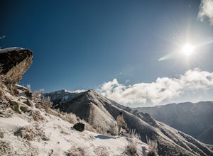
This trip makes a great extended weekend getaway from Beijing. Mt. Xiawutai lies in the neighboring province of Hebei and is Hebei's highest peak at 2882m. Getting to the mountain requires either taking a bus from the Beijing South Railway station to the town of Taohua (桃花镇) or train to Xiahuayuan (下花园). Either option is for under $15 and takes about 3-4 hours. If taking the train, you'll need ...
Canoe or Kayak the Medina River
Medina, Texas
1.0
Start at the river crossing of Patterson Avenue in the town of Medina, Texas. From here, you have several take out options which can be seen in the map pictured above (spots marked by "x"). How far to go is up to you, but a good end point is Peaceful Valley Crossing where there is plenty of public parking along TX 16 for a total of 10.2 miles. Be aware that there are no public portage options h...
Gypsum Sand Dunes, Guadalupe Mountains NP
Hudspeth County, Texas
5.0
3.01 mi
/ 50 ft gain
To get there, first talk to park ranger at the Pine Springs Visitor Center. There is a gate that you may need to borrow a key for. You will need to actually drive out of the park to get to the gypsum dunes, leaving and heading west on 62/180 for 14 miles and then take a right (head north) on private road 1576 21 miles close to Dell City. Before you reach Dell city there will be a turn off heade...
Run Mt. Ma On Shan to Needle Hill
Tai Mong Tsai Road, Hong Kong
23 mi
/ 7217.8 ft gain
This run roughly follows Maclehose Trail Sections 4-7. You can take a bus or taxi to Sai Kung town in Hong Kong's New Territories, and start the ascent up to the peak of Ma On Shan. The start follows a paved, narrow row up the hill, and there is eventually a dirt path that breaks away once the road hits a dead end. This path will take you all the way up to the summit of Ma On Shan, elv. 702m. ...
Explore Tseung Kwan O's (將軍澳) Secret Beach
88, Hong Kong
This beach may not have an official name, but some of the locals in the area call it "secret beach." The title is fitting. While not hard to reach, it is hard to find.Take the Hong Kong West Rail MTR line to the Tiu Keng Leng stop. Take exit A2 and come out at the intersection of Chui Ling Rd (翠嶺路) and King Ling Rd (景嶺路). Cross Chui Ling Rd and head to the steal-gated red brick walkway (it's op...
Hike D'Aguilar Peak
19 Shek O Road, Hong Kong
2.5 mi
/ 1066.3 ft gain
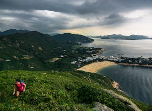
This hike is a great option for those looking for a quick, but challenging off the beaten-path adventure with stunning views. You can start from either two places: Shek O Beach or the city bus 9 stop on Cape D'Aguilar Road.The trail starts on the southwest corner of Shek O Beach, behind what Google maps calls the "Lam Au BBQ Store." There is a small stream coming out from the forest, flowing in...
Hike to Po Pin Chau
Maclehose Trail Sec. 1, Hong Kong
4.0
1.9 mi
/ 820.2 ft gain
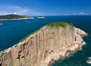
This is a fairly non-strenuous hike which still offers some really nice views, the chance to gain some elevation and then cool off at a beach, and also learn some geology. Getting to High Island Reservoir East Dam starts from Sai Kung village. There are many ways to get to Sai Kung village, I took Public Light Bus 101M from the Hang Hau Station MTR stop (Purple Line).From Sai Kung take a taxi t...
Capture the Sunset from Mt. Laozhai (老寨山)
Guilin Shi, China
2.0
0.5 mi
/ 656.2 ft gain
Mt. Laozhai is an approximately 220m karst peak in the village of Xingping. It overlooks a dramatic bend in the Li River, showing off some of Guilin Province’s most classic landscapes. Xingping is best reached from the well-known tourist town of Yangshuo (阳朔) either by rafting down the Li River or by a 1+ hour bus. You can also raft down the river halfway from the town of Yangdi (杨堤乡) to Nine H...
Hike from Princess Wencheng Temple to Yushu
Yushu Zangzuzizhizhou, China
19.9 mi
/ 1400 ft gain
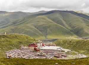
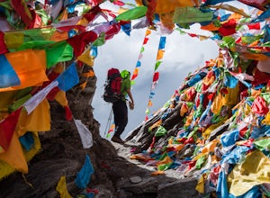
Take a taxi one way from Yushu (玉树) to Princess Wencheng Temple (文成公主寺). Should be around 30-40RMB and something like 12km.Once you get to the temple, take a look around. It's famous, butpretty small. There are tons of prayer flags and yaks hanging aroundthough. After that, hike back 2km to the main road.Cross the main road and head northalong it, back towards Yushu for a couple hundred meters....
Climb Mt. Buko (武甲山)
Yokoze-machi, Japan
6.2 mi
/ 2578.7 ft gain
Mt. Buko is about two hours drive from Tokyo. Alternatively, you could take the train to Chichibu's Yokoze Station 横瀬駅 and take a longer walk to the foot of the mountain (we drove from Tokyo). From the Mt. Buko parking lot the route is very simple and easy to follow. There is a well-marked map at the trail head that is in Japnese, but it is pretty easy to make sense of. Your starting elevation ...
Camp on Haba Snow Mountain (哈巴雪山): Huangtupo Camp
Diqing Zangzuzizhizhou, China
3.7 mi
/ 2296.6 ft gain
From Lijiang or the end of the Tiger Leaping Gorge (Tina’s Guesthouse) take a bus, small public van, or hire a driver to take you to Haba village. This is a spectacular four hour drive from Lijiang and about a one hour drive from Tina’s. Haba is a wonderful little local Naxi village spread out on the terraces of the northern base of Haba Mountain. This route takes you directly over the town to ...
Backpack Kawariluo (卡瓦洛日神山) Holy Mountain Pass
Ganzi Zangzuzizhizhou, China
18.6 mi
/ 4593.2 ft gain
Theroute starts right off HWY 317 on the opposite side of the river atGengda Village (更达村),elv. 3450m. Follow the road through the village along the rivervalley, soon crossing a bridge to the right side of the river (trueleft). Follow the road up the valley above the river for 5k or sountil you reach the next village at which point the road will descendinto the valley below. This is where the r...
Hike the Chenjiapu Great Wall
Zhangjiakou Shi, China
5.0
3.1 mi
/ 1968.5 ft gain
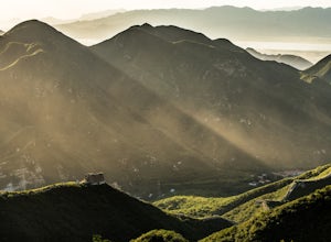
This is a really nice section of the Great Wall that is much less known than many other parts. You are likely to hike here and find yourself the only one on the wall. Some parts are completely overgrown, you have to bushwack through the growth on top of the wall to go ahead and stairs are dangerously crumbling, other parts have been fully restored.Practically, if you want to do it entirely on y...
Hike the Zhuqing Monastery (竹庆寺) Emerald Lakes
Ganzi Zangzuzizhizhou, China
7.5 mi
/ 1968.5 ft gain
The route startsdirectly behind the Zhuqing Monastery college (3948m). There is a path leading up theridge behind the college towards the right above the monastery.Once on the ridge, follow the path and cross the river onto the rightside (true left) at the first crossing. The path then leads slowly upthe ridge into a narrow high valley following the stream all the way.After about 1hr-1.5hrs you...
Hike Changping Valley in Siguniang National Park (长坪沟 - 四姑娘山)
Aba Zangzuqiangzuzizhizhou, China
8.7 mi
/ 1640.4 ft gain
This a 2.5+ hour drive from Chengdu, a city of 14 million and capital of China's Sichuan Province. Driving into Siguniang National Park you will reach Siguniang Village which is like any other touristy town in China - nothing but hotels and places to eat.
The entrance to Changping Valley costs around $15 (~100 RMB) which includes the ticket for entry and a short, round trip bus ride to the entr...
Jinshanling Great Wall Hike (金山岭)
Beijing, China
4.0
6.2 mi
Constructed during the Ming Dynasty in 1368 CE, the Jinshanling section of the Great Wall is famous for its many watchtowers and stunning vistas as the rest of the wall stretches out to the east and west. On a clear night, it's possible to see the milkyway. One of the best times to go is in April when the trees are blooming and the landscape comes alive!The hike is not too strenuous, but there ...
Camp on Lijiang's (丽江) Nob Hill
Lijiang Shi, China
4.5 mi
/ 656.2 ft gain
The town of Lijiang is one of the best hiking and cultural hubs for Yunnan province. It's an awesome place for exploration and relaxation for both the first-timer in China and the China-hand. This camp spot offers a quick and easy way to get out of the city bustle and spend the night above the city with some unparalleled views of the famous Jade Dragon Snow Mountain (5596m) and old town below....
Hike the Jade Dragon Glacial Trough
Lijiang Shi, China
6.2 mi
/ 1640.4 ft gain
Jade Dragon Snow Mountain is one of the most famous mountains in China’s Yunnan province. It’s China’s southernmost glaciated peak and stands at the southeastern edge of the Tibetan plateau. Regarded by the local Naxi people as a holy mountain protecting those who dwell below, its position less than 20km north of the ancient and touristy town of Lijiang now makes parts of it a hot-spot for visi...
Hike the Kora around Yading's Mt. Chenresig (仙乃日)
Ganzi Zangzuzizhizhou, China
18 mi
/ 3444.9 ft gain
Kora: the Tibetan word for “revolution,” often referring to a holy pilgrimage circumambulating a sacred site or object in a clockwise direction.This route is the traditional kora of Mt. Chenresig (仙乃日), the Tibetan name for “compassion.” This is Yading’s highest peak, and the route will take you past three stunning glacial lakes, over two 4700m+ passes, under the face of another holy peak, and ...
Hike the Avalanche Peak - Crow River Valley Traverse
Arthur's Pass, New Zealand
2.3 mi
/ -2624.7 ft gain
The beginning starts with the popular day hike climb up Avalanche Peak in Arthur’s Pass, NZ. You can view that route on the Outbound here. Scott’s Track up is a bit longer but less steep and with better views so I’d recommend taking that up. Should only take around 2-3 hours, but you’ll want to start as early as you can in the morning so there’s no rush for the next piece and you avoid any afte...
Summit Four Girls Mountain Second Peak (四姑娘山二峰)
Aba Zangzuqiangzuzizhizhou, China
20.5 mi
/ 6594.5 ft gain
The route is most easiest found fromthe front of the hostel 日月山庄(Ri Yue Shan Zhuang – 3254m, phone no. of manager:18384253062 (he speaks OK English)). This is not the official startof the route, but it's a back way that avoids going through the maingate and paying a ticket fee. Across the road from the hostel is ariver and a small forested hill. There is a fence along the bottom ofthe hill but ...
Hike the Tiger Leaping Gorge
Diqing Zangzuzizhizhou, China
13.7 mi
/ 3280.8 ft gain
About 100km and a 1.5 hour ride from the city of Lijiang in Yunnan Province, the Tiger Leaping Gorge cuts between Jade Dragon Snow Mountain and Haba Snow Mountain. The upper route takes around 8-10hrs to hike in full, but most people split the hike up in two days staying at one of the many local guesthouses in between. The route is famous for its stunning cliff-face views, and is one of the bes...
Hike to Ng Tung Chai Waterfalls
Lam Kam Road, Hong Kong
3.7 mi
/ 656.2 ft gain
Take the MTR (subway) to the Tai Wo station in the New Territories. Take Exit A and head left, following the sings for the bus stops and head down the escalators. From here, you can either take Bus 64K or minibus 25K to the Ng Tung Chai stop. From the stop, head down Ng Tung Chai road on your left (due south) through the village. There are a variety of paved paths here, but generally follow th...
Climb Mt. Wakefield
Tasman River, New Zealand
4.0
3 mi
/ 4593.2 ft gain
The route begins on Tasman Valley Road right after it crosses over the Hooker River heading towards the Tasman Valley. Right after the bridge at Hooker corner there will be a small cutoff on the left side (as you head towards the Tasman). This gravel cutoff is where the trail starts up Mt. Wakefield and you can park your car (no camping allowed).The first hour or so is a battle up through thick...
Community
© 2023 The Outbound Collective - Terms of Use - Privacy Policy

