Haley BakerExplorer
Technology and Digital Collections Librarian trying to have an adventure every weekend.
Perkins Central Garden Trail
Colorado Springs, Colorado
5.0
1.13 mi
/ 138 ft gain
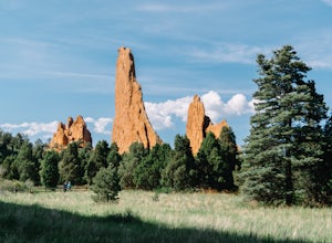
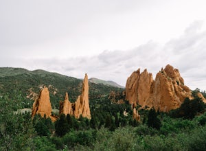
Garden of the Gods has dozens of hiking trails that cover miles through the park itself. The Perkins Central Garden Trail takes you through the heart of the rock formations and really gives you perspective on the size of these red rocks.
This trail also takes you past several areas where rock climbing is allowed (with the required permits), which gives you either something fun to watch or a wa...
Hike to Brook Pond
Divide, Colorado
4.0
4.74 mi
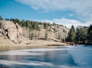
This hike begins at the east side of the Visitor's Center parking lot. The Visitor's Center keeps a record of any recent wildlife sightings, so its a good idea to check in the building if your goal is to see some animals. Otherwise, head to the end of the parking lot and take trail #5 down the hill.
There are a few splits along the trail, but just follow the signs for trail #5 and you'll get th...
Hike the Rim Rock / Creek Bottom Trail Loop
Franktown, Colorado
5.0
4.54 mi
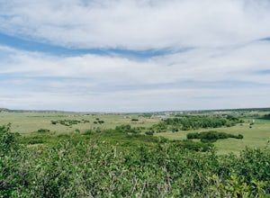
The West Side of Castlewood Canyon is the more "rugged" side of the park, it has a dirt road, gravel parking lots, and only vault toilets. Luckily, this also means this is a less popular side of the park, making for less crowded trails and easier parking!
Park at the first trailhead, for the Homestead Trail. You follow the Homestead Trail (J) until you meet up with the Rim Rock Trail (M) and C...
Camp at Mt. Elbert Forebay Reservoir
Buena Vista, Colorado
5.0
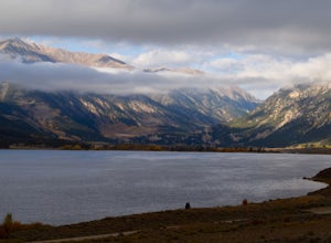
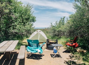
At the base of Mt. Elbert there are three campgrounds. One is a National Forest campground - you have to pay for a spot and it is closed from October-May. The other two are first-come, first-serve free campground areas. As you drive past the south trailhead, right before the reservoir, there is a very large space with multiple campsites.We were here the first weekend in October and there were o...
Hike to Mitchell Lake
Ward, Colorado
4.0
4 mi
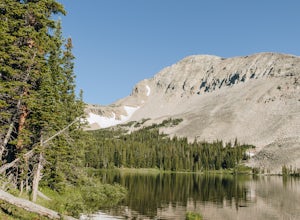
Located in the Brainard Lake Recreation Area, Mitchell Lake is a good quick hike for an afternoon getaway. With just two miles to go till you reach the lake itself, it's easy for the whole family and the pups (the recreation area is super popular, so this is assuming the lots are full and you have to park in the day use area).
From the parking lot, follow the signs that say "lake access." This...
Camp at Black Canyon of the Gunnison's South Rim Campground
Montrose, Colorado
5.0
The South Rim Campground is located about 6 miles inside Black Canyon of the Gunnison National Park. There are a total of 88 sites, 34 of which are available year-round. Reservations are definitely recommended, but are not required - loop C is first-come, first-served. Loop B fills up first, as it has electrical hookups, but chances are you'll be able to find a site up to a week before you go.
...
Palmer Lake Reservoir Trail
Palmer Lake, Colorado
4.11 mi
/ 656 ft gain
This hike starts with a steep uphill, and if that doesn't take your breath away, the views of the lakes definitely will. After the uphill slog, you'll immediately reach the lower reservoir. On still mornings, it offers perfect reflections of its surroundings. The trail continues along its northern shore and gently works its way to Palmer Lake.
You'll go through a meadow that, in the summer, ...
Hike the Creek Bottom Trail
Franktown, Colorado
5.0
4.1 mi
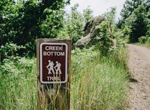
The West Side of Castlewood Canyon is the more "rugged" side of the park, it has a dirt road, gravel parking lots, and only vault toilets. Luckily, this also means this is a less popular side of the park, making for less crowded trails and easier parking!
Park at the first trailhead, for the Homestead Trail. You'll follow the Homestead Trail (J) until you meet up with the Creek Bottom Trail (G...
Walk the Willow Creek Loop
Littleton, Colorado
1.4 mi
Roxborough State Park is located on the outskirts of Littleton, Colorado. Boasting incredible red rock formations and abundant wildlife, it is the perfect place for a quick escape outside.The Willow Creek Loop connects to the two parking lots in the park, so it is impossible to miss. With only the slightest uphills and mostly flat, even terrain, its a great hike to take your older or younger fa...
Hike La Senda de Medio Trail
La Senda de Medio Trailhead, New Mexico
5 mi
If you find yourself in Taos for the weekend, the La Senda del Medio trail is a perfect hike to add to your adventure. About 20 minutes south of town and located in Rio Grande del Norte National Monument, this trail follows the Rio Grande for 2.5 miles and connects 5 different campgrounds.
The trail begins at Pilar Campground. Your GPS might not take you directly there, but the sign is large an...
Dispersed Camp at the Buffalo Creek Area in Pike National Forest
Pine, Colorado
3.8
50 miles from Denver, nestled in Pike National Forest, there are dozens of free dispersed camping sites. With quick access to the Colorado Trail and Buffalo Creek Mountain Bike Area, these campsites make for a perfect weekend getaway. The campsites begin on Forest Road 550, and are clearly marked with signs (be sure to follow these diligently, as a hefty ticket will be the result of parking/cam...
Hike to Rock Pond
Divide, Colorado
4.0
4.76 mi
This hike begins at the east side of the Visitor's Center parking lot. The Visitor's Center keeps a record of any recent wildlife sightings, so its a good idea to check in the building if your goal is to see some animals. Otherwise, head to the end of the parking lot and take trail #5 down the hill.
There's a few splits along the way, but as long as you stay on trail #5, you'll get there in no ...
Hike to Square Top Lakes
Georgetown, Colorado
4.3 mi
/ 1080 ft gain
Starting from Guanella Pass, right across from the Bierstadt trailhead, Square Top Lakes is definitely a hidden gem. Most people here are attempting to do the 14er, but if you've already bagged that one (or are just looking for some high altitude hiking to get you ready for it), Square Top Lakes is perfect.
The hike begins by immediately descending a few hundred feet into a small valley. From t...
Hike to Carpenter Peak
Littleton, Colorado
4.5
6.2 mi
/ 1171 ft gain
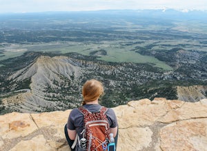
Carpenter Peak stands at 7,166 feet above sea level. While that altitude might not exactly take your breath away, the views from the top certainly will. Starting at the Visitor's Center, the trail to Carpenter's Peak begins as a relatively flat, well-traveled trail. A little less than a mile into the hike, you're given the choice to take a left and head on the South Rim Trail, or a right and co...
Explore the Far View Sites Complex
Mesa Verde National Park, Colorado
4.5
0.75 mi
The Far View Community is located four miles north of the Chapin Mesa Archeological Museum. In around 800 AD, the Ancestral Pueblo people lived in this area for several centuries. They mostly farmed the mesa tops, but were also hunters. It was one of the most densely populated regions of Mesa Verde, and it is estimated that there were at least 35 occupied villages within a half-square-mile area...
Hike the Chautauqua Trail to the Ski Jump Trail
Boulder, Colorado
5.0
1.55 mi
Beginning at the Chautauqua Trailhead, the Chautauqua Trail goes for 0.6 miles before connecting with the Bluebell-Baird Trail. From here it becomes a choose-your-own-adventure hike. For a short, simple hike you can do with people who aren't ready for lots of elevation gain, take a right and connect with the Ski Jump Trail that connects back to the beginning of the Chautauqua Trail. It is possi...
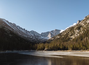
Hike to Jewel Lake
Larimer County, Colorado
4.0
6.12 mi
/ 727 ft gain
This trail starts at the Glacier Gorge Trailhead. This trailhead fills quickly at any time of year, so it's best to get there early to guarantee a parking spot. You can also park at Bear Lake where there's more spaces and add just under 2 miles to your round trip length.
A mile into the hike, you'll come across Alberta Falls, a 30 foot waterfall named after the wife of the first person to eve...
Hike Beaver Trail in Golden Gate Canyon State Park
Golden, Colorado
2.3 mi
/ 1046 ft gain
This trail starts off at Slough Pond, a great fishing pond or picnic spot. The trail starts out tree-covered. After a few tenths of a mile you have the choice to go clockwise or counter-clockwise. If you go counter-clockwise you have about 3/4 of a mile of steep uphill hiking to do (the Park rates this trail as "most difficult"), but then it's all downhill from there. If you go clockwise, you'l...
Hike Point Lookout Trail
Mancos, Colorado
5.0
2.3 mi
/ 400 ft gain
This trail is located within Morefield Campground in Mesa Verde National Park. The parking lot also serves as the parking lot for the amphitheater, so it's pretty huge - unless there's a program going on you shouldn't have to worry about finding a spot.
The trail starts out nice and level, facing north. It meanders through a field before taking a sharp right turn and beginning the slow series ...
Camp at Morefield Campground
Mancos, Colorado
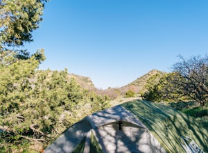
Morefield Campground is located 4 miles inside of Mesa Verde National Park. There are 267 sites in the campground, and it has tent-only loops. There are also 15 full-hookup RV sites, with many more able to fit RVs. Reservations are recommended, but are not required; the full-hookup sites are the first to fill, but you should have pretty good luck getting a tent site without a reservation.
There...
Hike the Rim Rock Trail
Franktown, Colorado
4.98 mi
The West Side of Castlewood Canyon is the more "rugged" side of the park, it has a dirt road, gravel parking lots, and only vault toilets. Luckily, this also means this is a less popular side of the park, making for less crowded trails and easier parking!
Park at the first trailhead, for the Homestead Trail. You follow the Homestead Trail (J) until you meet up with the Rim Rock Trail (M). You'...
Hike the Upper Loop Trail
Colorado Springs, Colorado
5.0
0.75 mi
/ 72 ft gain
This short spur trail is right off Perkins Central Garden Trail. Most people walk by it because the walkway changes from paved to dirt, but it is definitely a must-see if you're exploring the park.
It climbs just a short amount before reaching the rocks you can climb on. Make sure you take a moment here and look west to admire Pikes Peak off in the distance. The rocks on this loop are available...
Hike the Mountain Lion Trail
Golden, Colorado
6.7 mi
/ 1230 ft gain
There are three parking lots with direct access to the Mountain Lion Trail. The main one is off of Crawford Gulch Road, but any of them are good starting points!
This loop has pretty similar elevation gain and loss profiles no matter which way you go, so you can go any direction. This adventure will be written for starting out east, though.
Immediately out of the trailhead you'll be greeted w...
Inner Canyon Trail
Franktown, Colorado
5.0
2.17 mi
/ 213 ft gain
The Inner Canyon Trail begins at the Canyon Point Parking Lot. There are a few trails that leave from this lot, so make sure you're following signs for "K."
Right away, you'll descend down a few dozen stairs into the canyon itself. You'll quickly cross a bridge and be on your way. This trail is a lot of fun, with lots of rocks to climb over and stunning views of the canyon in both directions....
Community
© 2023 The Outbound Collective - Terms of Use - Privacy Policy

