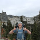
Two Mouth Lakes
Bonners Ferry, Idaho
Details
Distance
9.22 miles
Elevation Gain
2037 ft
Route Type
Out-and-Back
Description
Added by Colin Ayers
Explore two beautiful, isolated lakes in Two Mouth Lakes in the Selkirk Mountains. Get fantastic views of the Selkirk Crest, Chimney Rock, and Harrison Peak.
Start at Two Mouth Trail #268 as it goes north along an old logging road. The trail then heads west following Peak Creek before bending back to the south. The trail narrows, alternating between dirt and boardwalk, while meandering west toward a viewpoint of the giant granite slabs of the Selkirk Crest. You will reach the top of this crest at around mile 3.6, where you can check out amazing views of the glacier-carved peaks to the north, and Bonners Ferry Valley to the east.
Head east, down into the marshlands, before turning right toward Lower Two Mouth Lake. There are many campsites along the lake's pristine eastern shore where you can camp for the night. You can also follow Two Mouth Creek south to Upper Two Mouth Lake, which is wider and deeper, but has fewer camping spots. This is a great place to camp for the night and check out the surrounding areas. A nice, easy day hike to the top of Harrison Peak gives a great overlook of the lakes, along with fantastic views of Chimney Rock in the distance.
Getting there: From Bonners Ferry, head west on Riverside Street toward the Kootenai National Wildlife Refuge, then head right on the West Side Road. Go about 1.5 miles past the refuge headquarters and turn left onto Myrtle Creek Road. Drive 10 miles and turn right onto Road 658 to the trailhead for Trail #268.
Another route from Bonners Ferry: Follow County Rd. 18 west for 5.6 miles. Turn left onto Forest Road 663, and parking and the trailhead will be on the left in 12.3 miles.
Download the Outbound mobile app
Find adventures and camping on the go, share photos, use GPX tracks, and download maps for offline use.
Get the appFeatures
Reviews
I did this hike in early October and it was absolutely stunning and we even got a blanket of snow overnight which made for a beautiful hike out in the morning. The main problem I faced was the directions to find the trailhead which lies after mile marker 12 on the dirt road, not closer to mile 10. For anyone going in the future, both the parking area and the trailhead off of the logging road are not very visible. So make sure to park at the closed logging road about 12.3 miles up the dirt road and hike up that logging road until the trailhead is visible on the left side about 1 mile into the road. Other than that, you are good to go enjoy an amazing hike!
4.0
This is one of my favorite overnight hikes in northern Idaho. From two mouth lakes you can also bush wake your way up to two unnamed lakes at the northern base of Harrison peak.
5.0
Leave No Trace
Always practice Leave No Trace ethics on your adventures and follow local regulations. Please explore responsibly!
Nearby
Cooks Lake
Hike the Harrison to Beehive Lake Lower Traverse
Bottleneck Lake and Snow Lake
Harrison Lake Trail
Hike to Beehive Lakes
Pyramid and Ball Lakes Trail
Visit Idaho
Idaho is a picturesque state filled with beautiful scenery and warm, wonderful people. It's an ideal destination for family travelers, outdoor enthusiasts, adventure seekers, or those just looking for a relaxing getaway.
Learn MoreCommunity
© 2023 The Outbound Collective - Terms of Use - Privacy Policy


