The Best Backpacking in Arnold
Looking for the best backpacking in Arnold? We've got you covered with the top trails, trips, hiking, backpacking, camping and more around Arnold. The detailed guides, photos, and reviews are all submitted by the Outbound community.
Top backpacking spots in and near Arnold
-
Long Barn, California
Camp at Black Oak Flat Campground
/ 5778 ft gainThe campground operates on a first come, first serve basis and is typically open from May - September. Each campsite is equipped with a picnic table and a fire ring. The campground provides potable water and bathrooms. The fee is $10/night for a single family site, or $25/night for a group site. ...Read more -
Pinecrest, California
Pinecrest Peak Trail
14.68 mi / 3169 ft gainPinecrest Peak Trail is a loop trail that takes you by a lake located near Pinecrest, California.Read more -
Arnold, California
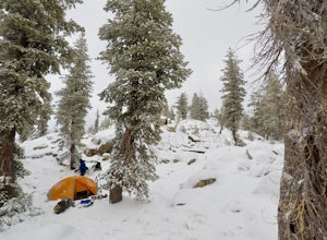
Snow Camp at Bull Run Lake
15 mi / 2400 ft gainThis is a long, beautiful snowshoe to a lake that is very accessible in the summer but almost untouched in the winter! There are a couple of ways to access the lake during the winter, but this is the most interesting: Starting at the easternmost sno-park along Highway 4 going east of Bear Valley,...Read more -
Bear Valley, California
Lake Alpine and Duck Lake Loop
9.28 mi / 1220 ft gainLake Alpine and Duck Lake Loop is a 14.8 kilometer moderately trafficked loop trail located near Arnold, California.Read more -
Pinecrest, California
Grouse Lake and Mud Lake
17.08 mi / 2162 ft gainGrouse Lake and Mud Lake is a loop trail that takes you by a waterfall located near Pinecrest, California.Read more -
Pinecrest, California
Crabtree Trail to Bear Lake
8.35 mi / 653 ft gainCrabtree Trail to Bear Lake is an out-and-back trail that takes you through a nice forest located near Mi Wuk Village, California.Read more -
Pinecrest, California
Backpack to Bear Lake (Emigrant Wilderness)
4.58.34 mi / 705 ft gainStart by picking up your wilderness permit at the Summit Ranger Station near Pinecrest - (209) 965-3434. There's no quota for this area, so no need for reservations in advance. To reach the trailhead, make your way south from the Ranger Station and turn left onto Crabtree Rd. Drive along this ro...Read more -
Arnold, California
Backpacking to Sword Lake
5.0Getting There Take 108 to Pinecrest Lake to pick up a free backcountry permit at the Summit Ranger Station. (If you reach Strawberry you've gone too far.) Continue past Beardsley Lake to Clark's Fork Road on the left. Cross two bridges and Forest Route 6N06 will take you to the trailhead (County ...Read more -
Pinecrest, California
Lower Emigrant Wilderness Shorter Loop
21.38 mi / 3274 ft gainLower Emigrant Wilderness Shorter Loop is a loop trail that takes you by a lake located near Pinecrest, California.Read more -
Pinecrest, California
Backpack to Chain Lakes
4.4 mi / 864 ft gainThis trip begins at ~7500 feet at the Box Springs Trailhead This trail is at the end of Forest Route 3N20Y. The trail, which is not regularly maintained and may at times be hard to follow, initially descends slightly to 7300', then stays mostly flat before rising just before the lakes. You will p...Read more -
Tuolumne County, California
Backpack Chewing Gum Lake
3.34.5 mi / 1000 ft gainChewing Gum Lakes is located in Emigrant Wilderness, South of Lake Tahoe and North of Yosemite, with stunning valley views and gorgeous granite faces, peaking through the tree lines of the Stanislaus National Forest. Sitting just north of Yosemite allows you to take in a portion of the beauty of ...Read more -
Arnold, California
Wheeler Lake
6.63 mi / 1775 ft gainWheeler Lake is an out-and-back trail where you may see beautiful wildflowers located near Markleeville, California.Read more -
Arnold, California
Backpack To Wheeler Lake
5.07.8 mi / 1000 ft gainThe trail to Wheeler Lake begins at the Woodchuck Basin Trailhead. This trailhead is located a little over a mile east of Lake Alpine on Highway 4. The trail starts off relatively flat and winds through forests and meadows, taking you into the Mokelumne Wilderness. Time it right and you'll be met...Read more -
Arnold, California
Bull Run Lake Trail
7.66 mi / 1565 ft gainBull Run Lake Trail is an out-and-back trail that takes you by a lake located near Markleeville, California.Read more -
Arnold, California
Hike To Bull Run Lake
4.3The hike to Bull Run Lake is about 7.8 miles, roundtrip, and begins at the Stanislaus Meadows Trailhead, located about 10 miles West of Ebbetts Pass. There is plenty of parking near the trailhead, off of the South side of CA 4. The trailhead GPS coordinates are: N38 30.376' / W119 56/617'Once you...Read more -
Pioneer, California
Camping at The Pots
4.2This fantastic camping or chilling spot has beautiful granite pools and slides of all sizes. The area consists of a river flowing over a granite slab creating pools some of which are over ten feet deep. The water cascades down the granite in small water falls. The area is located next to Silver L...Read more


