The Best Backpacking in Lone Pine
Looking for the best backpacking in Lone Pine? We've got you covered with the top trails, trips, hiking, backpacking, camping and more around Lone Pine. The detailed guides, photos, and reviews are all submitted by the Outbound community.
Top backpacking spots in and near Lone Pine
-
Inyo County, California
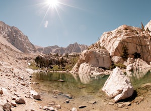
Green & Camp Lakes via Meysan Lakes
5.08.16 mi / 3248 ft gainGreen Lake via Meysan Lakes Trail is hiked from mid-June to end of September most seasons. Once the snow starts to fall, the road to the trailhead will be closed. A permit is require for overnight. You can obtain the permits online or at the ranger station in Lone Pine. Book online if you plan on...Read more -
Inyo County, California
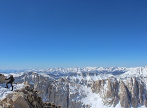
Summit Mount Whitney via the Mountaineers Route
5.05 mi / 6600 ft gainWith over 6,600 feet of elevation gain and class 4 climbing, this is not for the casual hiker, but can provide an excellent challenge to a budding mountaineer.Park your car at Whitney Portal, 12 miles west of the town of Lone Pine, and start up the main Whitney Trail. After 1 mile you will encou...Read more -
Inyo County, California
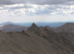
Scramble up Mt. Muir
5.018.5 mi / 6200 ft gainFrom the Whitney Trail - beyond trail crest - you will see a big cairn (right side). If you make it to the first "window of Mt. Whitney" you have gone too far. The cairn marks the start of an class 2 use trail up to the Mt. Muir headwall.The headwall is a fun climb with good handholds and has lit...Read more -
Inyo County, California
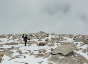
Winter Summit Mt. Whitney
22 mi / 6500 ft gainDay 1: We arrived at the Lone Pine Visitors Center at the intersection of HWY 395 and HWY 136 just south of Lone Pine, CA. We issued ourselves our overnight permits to climb Mt. Whitney and picked up our Wag Bags. You can self issue yourself the free permit Nov. 2 through Apr 30. Climbing during ...Read more -
Inyo County, California
PCT: CA Section H - Crabtree Meadow to Tuolumne Meadow
197.53 mi / 38822 ft gainPCT: CA Section H - Crabtree Meadow to Tuolumne Meadow is a point-to-point trail where you may see wildflowers located near Lone Pine, California.Read more -
Inyo County, California
Backpack Mount Langley
5.021 mi / 4000 ft gainMt. Langley sits four hours north of Los Angeles and is one of the easier 14ers to bag in California. Mt. Whitney absorbs most of the foot traffic, so enjoy the relative quiet and seclusion.The trailhead starts at Horseshoe Meadows/Cottonwood Lakes Trailhead Campgrounds and meanders for 7.5 miles...Read more -
Lone Pine, California
Cottonwood Lake and Long Lake via Cottonwood Lakes and New Army Pass Trail
12.68 mi / 1450 ft gainCottonwood Lake and Long Lake via Cottonwood Lakes and New Army Pass Trail is a loop trail that takes you by a lake located near Lone Pine, California.Read more -
Lone Pine, California
Horseshoe Meadow to the Kern River
39.24 mi / 5141 ft gainHorseshoe Meadow to the Kern River Trail is an out-and-back trail that takes you by a lake located near Lone Pine, California.Read more -
Lone Pine, California
Cottonwood Pass / New Army Pass Loop
22.85 mi / 3655 ft gainCottonwood Pass / New Army Pass Loop is a loop trail that takes you by a lake located near Lone Pine, California.Read more -
Lone Pine, California
Horseshoe Meadow to Haiwee Creek
41.63 mi / 2638 ft gainHorseshoe Meadow to Haiwee Creek Trail is a point-to-point trail where you may see beautiful wildflowers located near Death Valley, California.Read more -
Lone Pine, California
Groundhog Meadow Loop
31.14 mi / 4308 ft gainGroundhog Meadow Loop is a loop trail that takes you by a river located near Death Valley, California.Read more -
Lone Pine, California
John Muir Trail: Horseshoe Meadow to Happy Isles
230.11 mi / 42156 ft gainJohn Muir Trail: Horseshoe Meadow to Happy Isles is a point-to-point trail that takes you by a lake located near Lone Pine, California.Read more -
Lone Pine, California
Horseshoe Meadow Loop via Trail Pass Trail
3.83 mi / 387 ft gainHorseshoe Meadow Loop via Trail Pass Trail is a loop trail that takes you by a river located near Death Valley, California.Read more -
Lone Pine, California
Horseshoe Meadow Trailhead to Onion Valley Trailhead
48.87 mi / 9564 ft gainHorseshoe Meadow Trailhead to Onion Valley Trailhead is a point-to-point trail that takes you by a lake located near Lone Pine, California.Read more -
Lone Pine, California
Horseshoe Meadows, Pacific Crest Trail, High Sierra Trail, Golden Trout Loop
65.32 mi / 8750 ft gainHorseshoe Meadows, Pacific Crest Trail, High Sierra Trail, Golden Trout Loop is a loop trail that takes you by a lake located near Lone Pine, California.Read more -
Lone Pine, California
Horseshoe Meadow Trail
67.36 mi / 12467 ft gainHorseshoe Meadow Trail is a loop trail that takes you by a lake located near Lone Pine, California.Read more

