The Best Backpacking in Groveland
Looking for the best backpacking in Groveland? We've got you covered with the top trails, trips, hiking, backpacking, camping and more around Groveland. The detailed guides, photos, and reviews are all submitted by the Outbound community.
Top backpacking spots in and near Groveland
-
Groveland, California
Camp at Hetch Hetchy Backpacker's Campground
This campsite is a gateway into the Yosemite wilderness. Great starting/ending point for backpacking trips or simply for camping. Self-register and pay when you arrive at the site. Picnic tables, bathrooms, food lockers, and fire pits are available.Read more -
Groveland, California
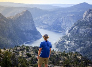
Hetch Hetchy Reservoir to Sierra Crest Backpacking Loop
87.79 mi / 17218 ft gainHetch Hetchy Reservoir to Sierra Crest Backpacking Loop Trail is a loop trail that takes you by a lake located near Yosemite Valley, California.Read more -
Groveland, California
Jack Main Canyon and Tilden Lake
42.58 mi / 7503 ft gainJack Main Canyon and Tilden Lake is a loop trail that takes you by a lake located near Groveland, California.Read more -
Groveland, California
Hetch Hetchy to Rancheria Falls
4.812.55 mi / 2500 ft gainSituated in the northwest portion of Yosemite National Park, Hetch Hetchy is is a not often visited treasure of the Central Sierra Nevada. In 1913, in an extremely controversial move, work on the O’Shaughnessy Dam was started to provide water to the growing population of San Francisco. Today, Het...Read more -
Tuolumne County, California
White Wolf to Piute Creek and the Grand Canyon of the Tuolumne River
22.67 mi / 4600 ft gainWhite Wolf to Piute Creek and the Grand Canyon of the Tuolumne River Trail is an out-and-back trail that takes you by a lake located near Wawona, California.Read more -
Tuolumne County, California
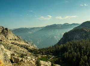
Backpack Grand Canyon of the Tuolumne
5.048.29 mi / 10610 ft gainThis is a rugged overnight backpack into the North country of Yosemite dropping in from Tuolumne Meadows into the Grand Canyon of the Tuolumne. The trail begins at an elevation just under 9,000' and drops to a low elevation of 4,500' almost 19 miles later at Pate Valley. Coming up out of Pate Val...Read more -
Wawona, California
Tamarack Flat to Yosemite Valley
16.79 mi / 3875 ft gainTamarack Flat to Yosemite Valley Trail is a point-to-point trail that takes you by a waterfall located near Yosemite Valley, California.Read more -
Wawona, California
Tamarack Flat to El Capitan
16.54 mi / 3793 ft gainTamarack Flat to El Capitan Trail is an out-and-back trail where you may see beautiful wildflowers located near Yosemite Valley, California.Read more -
Groveland, California
Enjoy Lost Claim Campground
/ 3073 ft gainLost Claim Campground is extremely popular with visitors to Yosemite National Park, sitting just 15 miles northwest of the park boundary. Visitors to Lost Claim Campground can enjoy all that Yosemite has to offer - along with the amazing wilderness of Stanislaus National Forest. The campground pr...Read more -
Wawona, California
Old Big Oak Flat to Yosemite Falls
17.18 mi / 4373 ft gainOld Big Oak Flat to Yosemite Falls is a point-to-point trail that takes you by a waterfall located near Yosemite Valley, California.Read more -
Mariposa County, California
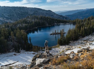
10 Lakes Basin in Yosemite
5.013.38 mi / 2200 ft gainBeginning at the Ten Lakes trailhead, the trail to the lakes is a moderately strenuous uphill grind to Ten Lakes pass, followed by a quick downhill into the lake basin. We met a woman at the top who made sure we didn’t miss the short side trail to a vista point on the pass that offered a sweeping...Read more -
Mariposa County, California
Grant Lake via Ten Lakes Trailhead
4.012.24 mi / 2000 ft gainThe trail begins at the Ten Lakes trailhead (7600 ft) right beside Yosemite Creek. The first 4 miles start you on the ascent through the wooded forest, however there are portions of the trail that will take you through granite rock valleys marked with only cairns so keep your eyes peeled througho...Read more -
Wawona, California
Ten Lakes Trailhead to Tenaya Lake
19.29 mi / 4439 ft gainTen Lakes Trailhead to Tenaya Lake is a point-to-point trail that takes you through a nice forest located near Yosemite Valley, California.Read more -
Mariposa County, California
Backpack Yosemite's South Rim
5.018 mi / 2800 ft gainStep 1: Get Wilderness Permit from the Wilderness Office the day before! Permits are free and required. This trail is a Point-to-Point trail so make sure you have a shuttle situation figured out (or you can always hitch hike). The best option is to get dropped off at Tunnel View so that you don'...Read more -
Mariposa County, California
Dewey Point via Tunnel View
5.09.25 mi / 2979 ft gainDewey Point lies on the western side of the Pohono Trail, across the valley from El Capitan and above Cathedral Rocks. When I was there in September, it was deserted but for a few birds drifting on the thermals above the cliffs. The sunset was stunning. It felt like there was nothing between me a...Read more -
YOSEMITE NATIONAL PARK, California
Hike to Eagle Peak via Rockslides Trail
4.016.07 mi / 5568 ft gainA Yosemite Valley trip in May has tourist filled buses, noisy car alarms, and crowded trails written all over it. Thus, I wanted to avoid the beaten path. Looking into possible destinations, John Muir once said in regards to Eagle Peak, "where the most comprehensive of all the views to be had on ...Read more


