The Best Backpacking in Mono County
Looking for the best backpacking in Mono County? We've got you covered with the top trails, trips, hiking, backpacking, camping and more around Mono County. The detailed guides, photos, and reviews are all submitted by the Outbound community.
Top backpacking spots in and near Mono County
-
Lee Vining, California
Bloody Canyon Trail to Agnew Meadows
25.84 mi / 6142 ft gainBloody Canyon Trail to Agnew Meadows is a point-to-point trail where you may see wildflowers located near Lee Vining, California.Read more -
Lee Vining, California
Hike to Upper Sardine Lake
Directions (from south of June Lake): 395 northTurn right onto the 158Keep right at fork onto Parker Lake Rd and go about 0.5 milesTurn right at first right and head all the way to the top until you hit a parking lot/camping ground/trail head From North of June Lake: 395 southTurn left at 158Keep...Read more -
June Lake, California
Donohue Pass via Rush Creek and John Muir Trail
26.4 mi / 5686 ft gainDonohue Pass via Rush Creek and John Muir Trail is a loop trail that takes you by a lake located near June Lake, California.Read more -
June Lake, California
Silver Lake to Tioga Pass Rd
20.33 mi / 5833 ft gainSilver Lake to Tioga Pass Rd is a point-to-point trail that takes you by a lake located near June Lake, California.Read more -
June Lake, California
Silver Lake to Thousand Island Lake Loop
17.75 mi / 4183 ft gainSilver Lake to Thousand Island Lake Loop is a loop trail that takes you by a lake located near June Lake, California.Read more -
Lee Vining, California
Camp at Junction Campground, Mono County
Junction campground is by far one of my favorite campsites when I am visiting the High Sierra and Tuolumne Meadows. The only downside is, you can only camp certain months; usually from June through October when highway 120 is open. The Junction campground is far away from the crowds of Yosemite ...Read more -
Tuolumne County, California
Backpack the Lyell Loop
31 mi / 5600 ft gainStart the hike at the Mono pass trail. You'll eventually take the fork towards Parker Pass a couple miles in. We tackled the trail in late spring, and it quickly became clear that there was still enough snow to make our lives difficult. As we climbed out of the Parker drainage, the trail essenti...Read more -
Tuolumne County, California
Backpack over Koip Peak Pass
19 mi / 2500 ft gainThis trip begins in Yosemite National Park and can be completed as an out-and-back or by hiking one-way to the Ansel Adams Wilderness and exiting at Silver Lake on the east side of the mountains. Start at the Mono/Parker Pass trailhead, a few miles past Tuolumne Meadows. Don't forget to make a pe...Read more -
Lee Vining, California
Twenty Lakes Basin and Saddlebag Lake Loop
7.8 mi / 804 ft gainTwenty Lakes Basin and Saddlebag Lake Loop is a loop trail that takes you by a lake located near Lee Vining, California.Read more -
Lee Vining, California
Twenty Lakes Basin Loop Trail
7.81 mi / 915 ft gainTwenty Lakes Basin Loop Trail is a loop trail that takes you by a lake located near Lee Vining, California.Read more -
Lee Vining, California
Conness and Cascade Lakes from Saddlebag Lake
6.09 mi / 1070 ft gainConness and Cascade Lakes from Saddlebag Lake is an out-and-back trail where you may see local wildlife located near Lee Vining, California.Read more -
Madera County, California
John Muir Trail: Camping at Thousand Island Lake
5.0This is one of the most recogizable lakes on the John Muir Trail and is known for being one of Ansel Adams' favorite places to photograph. Banner and Ritter Peaks tower over the tree covered islands and make for incredible scenery. This is a good spot to spend the day eating lunch and swimming ou...Read more -
Crowley Lake, California
Shadow Creek Trail to John Muir Trail
8.24 mi / 1283 ft gainShadow Creek Trail to John Muir Trail is an out-and-back trail that takes you by a lake located near June Lake, California.Read more -
Crowley Lake, California
Ediza Lake Loop Trail
21.05 mi / 3698 ft gainEdiza Lake Loop Trail is a loop trail that takes you by a lake located near Mammoth Lakes, California.Read more -
Madera County, California
4-Day Backpack Trip to Thousand Island Lake
5.0Start from Agnew Meadows about 7 miles away. You can take the High Trail out as part of the River Trail with a long detour passing by several other scenic lakes, including Shadow Lake, Garnet Lake, and Ruby Lake. You will arrive at Thousand Island Lake a few hours after lunch, just in time to set...Read more -
Madera County, California
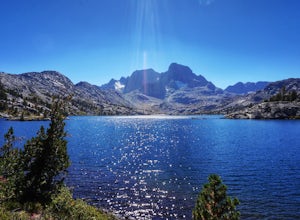
Ansel Adams' Garnet Lake
5.014.46 mi / 2717 ft gainGarnet Lake is one of the premier stops along the Pacific Crest Trail. However, even if you don't have time for an entire thru-hike (like most of us), this beautiful lake is still easily accessible as an overnight trip! While there are many possible routes for reaching Garnet Lake, the Agnew Me...Read more


