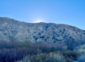
The Best Backpacking in Palm Springs
Looking for the best backpacking in Palm Springs? We've got you covered with the top trails, trips, hiking, backpacking, camping and more around Palm Springs. The detailed guides, photos, and reviews are all submitted by the Outbound community.
Top backpacking spots in and near Palm Springs
-
Palm Springs, California
Palm Canyon Trail
4.51.94 mi / 308 ft gainThe fifteen mile long Palm Canyon, one of the Indian Canyons, is among the most beautiful natural sites in Western North America. Its indigenous flora and fauna, expertly used by the Cahuilla people, and its abundant Washingtonia Filifera (California Fan Palm) stand in breathtaking contrast to th...Read more -
Palm Springs, California
San Jacinto through Humber Park
12.27 mi / 2500 ft gainSan Jacinto through Humber Park is a point-to-point trail that takes you past scenic surroundings located near Palm Springs, California.Read more -
Mountain Center, California
Humber Park to Ranger Station Loop
15.93 mi / 4154 ft gainHumber Park to Ranger Station Loop is a loop trail where you may see local wildlife located near Palm Springs, California.Read more -
Mountain Center, California
Devil's Slide Trail, Willow Creek Trail, and San Jacinto Peak Loop
19.61 mi / 5308 ft gainDevil's Slide Trail, Willow Creek Trail, and San Jacinto Peak Loop is a loop trail that provides a good opportunity to see wildlife located near Palm Springs, California.Read more -
Mountain Center, California
Mount San Jacinto Round Valley Loop via Devils Slide Trail
14.13 mi / 3684 ft gainMount San Jacinto Round Valley Loop via Devils Slide Trail is a loop trail where you may see beautiful wildflowers located near Idyllwild-Pine Cove, California.Read more -
Mountain Center, California
Tahquitz Peak via Devils Slide Trail
5.08.31 mi / 2238 ft gainTahquitz Peak via Devils Slide Trail is a moderately trafficked 8+ mile out and back trail located near Idyllwild, California. This trail is one of the most popular hikes in the San Jacinto area that features a fire lookout tower at the peak and amazing views of the valley below. At an elevation...Read more -
Mountain Center, California
San Jacinto Loop
17.74 mi / 5361 ft gainSan Jacinto Loop is a loop trail where you may see beautiful wildflowers located near Idyllwild-Pine Cove, California.Read more -
Idyllwild-Pine Cove, California
Devils Slide Trail
6.12 mi / 2267 ft gainDevils Slide Trail is an out-and-back trail that provides a good opportunity to see wildlife located near Idyllwild-Pine Cove, California.Read more -
Idyllwild-Pine Cove, California
San Jacinto Peak Via South Ridge Trail
21.51 mi / 6375 ft gainSan Jacinto Peak Via South Ridge Trail is an out-and-back trail that takes you through a nice forest located near Idyllwild-Pine Cove, California.Read more -
Idyllwild-Pine Cove, California
San Jacinto Peak via Deer Springs Trail
16.85 mi / 5138 ft gainSan Jacinto Peak via Deer Springs Trail is an out-and-back trail that takes you through a nice forest located near Idyllwild-Pine Cove, California.Read more -
Whitewater, California
PCT: CA Section C - Highway 10 to Highway 15 (Cajon Pass)
127.89 mi / 22989 ft gainPCT: CA Section C - Highway 10 to Highway 15 (Cajon Pass) is a point-to-point trail where you may see wildflowers located near Whitewater, California.Read more -
9160 Whitewater Canyon Road, California
Whitewater Ranger Station to Cottonwood TH via PCT
7.79 mi / 1421 ft gainWhitewater Ranger Station to Cottonwood TH via PCT is a point-to-point trail where you may see beautiful wildflowers located near Whitewater, California.Read more -
9160 Whitewater Canyon Road, California
Pacific Crest Trail: Whitewater Preserve to Stone House
12.38 mi / 1588 ft gainPacific Crest Trail: Whitewater Preserve to Stone House is an out-and-back trail that takes you by a river located near Whitewater, California.Read more -
9160 Whitewater Canyon Road, California
San Gorgonio Overlook via Pacific Crest Trail (Whitewater)
10.19 mi / 1775 ft gainSan Gorgonio Overlook via Pacific Crest Trail (Whitewater) is an out-and-back trail that takes you by a lake located near Whitewater, California.Read more -
Morongo Valley, California
Big Morongo Canyon Trail
11.65 mi / 1401 ft gainBig Morongo Canyon Trail is a loop trail where you may see wildflowers located near Morongo Valley, California.Read more -
Mountain Center, California
Quail Mountain from Covington Crest Trailhead
37.35 mi / 2825 ft gainQuail Mountain from Covington Crest Trailhead is a loop trail where you may see wildflowers located near Joshua Tree, California.Read more

