The Best Backpacking in Big Bear
Looking for the best backpacking in Big Bear? We've got you covered with the top trails, trips, hiking, backpacking, camping and more around Big Bear. The detailed guides, photos, and reviews are all submitted by the Outbound community.
Top backpacking spots in and near Big Bear
-
Big Bear, California
Cougar Crest Trail
5.58 mi / 892 ft gainCougar Crest Trail is a loop trail where you may see wildflowers located near Big Bear City, California.Read more -
Big Bear, California
Delamar Mountain via Pacific Crest Trail
5.57 mi / 1161 ft gainDelamar Mountain via Pacific Crest Trail is an out-and-back trail where you may see wildflowers located near Fawnskin, California.Read more -
Big Bear, California
Holcomb Creek via the PCT
12.98 mi / 971 ft gainHolcomb Creek via the PCT is a point-to-point trail where you may see wildflowers located near Big Bear City, California.Read more -
Fawnskin, California
Butler Peak Trail
9.36 mi / 1526 ft gainButler Peak Trail is an out-and-back trail where you may see wildflowers located near Big Bear City, California.Read more -
Angelus Oaks, California
Dollar Lake Trail via South Fork Trail
11.57 mi / 3028 ft gainDollar Lake Trail via South Fork Trail is an out-and-back trail that takes you by a lake located near Angelus Oaks, California.Read more -
Angelus Oaks, California
South Fork to Dollar Lake Trail
11.3 mi / 449 ft gainSouth Fork to Dollar Lake Trail is an out-and-back trail that takes you by a lake located near Banning, California.Read more -
Angelus Oaks, California
San Gorgonio Mountain from Fish Creek
19.87 mi / 4203 ft gainSan Gorgonio Mountain from Fish Creek is an out-and-back trail that takes you by a lake located near Whitewater, California.Read more -
Forest Falls, California
Summit Mt. San Bernardino from Angelus Oaks
16 mi / 4775 ft gainThe trailhead is somewhat 'interesting' to get to given the dirt roads are in questionable shape and some of the roads in Angelus Oaks are not easily identifiable but I didn't have any problems finding it by closely following Google Maps. Trailhead parking requires an Adventure Pass parking pe...Read more -
Forest Falls, California
San Bernardino Peak via Momyer Creek Trail
16.3 mi / 5735 ft gainSan Bernardino Peak via Momyer Creek Trail is an out-and-back trail that takes you by a river located near Forest Falls, California.Read more -
Forest Falls, California
Momyer to San Gorgonio
25.19 mi / 7539 ft gainMomyer to San Gorgonio is an out-and-back trail where you may see beautiful wildflowers located near Pismo Beach, California.Read more -
Forest Falls, California
Momyer Creek and Falls Creek Loop
19.88 mi / 6476 ft gainMomyer Creek and Falls Creek Loop is a loop trail that takes you by a waterfall located near Forest Falls, California.Read more -
Forest Falls, California
Vivian Creek Trail to San Gorgonio Peak
17.83 mi / 5627 ft gainVivian Creek Trail to San Gorgonio Peak is an out-and-back trail that takes you by a waterfall located near Forest Falls, California.Read more -
Forest Falls, California
San Bernardino Divide with 9 Summits
25.56 mi / 7333 ft gainSan Bernardino Divide with 9 Summits is a point-to-point trail where you may see local wildlife located near Forest Falls, California.Read more -
Forest Falls, California
North Fork Meadows Trail
27.7 mi / 8566 ft gainNorth Fork Meadows Trail is an out-and-back trail that takes you by a river located near Forest Falls, California.Read more -
Forest Falls, California
Loch Leven to Angelus Oaks
9.78 mi / 2054 ft gainLoch Leven to Angelus Oaks is an out-and-back trail that is moderately difficult located near Yucaipa, California.Read more -
San Bernardino County, California
Deep Creek Hot Springs via Bradford Ridge
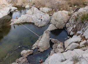
4.04.75 mi / 1335 ft gainLocated in the San Bernardino National Forest and part of the Pacific Crest Trail, the Deep Creek Hot Springs are a relaxing site for those of us without access to a Jacuzzi. There are at least 4 pools of hot (not just warm) water that you can soak in with your fellow neighbor (who may or may not...Read more


