The Best Backpacking in Pacifica
Looking for the best backpacking in Pacifica? We've got you covered with the top trails, trips, hiking, backpacking, camping and more around Pacifica. The detailed guides, photos, and reviews are all submitted by the Outbound community.
Top backpacking spots in and near Pacifica
-
Tiburon, California
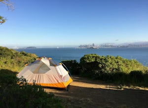
Camp on Angel Island
5.0Thousands of years ago, this island was a fishing and hunting ground for the Miwok Native Americans. It has also been an outpost for the U.S. Army and a cattle ranch. Now, it’s one of the closest places to escape from the hustle of San Francisco and set up camp. Camping on the island requires ba...Read more -
Sausalito, California
Dipsea Trail to Steep Ravine Trail Loop via Coastal Trail
10.12 mi / 2021 ft gainDipsea Trail to Steep Ravine Trail Loop via Coastal Trail is a loop trail that takes you past scenic surroundings located near Sausalito, California.Read more -
Stinson Beach, California
Dipsea to Ben Johnson Trail Loop
10.13 mi / 2680 ft gainDipsea to Ben Johnson Trail Loop is a loop trail that takes you by a waterfall located near Stinson Beach, California.Read more -
Castro Valley, California
Aaron Alcorn Castro Valley to Brentwood Memorial Trail
58.54 mi / 6755 ft gainAaron Alcorn Castro Valley to Brentwood Memorial Trail is a point-to-point trail that takes you past scenic surroundings located near Castro Valley, California.Read more -
Kentfield, California
Lake Lagunitas, Bon Tempe and Alpine Lakes, Cataract Falls to Mount Tam Loop
14.78 mi / 3645 ft gainLake Lagunitas, Bon Tempe and Alpine Lakes, Cataract Falls to Mount Tam Loop is a loop trail that takes you by a river located near Greenbrae, California.Read more -
La Honda, California
Sam McDonald Park Loop
5.012.19 mi / 2192 ft gainThe Pescadero Creek Park Complex is a great place to escape for a day or overnight hike in the heart of the Bay Area. You will need to get a permit to stay overnight - these can be attained on a first-come, first-serve basis from the ranger station. Most of the campsites here are also available f...Read more -
Bolinas, California
Coast Trail: Palomarin Beach to Limantour Beach
15.72 mi / 2671 ft gainCoast Trail: Palomarin Beach to Limantour Beach is a point-to-point trail that takes you by a lake located near Bolinas, California.Read more -
Bolinas, California
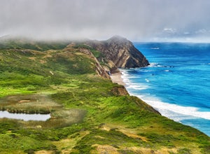
Point Reyes' Wildcat Camp via Coast Trail
5.011.19 mi / 1926 ft gainIn order to make this trip possible, go to recreation.gov and make a reservation for Wildcat Camp (available year-round). On your way to the trailhead, make sure to stop by the Bear Valley Visitor Center to grab your camping permit. For more information, visit: http://www.nps.gov/pore/planyourvis...Read more -
Bolinas, California
Glen Camp Loop via the Palomarin Trailhead
4.715.72 mi / 3091 ft gainDay 1 Before heading to the trailhead, make sure to stop by the Bear Valley Visitor Center to pick up your permit. To stay overnight in Point Reyes, you must stay at one of the trail camps. Camping anywhere else in the park is not allowed. Permits for the trail camps can be booked up to 6 mo...Read more -
Bolinas, California
Backpack to Coast Camp in Point Reyes via Palomarin Trailhead
20.5 mi / 2705 ft gainSpanning from just north of the small town of Bolinas (about an hour north of San Francisco) across Inverness ridge and to the top of Tomales Point, Point Reyes National Seashore is as stunning park featuring breathtaking ocean views and solitude among the grassy hillsides and forested ridges. Th...Read more -
Los Altos Hills, California
Rhus Ridge and Chamise Trail
10.1 mi / 1555 ft gainRhus Ridge and Chamise Trail is a point-to-point trail where you may see wildflowers located near Los Altos, CaliforniaRead more -
Lafayette, California
Briones Peak via Lafayette Ridge Trail
10.46 mi / 1598 ft gainBriones Peak via Lafayette Ridge Trail is an out-and-back trail where you may see wildflowers located near Lafayette, California.Read more -
Los Altos, California
Wildcat Canyon Loop
7.38 mi / 1138 ft gainWildcat Canyon Loop is a loop trail where you may see beautiful wildflowers located near Cupertino, California.Read more -
Cupertino, California
Black Mountain via PG&E, Quarry and Black Mountain Trail
11.72 mi / 3901 ft gainBlack Mountain via PG&E, Quarry and Black Mountain Trail is an out-and-back trail where you may see wildflowers located near Cupertino, California.Read more -
Cupertino, California
Black Mountain via Rogue Valley, Chamise, Black Mountain, Quarry and PG&E Loop
14.41 mi / 3615 ft gainBlack Mountain via Rogue Valley, Chamise, Black Mountain, Quarry and PG&E Loop is a loop trail where you may see wildflowers located near Cupertino, California.Read more -
Pescadero, California
Hike the Canyon Rim Route in Butano State Park
5.011.7 miLocated deep within the Santa Cruz Mountains, Butano State Park boasts a large redwood canyon with many miles of hiking trails as well as campsites. This state park is one of the quietest and least visited parks on the peninsula making a perfect place to escape the hustle of the Bay Area Butano S...Read more

