The Best Backpacking in McCloud
Looking for the best backpacking in McCloud? We've got you covered with the top trails, trips, hiking, backpacking, camping and more around McCloud. The detailed guides, photos, and reviews are all submitted by the Outbound community.
Top backpacking spots in and near McCloud
-
McCloud, California
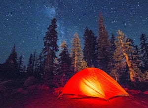
Camp at Panther Meadows
5.0The Panther Meadows Campground is located in the timberline on Mt. Shasta. The free campsite has 10 sites with a fire ring and a table. The elevation of the campground is 7,500 ft, making it the highest campground on Mt. Shasta. Summer nights can get pretty cold, so make sure to bring proper atti...Read more -
McCloud, California
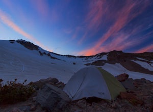
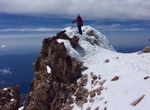
Mt. Shasta via Clear Creek Route
11.43 mi / 7615 ft gainThe least technical route to the summit of Mt Shasta begins at the Clear Creek Trailhead (elevation 6390 ft). Please note that although this is a less technical route, this is still dangerous and there have been deaths on Mt. Shasta because of falling rock. To start this, you should be a good hik...Read more -
McCloud, California
Mount Shasta via Avalanche Gulch Route
10.73 mi / 7178 ft gainMount Shasta via Avalanche Gulch Route is an out-and-back trail where you may see beautiful wildflowers located near Mount Shasta, California.Read more -
Mount Shasta, California
Sisson Southern Trail: Sand Flat Trailhead to Gateway Trailhead
5.25 mi / 138 ft gainSisson Southern Trail: Sand Flat Trailhead to Gateway Trailhead is a point-to-point trail where you may see beautiful wildflowers located near Mount Shasta, California.Read more -
Shasta County, California
PCT: CA Section P - Highway 5 to Etna Summit
97 mi / 16519 ft gainPCT: CA Section P - Highway 5 to Etna Summit is a point-to-point trail that takes you by a lake located near Castella, California.Read more -
Siskiyou County, California
Climb Mt. Shasta via the Hotlum-Bolam Ridge
10 mi / 7200 ft gainThe Hotlum-Bolam route follows the ridge between the Hotlum and Bolam Glaciers on Shasta's north side. It's an intermediate route that isn't much more technical than the south side routes, except for icy sections and possible late-season open crevasses. For this reason it's a popular alternative ...Read more -
Mount Shasta, California
Upper Sisson-Callahan Trail: North Fork Sacramento to Deadfall Crest
9.21 mi / 2707 ft gainUpper Sisson-Callahan Trail: North Fork Sacramento to Deadfall Crest is an out-and-back trail located near Mount Shasta, California.Read more -
Mount Shasta, California
North Fork Sacramento River and Toad Lake Loop
9.37 mi / 1972 ft gainNorth Fork Sacramento River and Toad Lake Loop is a loop trail that takes you by a lake located near Mount Shasta, California.Read more -
Pacific Crest Trail, California
Hike or Backpack the Dead Falls Lake Trail
5.08.1 mi / 1358 ft gainThe Dead Falls Lake Trail is perfect for families, dog, and all adventurers. In the spring and summer, there are gorgeous and abundant wildflowers. There is a perfect lunch spot at Deadfall Lake. Close to the gargantuan Shasta, Mount Eddy is the highest peak in the Klamath Mountain. Mount Eddy o...Read more -
Trinity County, California
East Boulder Lake Via Pacific Crest Trail
16.96 mi / 3238 ft gainEast Boulder Lake Via Pacific Crest Trail is an out-and-back trail that takes you by a lake located near Callahan, California.Read more -
Callahan, California
Masterson Meadow Lake via PCT
6.71 mi / 1053 ft gainMasterson Meadow Lake via PCT is an out-and-back trail that is good for all skill levels located near Trinity Center, California.Read more -
Burney, California
PCT: CA Section O - Burney Falls State Park to Highway 5 (Castle Crags)
80.39 mi / 15604 ft gainPCT: CA Section O - Burney Falls State Park to Highway 5 (Castle Crags) is a point-to-point trail that takes you by a lake located near Burney, California.Read more -
Callahan, California
Mill Creek and Washbasin Lakes Trail
6.28 mi / 2625 ft gainMill Creek and Washbasin Lakes Trail is an out-and-back trail that is moderately difficult located near Callahan, California.Read more -
Trinity Center, California
Hike to Boulder Lakes
3.9 mi / 859 ft gainThe upper lake (Little Boulder) is warm and perfect for swimming later in the summer. There are fairly large trout in this lake. The lower lake is bigger and has an abundance of campsites. If you want a bit more solitude, the trail continues further in two directions. Mosquitos can be a problem, ...Read more -
Callahan, California
Middle Boulder and Telephone Lakes Loop
7.15 mi / 2451 ft gainMiddle Boulder and Telephone Lakes Loop is a loop trail that takes you by a lake located near Callahan, California.Read more -
Callahan, California
Hike Fox Creek and Mavis Lakes
7.8 mi / 1637 ft gainThe Fox Creek and Mavis Lakes Trail is great for finding tranquility and solitude. Dogs and horses are allowed on this trail. If you want to spend the night, free wilderness permits are required. Campfire permits are required for fires and camp stoves.Read more


