The Best Backpacking in Estes Park
Looking for the best backpacking in Estes Park? We've got you covered with the top trails, trips, hiking, backpacking, camping and more around Estes Park. The detailed guides, photos, and reviews are all submitted by the Outbound community.
Top backpacking spots in and near Estes Park
-
Estes Park, Colorado
Hike Deer Mountain
6.03 mi / 1200 ft gainBeginning in Rocky Mountain National Park near the Deer Ridge Junction (where US 34 & US 36 meet), park your car in one of the 20 spots on either side of the road. Start at the trailhead booth and head north, keeping to the right-side trail at the first intersection about a tenth of a mile fr...Read more -
Estes Park, Colorado
Storm Pass and Longs Peak Trail
21.48 mi / 6906 ft gainStorm Pass and Longs Peak Trail is an out-and-back trail that takes you by a lake located near Estes Park, Colorado.Read more -
Estes Park, Colorado
Hike to Cub Lake
5.04.6 mi / 645 ft gainRocky Mountain National Park showcases 355 miles of hiking trails, 6 campgrounds, and hundreds of backcountry camp sites. The cost to enter the park is $20.00 per vehicle, I recommend buying the annual National Parks Pass for $80.00. Cub Lake is an excellent trail for viewing wildlife. There ar...Read more -
Estes Park, Colorado
Backpack to Odessa Lake via Fern Lake Trailhead
4.09.65 mi / 1890 ft gainOdessa Lake seems to be one of the true hidden gems of Rocky Mountain National Park. Don't get me wrong, you will likely see some folks there, but it is a far cry from the other crowded Bear Lake trailhead lakes. There are two ways to reach Odessa; one, from the Bear Lake Trailhead, and the oth...Read more -
1398 Longs Peak Road, Colorado
The Keyhole and Longs Peak via Longs Peak Trail
13.29 mi / 4646 ft gainThe Keyhole and Longs Peak via Longs Peak Trail is an out-and-back trail that takes you by a lake located near Allenspark, Colorado.Read more -
Drake, Colorado
North Fork Big Thompson River Trail
10.11 mi / 1804 ft gainNorth Fork Big Thompson River Trail Via Dunraven Trailhead is an out-and-back trail that takes you by a river located near Glen Haven, Colorado.Read more -
Drake, Colorado
Lost Lake via North Fork Trail
18.4 mi / 3314 ft gainLost Lake via North Fork Trail is an out-and-back trail that takes you by a lake located near Glen Haven, Colorado.Read more -
Estes Park, Colorado
Summit Storm Peak and Mount Lady Washington
4.512.58 mi / 4500 ft gainThis adventure began at the Longs Peak trailhead in southeastern Rocky Mountain National Park, Colorado. I followed the Longs Peak trail for 6 miles to the Boulderfield backcountry camping area. This is a fairly steep on-trail climb of 3,360 feet. After setting up camp at 12,760 feet, my partner...Read more -
Estes Park, Colorado
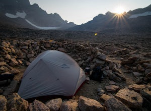
Camp at Boulder Field in Rocky Mountain National Park
12 mi / 3360 ft gainBoulder Field is a high alpine backcountry site on Longs Peak, and is a popular camp for backpackers attempting to summit Longs Peak via the Keyhole route. At an impressive elevation of 12,760 feet, Boulder Field is a vast wasteland of rocks that sits 500 feet below the famous Keyhole feature, an...Read more -
Larimer County, Colorado
Sky Pond via Glacier Gorge Trailhead
4.78.43 mi / 1780 ft gainStart at the Glacier Gorge trailhead on Bear Lake Road. Parking is limited so it is advised to get there very early. It's a longer hike so plan on taking a full day to complete or stay overnight to enjoy more of the scenery. Within the first mile on the Glacier Gorge Trail you will pass by Alber...Read more -
Larimer County, Colorado
North Long's Peak Trail to Boulder Brook
8.03 mi / 1713 ft gainNorth Long's Peak Trail to Boulder Brook is an out-and-back trail where you may see beautiful wildflowers located near Estes Park, Colorado.Read more -
Estes Park, Colorado
Green Lake via Glacier Gorge Trail
5.011.38 mi / 3400 ft gainBegin at the popular Glacier Gorge trailhead along Bear Lake Road in Rocky Mountain National Park. Arrive VERY early for parking as the lot typically fills by 7:30 am. For the best photography options - choose to either backpack into the Glacier Gorge campsite (reservations must be made early in ...Read more -
Larimer County, Colorado
Andrews Tarn and Andrews Glacier Trail
8.5 mi / 2244 ft gainAndrews Tarn and Andrews Glacier Trail is an out-and-back trail that takes you by a lake located near Estes Park, Colorado.Read more -
Larimer County, Colorado
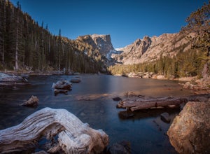
Nymph, Dream, Emerald, and Haiyaha Lakes
4.94.51 miFrom the Bear Lake Trailhead, the path to Nymph Lake is a moderate paved trail. At the lake there are several places to sit and take in the scenery. This is also where you'll find the most people. From here, continue up the trail towards Dream Lake. On the way, the trail forks. The left will take...Read more -
Larimer County, Colorado
Lake Nanita and Nokoni via Bear Lake Trailhead
25.64 mi / 8225 ft gainLake Nanita and Nokoni via Bear Lake Trailhead is an out-and-back trail that takes you by a waterfall located near Estes Park, Colorado.Read more -
Larimer County, Colorado
Rocky Mountain Lake Loop
12.14 mi / 2618 ft gainRocky Mountain Lake Loop is a loop trail that takes you by a lake located near Estes Park, Colorado.Read more

