The Best Backpacking in Crested Butte
Looking for the best backpacking in Crested Butte? We've got you covered with the top trails, trips, hiking, backpacking, camping and more around Crested Butte. The detailed guides, photos, and reviews are all submitted by the Outbound community.
Top backpacking spots in and near Crested Butte
-
Crested Butte, Colorado
Lupine, Gunsight Connection and Lower Loop Trail
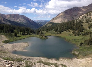
12.86 mi / 1453 ft gainLupine, Gunsight Connection and Lower Loop Trail is a loop trail that takes you by a lake located near Crested Butte, Colorado.Read more -
Crested Butte, Colorado
Conundrum Hot Springs via Copper Creek
22.5 mi / 4000 ft gainPlease Note: Conundrum Springs camping requires an overnight permit. You must get a permit in order to camp at the springs. If you're looking for an incredibly challenging hike, Copper Creek to Triangle Pass to Conundrum Springs is the hike for you! When you plug in "Conundrum Springs" into you...Read more -
Gunnison, Colorado
Swampy to Beckwith Pass to Lost Lake Slough
11.41 mi / 2096 ft gainSwampy to Beckwith Pass to Lost Lake Slough is a point-to-point trail that takes you by a lake located near Somerset, Colorado.Read more -
Crested Butte, Colorado
Washington Gulch Trail
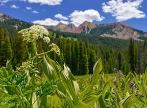
7.59 mi / 2146 ft gainWashington Gulch Trail is an out-and-back trail where you may see beautiful wildflowers located near Crested Butte, Colorado.Read more -
Crested Butte, Colorado
Hike Rustler's Gulch
5.09 mi / 1748 ft gainFrom Crested Butte, continue 6 miles past the town of Gothic to Rustler's Gulch Road. Turn right on the road, cross the East River to get to a small parking area near the river. If you don't have 4WD, park here and hike another 1/2 mile to the trailhead. It's a pretty steep hike. If you do have 4...Read more -
Somerset, Colorado
Beckwith Bench Trail
12.18 mi / 2605 ft gainBeckwith Bench Trail is an out-and-back trail that takes you by a river located near Somerset, Colorado.Read more -
Aspen, Colorado
Backpack to Copper Lake
10 miLooking for a wildflower hike, we decided on Copper Lake in the Maroon Bells Wilderness as a place to base camp for 4 nights. It is 5 miles from the Trailhead, which is off Gothic Road above Crested Butte (2WD Accessible).Copper Lake is this beautiful alpine lake, situated right at treeline, with...Read more -
Carbondale, Colorado
Crested Butte to Aspen via West Maroon Pass
10.23 mi / 2185 ft gainCrested Butte to Aspen via West Maroon Pass is a point-to-point trail that takes you by a lake located near Crested Butte, Colorado.Read more -
Carbondale, Colorado
West Maroon Bells Pass
7.86 mi / 2021 ft gainWest Maroon Bells Pass is an out-and-back trail that takes you by a river located near Crested Butte, Colorado.Read more -
Carbondale, Colorado
Hasley Basin Trail
11.77 mi / 3406 ft gainHasley Basin Trail is a loop trail that takes you by a river located near Crested Butte, Colorado.Read more -
Gunnison, Colorado
Mill Castle Trail to Lowline Trail Loop
22.92 mi / 5436 ft gainMill Castle Trail to Lowline Trail Loop is a loop trail where you may see beautiful wildflowers located near Almont, Colorado.Read more -
Gunnison, Colorado
Mill-Castle Trail
25.95 mi / 6657 ft gainMill-Castle Trail is an out-and-back trail where you may see beautiful wildflowers located near Gunnison, Colorado.Read more -
Gunnison County, Colorado
Bear Creek to Deadmans Gulch, Doubletop, Brush Creek, and Red Ridge Loop
57.31 mi / 9754 ft gainBear Creek to Deadmans Gulch, Doubletop, Brush Creek, and Red Ridge Loop is a loop trail where you may see beautiful wildflowers located near Almont, Colorado.Read more -
Aspen, Colorado
Pearl Pass
21.7 mi / 3392 ft gainPearl Pass is a point-to-point trail that takes you by a river located near Aspen, Colorado.Read more -
Carbondale, Colorado
Snowmass Lake via North Fork Crystal River
13.83 mi / 4163 ft gainSnowmass Lake via North Fork Crystal River is a loop trail that takes you by a lake located near Carbondale, Colorado.Read more -
Carbondale, Colorado
Backpack the Lead King Basin Trail
4.5 mi / 2000 ft gainWe began our hike at the beginning of the afternoon after about two-three hours driving up the 14 mile road. The first mile of the trail was mild, turning into an uphill adventure. Lots of switchbacks, winding paths, and some tree coverage. By mile 2, we were on a steep grade the rest of the way....Read more


