The Best Backpacking in Bellvue
Looking for the best backpacking in Bellvue? We've got you covered with the top trails, trips, hiking, backpacking, camping and more around Bellvue. The detailed guides, photos, and reviews are all submitted by the Outbound community.
Top backpacking spots in and near Bellvue
-
Fort Collins, Colorado
Westridge Trail Via Timber Trail
10.67 mi / 1965 ft gainWestridge Trail Via Timber Trail is an out-and-back trail that takes you past scenic surroundings located near Fort Collins, Colorado.Read more -
Bellvue, Colorado
Hike the Mt. McConnel Summit Trail
4.8 mi / 1334 ft gainThis 4.8 mile round trip hike gains 1300 feet of elevation before reaching the Mt.McConnel summit. The primitive trail is rated as difficult and has an ascent of many switchbacks, leading up to a wild flower covered summit. The trail winds along the ridge line around 8,000 feet, offering panorami...Read more -
Bellvue, Colorado
Climb Greyrock Mountain
5.07.1 mi / 3000 ft gainThe main trail begins at the Cache La Poudre river on the Poudre Canyon Highway about 30 minutes from Fort Collins. After about .75 miles the trail splits. To go left on Greyrock Meadows trail adds 2 miles to your trip and provides excellent views of Greyrock Mountain and Meadows from the south, ...Read more -
Drake, Colorado
Lost Lake via North Fork Trail
18.4 mi / 3314 ft gainLost Lake via North Fork Trail is an out-and-back trail that takes you by a lake located near Glen Haven, Colorado.Read more -
Drake, Colorado
North Fork Big Thompson River Trail
10.11 mi / 1804 ft gainNorth Fork Big Thompson River Trail Via Dunraven Trailhead is an out-and-back trail that takes you by a river located near Glen Haven, Colorado.Read more -
Red Feather Lakes, Colorado
Lady Moon and Molly Moon
6.48 mi / 656 ft gainLady Moon and Molly Moon is an out-and-back trail where you may see beautiful wildflowers located near Buena Vista, Colorado.Read more -
Red Feather Lakes, Colorado
Mount Margaret Trail
7.28 mi / 535 ft gainMount Margaret Trail is an out-and-back trail that takes you by a lake located near Red Feather Lakes, Colorado.Read more -
Bellvue, Colorado
Beaver Creek to Fish Creek Loop
22.09 mi / 3688 ft gainBeaver Creek to Fish Creek Loop is a loop trail that takes you by a lake located near Glen Haven, Colorado.Read more -
Bellvue, Colorado
Hourglass, Brackenbury Cabin and Beaver Creek Loop
18.93 mi / 3845 ft gainHourglass, Brackenbury Cabin and Beaver Creek Loop is an out-and-back trail where you may see beautiful wildflowers located near Villa Grove, Colorado.Read more -
Bellvue, Colorado
Hike to Comanche Lake in Pingree Park
3.58 mi / 700 ft gainYou start out hiking through the average Colorado forest for the first 4 miles of the 7-8 mile trip at about 6,500 feet. The trail is largely downhill for the first couple miles until it levels out and you are headed North. A little more than halfway, you come to Comanche Reservoir and hike up al...Read more -
Estes Park, Colorado
Hike Deer Mountain
6.03 mi / 1200 ft gainBeginning in Rocky Mountain National Park near the Deer Ridge Junction (where US 34 & US 36 meet), park your car in one of the 20 spots on either side of the road. Start at the trailhead booth and head north, keeping to the right-side trail at the first intersection about a tenth of a mile fr...Read more -
Lyons, Colorado
Coulson Gulch Trail
5.39 mi / 879 ft gainCoulson Gulch Trail is an out-and-back trail that takes you by a river located near Lyons, Colorado.Read more -
Lyons, Colorado
Camp at Coulson Gulch
4.09 miCoulson Gulch is a lightly used area of the Roosevelt National Forest which makes it perfect for a weekend getaway without the crowds. This is a great place to camp out under the stars!To get to Coulson Gulch From Lyons, head west on U.S. Highway 36 for about 9 miles. Turn southwest onto Larimer ...Read more -
Estes Park, Colorado
Storm Pass and Longs Peak Trail
21.48 mi / 6906 ft gainStorm Pass and Longs Peak Trail is an out-and-back trail that takes you by a lake located near Estes Park, Colorado.Read more -
Estes Park, Colorado
Hike to Cub Lake
5.04.6 mi / 645 ft gainRocky Mountain National Park showcases 355 miles of hiking trails, 6 campgrounds, and hundreds of backcountry camp sites. The cost to enter the park is $20.00 per vehicle, I recommend buying the annual National Parks Pass for $80.00. Cub Lake is an excellent trail for viewing wildlife. There ar...Read more -
Estes Park, Colorado
Backpack to Odessa Lake via Fern Lake Trailhead
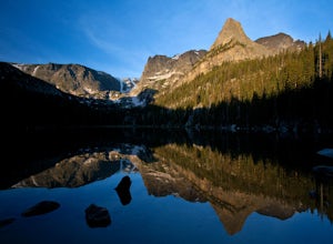
4.09.65 mi / 1890 ft gainOdessa Lake seems to be one of the true hidden gems of Rocky Mountain National Park. Don't get me wrong, you will likely see some folks there, but it is a far cry from the other crowded Bear Lake trailhead lakes. There are two ways to reach Odessa; one, from the Bear Lake Trailhead, and the oth...Read more


