The Best Backpacking in Cañon City
Looking for the best backpacking in Cañon City? We've got you covered with the top trails, trips, hiking, backpacking, camping and more around Cañon City. The detailed guides, photos, and reviews are all submitted by the Outbound community.
Top backpacking spots in and near Cañon City
-
Florence, Colorado
Newlin Creek Trail
5.85 mi / 2041 ft gainNewlin Creek Trail is an out-and-back trail that takes you by a waterfall located near Florence, Colorado.Read more -
Teller County, Colorado
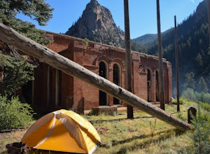
Backpack to the Abandoned Skagway Power Plant and Ghost Town
3.510 mi / 1000 ft gainConstruction of the Skagway Plant began in 1899 and was complete in 1901. In 1965, 15 days of rain brought floods washing out a lot of the pipeline and other infrastructure. Fixing the power plant didn’t make sense and funds weren’t in place. The land was reverted to the government. The hike b...Read more -
Divide, Colorado
Horsethief to the Crags Trail
9.08 mi / 2457 ft gainHorsethief to the Crags Trail is an out-and-back trail that takes you by a waterfall located near Cripple Creek, Colorado.Read more -
Colorado Springs, Colorado
Stratton Reservoir
13.87 mi / 5942 ft gainStratton Reservoir is an out-and-back trail that takes you past scenic surroundings located near Colorado Springs, Colorado.Read more -
Colorado Springs, Colorado
Mount Buckhorn Trail to Seven Bridges Trail Loop
6.68 mi / 1673 ft gainMount Buckhorn Trail to Seven Bridges Trail Loop is a loop trail where you may see beautiful wildflowers located near Colorado Springs, Colorado.Read more -
Colorado Springs, Colorado
Goldcamp, Buckhorn, Bear Creek, Section 16, Contemplative Trail
10.16 mi / 1886 ft gainGoldcamp, Buckhorn, Bear Creek, Section 16, Contemplative Trail is a point-to-point trail where you may see beautiful wildflowers located near Manitou Springs, Colorado.Read more -
Divide, Colorado
Pikes Peak from the Crags Trail
13.45 mi / 4304 ft gainPikes Peak from the Crags Trail is an out-and-back trail that takes you by a lake located near Divide, Colorado.Read more -
Westcliffe, Colorado
Backpack to Sand Creek Lakes
5.04 mi / 1700 ft gainStart at the Music Pass trail head south of Westcliffe, Colorado off County Road 119. You will need a 4x4 with high clearance to get to the actual trailhead as the last 2.5 miles are rough. Otherwise, park at the Crape Creek TH and walk the 2.5 miles up to Music Pass Trailhead.Once on the trail...Read more -
Westcliffe, Colorado
Rito Alto Four Pass Loop
23.37 mi / 6457 ft gainRito Alto Four Pass Loop is a loop trail that takes you by a lake located near Westcliffe, Colorado.Read more -
Manitou Springs, Colorado
Barr Trail to Barr Camp
12.38 mi / 3629 ft gainBarr Trail to Barr Camp is an out-and-back trail that provides a good opportunity to view wildlife located near Manitou Springs, Colorado.Read more -
Westcliffe, Colorado
Lower and Upper Macey Lakes Via Rainbow Trail
12.66 mi / 2910 ft gainLower and Upper Macey Lakes Via Rainbow Trail is an out-and-back trail that takes you by a lake located near Westcliffe, Colorado.Read more -
Cotopaxi, Colorado
Hayden Creek Rainbow Trail #1336
4.63 mi / 1362 ft gainHayden Creek Rainbow Trail #1336 is an out-and-back trail that takes you by a river located near Coaldale, Colorado.Read more -
Colorado Springs, Colorado
Red Rock, Lion and Section 16 Loop
11.33 mi / 2139 ft gainRed Rock, Lion and Section 16 Loop is a loop trail that takes you by a river located near Colorado Springs, Colorado.Read more -
Westcliffe, Colorado
Crestone Peak Trail
12.93 mi / 5436 ft gainCrestone Peak Trail is an out-and-back trail that takes you by a lake located near Crestone, Colorado.Read more -
Westcliffe, Colorado
South Colony Lakes Trail
5.08.92 mi / 2241 ft gainSouth Colony Lakes Trail is an out-and-back trail that takes you by a lake located near Crestone, Colorado.Read more -
Westcliffe, Colorado
Humboldt Peak Trail
10.83 mi / 4137 ft gainHumboldt Peak Trail is an out-and-back trail that provides a good opportunity to view wildlife located near Nederland, Colorado.Read more


