The Best Backpacking in Divide
Looking for the best backpacking in Divide? We've got you covered with the top trails, trips, hiking, backpacking, camping and more around Divide. The detailed guides, photos, and reviews are all submitted by the Outbound community.
Top backpacking spots in and near Divide
-
Divide, Colorado
Pikes Peak from the Crags Trail
13.45 mi / 4304 ft gainPikes Peak from the Crags Trail is an out-and-back trail that takes you by a lake located near Divide, Colorado.Read more -
Divide, Colorado
Horsethief to the Crags Trail
9.08 mi / 2457 ft gainHorsethief to the Crags Trail is an out-and-back trail that takes you by a waterfall located near Cripple Creek, Colorado.Read more -
Manitou Springs, Colorado
Barr Trail to Barr Camp
12.38 mi / 3629 ft gainBarr Trail to Barr Camp is an out-and-back trail that provides a good opportunity to view wildlife located near Manitou Springs, Colorado.Read more -
Colorado Springs, Colorado
Red Rock, Lion and Section 16 Loop
11.33 mi / 2139 ft gainRed Rock, Lion and Section 16 Loop is a loop trail that takes you by a river located near Colorado Springs, Colorado.Read more -
Colorado Springs, Colorado
Goldcamp, Buckhorn, Bear Creek, Section 16, Contemplative Trail
10.16 mi / 1886 ft gainGoldcamp, Buckhorn, Bear Creek, Section 16, Contemplative Trail is a point-to-point trail where you may see beautiful wildflowers located near Manitou Springs, Colorado.Read more -
Colorado Springs, Colorado
Stratton Reservoir
13.87 mi / 5942 ft gainStratton Reservoir is an out-and-back trail that takes you past scenic surroundings located near Colorado Springs, Colorado.Read more -
Colorado Springs, Colorado
Mount Buckhorn Trail to Seven Bridges Trail Loop
6.68 mi / 1673 ft gainMount Buckhorn Trail to Seven Bridges Trail Loop is a loop trail where you may see beautiful wildflowers located near Colorado Springs, Colorado.Read more -
Palmer Lake, Colorado
Harrison Plane Crash from Palmer Lake
11.1 mi / 2031 ft gainHarrison Plane Crash from Palmer Lake is an out-and-back trail where you may see beautiful wildflowers located near Dinosaur, Colorado.Read more -
Teller County, Colorado
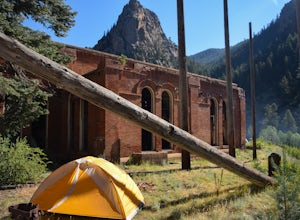
Backpack to the Abandoned Skagway Power Plant and Ghost Town
3.510 mi / 1000 ft gainConstruction of the Skagway Plant began in 1899 and was complete in 1901. In 1965, 15 days of rain brought floods washing out a lot of the pipeline and other infrastructure. Fixing the power plant didn’t make sense and funds weren’t in place. The land was reverted to the government. The hike b...Read more -
Sedalia, Colorado
Backpack the Lost Creek Loop
33.5 mi / 6200 ft gainLost Creek Wilderness may be my favorite part of Colorado. It contains varied terrain and geography, and is less crowded than most places. This loop will take you through everything the wilderness area has to offer. You will get sweeping panoramas of mountain ranges to the south, as well has m...Read more -
Sedalia, Colorado
Backpack the McCurdy Park Loop
25 mi / 7202 ft gainThe total distance of the loop is a little under 25 miles and you will climb a total of 7202 feet. It can be done as a 3 day backpacking trip as shown below.The LoopDay 1: After Parking in the trail head's parking lot, which fills up quickly on weekends, start down the trail after signing your pe...Read more -
Sedalia, Colorado
Goose Creek Trail 612 to McCurdy Trail
12.66 mi / 2408 ft gainGoose Creek Trail 612 to McCurdy Trail is an out-and-back trail where you may see beautiful wildflowers located near Lake George, Colorado.Read more -
Pine, Colorado
Wigwam Trail 609
5.011.28 mi / 2382 ft gainWigwam Trail 609 is a point-to-point trail that takes you by a river located near Bailey, Colorado.Read more -
Jefferson, Colorado
Backpack Lost Creek
4.05 miI included a trail map of where I camped. There are many sites all throughout this area. From the Lost Park Campground Parking lot follow the Lost Creek for 2.4 miles. At the 1 mile mark was the best place that we found to cross the creek (there are two logs that make a bridge across the creek). ...Read more -
Jefferson, Colorado
Wigwam, McCurdy and Brookside McCurdy Trail
20.81 mi / 3681 ft gainWigwam, McCurdy and Brookside McCurdy Trail is a loop trail that takes you by a waterfall located near Jefferson, Colorado.Read more -
Jefferson, Colorado
Lost Creek Wilderness Loop
28.27 mi / 5128 ft gainLost Creek Wilderness Loop is a loop trail where you may see local wildlife located near Grant, Colorado.Read more


