The Best Backpacking in Gypsum
Looking for the best backpacking in Gypsum? We've got you covered with the top trails, trips, hiking, backpacking, camping and more around Gypsum. The detailed guides, photos, and reviews are all submitted by the Outbound community.
Top backpacking spots in and near Gypsum
-
Gypsum, Colorado
Explore Hardscrabble Mountain
Depending where you choose to access the Hardscrabble area from, this can be a fairly easy day hike or an overnight camping trip. If looking for a shorter day hike, access the Hardscrabble area by way of Hardscrabble Mountain Rd. From the town of Eagle, head South on Sylvan Lake Rd. In 5 miles, t...Read more -
Basalt, Colorado
Backpack & Fish at Lake Charles
11 mi / 1700 ft gainI decided to make an Outbound listing for this because the AllTrails listing is incredibly inaccurate. Hopefully you're reading this one! Your adventure starts at the trailhead of Fulford Cave / Fulford Cave Campground in Yeoman Park. Yeoman Park is just past Sylvan Lake State Park and is consid...Read more -
Basalt, Colorado
Mystic Island Lake and Lake Charles via Ironedge Trail
12.36 mi / 2861 ft gainMystic Island Lake and Lake Charles via Ironedge Trail is an out-and-back trail that takes you past scenic surroundings located near Eagle, Colorado.Read more -
Basalt, Colorado
Lake Charles Trail
8.5 mi / 1877 ft gainLake Charles Trail is a loop trail where you may see beautiful wildflowers located near Westminster, Colorado.Read more -
Edwards, Colorado
Holy Cross Wilderness - Eagle Ranger District Wilderness Area Trail
13.39 mi / 2385 ft gainHoly Cross Wilderness - Eagle Ranger District Wilderness Area Trail is a point-to-point trail that provides a good opportunity to view wildlife located near Glenwood Springs, Colorado.Read more -
Basalt, Colorado
Camp at Thomas Lake and Summit Mt. Sopris
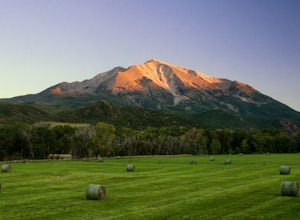
5.013 mi / 4400 ft gainWith the Elk Mountain range behind it, It appears to be standing by itself, and has the resemblance of a grand volcano.From Hwy 133 out of Carbondale, turn down Prince Creek Road and drive 6 miles to the trailhead. The trail is a nice mixture of meadows and woods, with excellent views of the vall...Read more -
Meeker, Colorado
Devils Causeway and Island Lakes Loop
24.18 mi / 3904 ft gainDevils Causeway and Island Lakes Loop is a loop trail that takes you by a lake located near Burns, Colorado.Read more -
Meeker, Colorado
Mosquito Lake and Deer Lake Trail
14.21 mi / 1929 ft gainMosquito Lake and Deer Lake Trail is an out-and-back trail that takes you by a lake located near Yampa, Colorado.Read more -
Meeker, Colorado
Devil's Causeway, Skinny Fish and Trappers Lake Loop
29.38 mi / 6709 ft gainDevil's Causeway, Skinny Fish and Trappers Lake Loop is a loop trail that takes you by a lake located near Yampa, Colorado.Read more -
Garfield County, United States
Hike the Devil's Causeway Loop
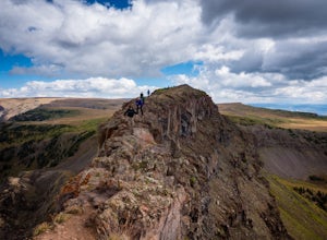
5.010.5 mi / 1550 ft gainCrossing the Devil's Causeway is a rite of passage for Colorado hikers. The dramatic exposure will terrify some and exhilarate others, but the loop offers much more than the short rocky expanse that's the draw for most people.The Approach: From the trailhead at Stillwater Reservoir, the East Fork...Read more -
Meeker, Colorado
Devil's Causeway, Lost Lakes, and Chinese Wall
21.62 mi / 4183 ft gainDevil's Causeway, Lost Lakes, and Chinese Wall is a loop trail that takes you by a lake located near Yampa, Colorado.Read more -
Meeker, Colorado
Anderson Lake and Trapper's Lake
8.47 mi / 1516 ft gainAnderson Lake and Trapper's Lake is an out-and-back trail where you may see beautiful wildflowers located near Burns, Colorado.Read more -
Meeker, Colorado
Trappers Lake, Wall Lake, and Island Lakes Loop
23.1 mi / 3297 ft gainTrappers Lake, Wall Lake, and Island Lakes Loop is a loop trail that takes you by a lake located near Yampa, Colorado.Read more -
Meeker, Colorado
Little Trappers Lake
3.4 mi / 453 ft gainLittle Trappers Lake is an out-and-back trail that takes you by a river located near Gypsum, Colorado.Read more -
Minturn, Colorado
Cross Creek Trail
25.82 mi / 3924 ft gainCross Creek Trail is an out-and-back trail that takes you by a lake located near Minturn, Colorado.Read more -
Snowmass, Colorado
Capitol Lake via Capitol Ditch
5.012.28 mi / 2575 ft gainThe route to Capitol Lake is fairly straightforward, but not without its minor hardships. The route begins at the end of Capitol Creek Road, 9 miles from the small "town" of Snowmass (NOT Snowmass Village - that's the high-class ski resort). The last few miles of this road provide the first min...Read more

