The Best Backpacking in Lyons
Looking for the best backpacking in Lyons? We've got you covered with the top trails, trips, hiking, backpacking, camping and more around Lyons. The detailed guides, photos, and reviews are all submitted by the Outbound community.
Top backpacking spots in and near Lyons
-
Lyons, Colorado
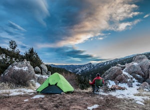
Camp at Coulson Gulch
4.09 miCoulson Gulch is a lightly used area of the Roosevelt National Forest which makes it perfect for a weekend getaway without the crowds. This is a great place to camp out under the stars!To get to Coulson Gulch From Lyons, head west on U.S. Highway 36 for about 9 miles. Turn southwest onto Larimer ...Read more -
Lyons, Colorado
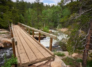
Coulson Gulch Trail
5.39 mi / 879 ft gainCoulson Gulch Trail is an out-and-back trail that takes you by a river located near Lyons, Colorado.Read more -
Ward, Colorado
Hike the Ceran St. Vrain Trail
5.04 mi / 1207 ft gainThe Ceran St. Vrain trail north of Jamestown offers the hiker a nice respite from the summer sun as this path runs through dense pine forests. The trail follows the South St. Vrain Creek for most of the way and follows moderate grades throughout. There is no official end to the trail, only that i...Read more -
Allenspark, Colorado
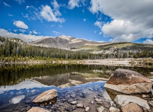
Sandbeach Lake Trail
4.08.56 mi / 2057 ft gainSandbeach Lake is best known for (as you can probably guess) its wide sandy shore. At nearly 50 feet deep, it is one of Rocky Mountain National Parks deepest lakes. If you are looking to fish at the lake, make sure to bring barbless flies and lures. There are six official campsites (1.8 miles Hol...Read more -
Ward, Colorado
South Saint Vrain Figure 8 Loop
16.18 mi / 2415 ft gainSouth Saint Vrain Figure 8 Loop is a loop trail that takes you by a lake located near Ward, Colorado.Read more -
Allenspark, Colorado
Finch Lake via Allenspark Trail
7.29 mi / 1430 ft gainFinch Lake via Allenspark Trail is an out-and-back trail that takes you by a lake located near Allenspark, Colorado.Read more -
Lyons, Colorado
Camp Dick to Beaver Reservoir via Cutoff Trail
2.57 mi / 535 ft gainCamp Dick to Beaver Reservoir via Cutoff Trail is an out-and-back trail that takes you by a lake located near Ward, Colorado.Read more -
Lyons, Colorado
Red Deer Lake via Red Deer Lake and Buchanan Pass Trail
13.56 mi / 1736 ft gainRed Deer Lake via Red Deer Lake and Buchanan Pass Trail is an out-and-back trail that takes you by a lake located near Lyons, Colorado.Read more -
Ward, Colorado
Beaver Reservoir to Monarch Lake Via Sawtooth Mountain
16.56 mi / 3107 ft gainBeaver Reservoir to Monarch Lake Via Sawtooth Mountain is a point-to-point trail that takes you by a lake located near Ward, Colorado.Read more -
Estes Park, Colorado
Storm Pass and Longs Peak Trail
21.48 mi / 6906 ft gainStorm Pass and Longs Peak Trail is an out-and-back trail that takes you by a lake located near Estes Park, Colorado.Read more -
Allenspark, Colorado
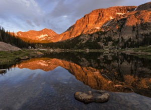
Hike to Pear Lake
5.013 mi / 2112 ft gainPear lake is a beautiful alpine lake in the southern Wild Basin region of Rocky Mountain National Park. Once used as a reservoir, Pear Lake has been restored to its natural state and lies in scenic basin below some of the most isolated mountains in the park. The trail to Pear Lake passes through ...Read more -
Estes Park, Colorado
Summit Storm Peak and Mount Lady Washington
4.512.58 mi / 4500 ft gainThis adventure began at the Longs Peak trailhead in southeastern Rocky Mountain National Park, Colorado. I followed the Longs Peak trail for 6 miles to the Boulderfield backcountry camping area. This is a fairly steep on-trail climb of 3,360 feet. After setting up camp at 12,760 feet, my partner...Read more -
Estes Park, Colorado
Camp at Boulder Field in Rocky Mountain National Park
12 mi / 3360 ft gainBoulder Field is a high alpine backcountry site on Longs Peak, and is a popular camp for backpackers attempting to summit Longs Peak via the Keyhole route. At an impressive elevation of 12,760 feet, Boulder Field is a vast wasteland of rocks that sits 500 feet below the famous Keyhole feature, an...Read more -
1398 Longs Peak Road, Colorado
The Keyhole and Longs Peak via Longs Peak Trail
13.29 mi / 4646 ft gainThe Keyhole and Longs Peak via Longs Peak Trail is an out-and-back trail that takes you by a lake located near Allenspark, Colorado.Read more -
Allenspark, Colorado
Ouzel & Ogallala Peaks
17.18 mi / 4403 ft gainBegin at the Wild Basin Trailhead in southeastern Rocky Mountain National Park near the town of Allenspark. Plan to start before sunrise if attempting this trek as a day trip in order to avoid afternoon thunderstorms above the treeline. This trip can easily be made into a backpacking experience b...Read more -
Allenspark, Colorado
Backpack to Bluebird Lake
4.314 mi / 2500 ft gainStarting at the Wild Basin trailhead on the south side of Rocky Mountain National Park, hike through a wet forest towards upper and lower Copeland Falls, located 0.45 miles from the trailhead. From here, continue on the main trail along the North Fork of the Saint Vrain River to Calypso Cascades,...Read more

