The Best Backpacking in Government Camp
Looking for the best backpacking in Government Camp? We've got you covered with the top trails, trips, hiking, backpacking, camping and more around Government Camp. The detailed guides, photos, and reviews are all submitted by the Outbound community.
Top backpacking spots in and near Government Camp
-
Government Camp, Oregon
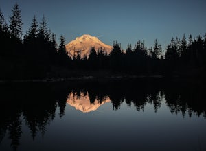
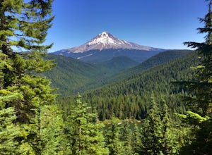
Tom Dick and Harry Mountain
5.08.28 mi / 1726 ft gainLooking to score those iconic photos of Mt. Hood? Climb the well-graded trail to Tom Dick and Harry Mountain, one of the most accessible summit hikes to Portlanders, and see where they were all taken. Starting from the busy Mirror Lake Trailhead, climb roughly 900 feet and 1.5 miles to Mirror La...Read more -
Government Camp, Oregon
Climb the Mt. Hood Summit
4.87 mi / 5239 ft gainStarting at 6,000 ft of elevation at Timberline Lodge, start your climb up the south side of Mt. Hood. If you head out at noon, in 6 hours you can make it about an hour past the last ski lift, called Palmer, where you can set up camp for the night. You may need to dig out a flat spot for your ten...Read more -
Mount Hood, Oregon
Timberline Trail Around Mount Hood
40.05 mi / 10236 ft gainTimberline Trail Around Mount Hood is a loop trail that takes you by a waterfall located near Government Camp, Oregon.Read more -
Clackamas County, Oregon
Timberline Trail: Timberline Lodge to Ramona Falls
29.12 mi / 5883 ft gainTimberline Trail: Timberline Lodge to Ramona Falls is a point-to-point trail where you may see local wildlife located near Government Camp, Oregon.Read more -
Government Camp, Oregon
Barlow Pass to Upper Twin Lake via PCT
7.02 mi / 912 ft gainBarlow Pass to Upper Twin Lake via PCT is an out-and-back trail that takes you by a lake located near Mount Hood Parkdale, Oregon.Read more -
Government Camp, Oregon
Veda Lake Trail
4.02.5 mi / 748 ft gainThis hike starts at the Fir Tree Trailhead and is an out and back 2.8 mile round trip. It's short, but there's 660 feet of elevation gain. To start, you climb steeply then it's an easy hike to a beautiful viewpoint overlooking the lake. The trail descends via switchbacks down to the lake for the ...Read more -
Rhododendron, Oregon
Burnt Lake and Zigzag Mountain
5.012.27 mi / 3225 ft gainAfter getting your back country permit from a park ranger, you can park your car and head up Zigzag Mountain. There's a tiny 'parking lot' (lot of dirt) where you park that's right by the trailhead. The hike up to the campsites is roughly 4 miles, and it is all uphill. Not only are you surrounde...Read more -
Government Camp, Oregon
Lower & Upper Twin Lakes via PCT
5.77 mi / 974 ft gainLower & Upper Twin Lakes via PCT is an out-and-back trail that takes you by a lake located near Government Camp, Oregon.Read more -
Government Camp, Oregon
Twin Lake South via Twin Lakes Trail
4.13 mi / 797 ft gainTwin Lake South via Twin Lakes Trail is an out-and-back trail that takes you by a lake located near Government Camp, Oregon.Read more -
Hood River County, Oregon
Camp at Elk Meadows
4.54.5 mi / 1200 ft gainThis is a great trip for those who are new to backpacking. The hike to the quiet, peaceful Elk Meadows is relatively short, but the Newton Creek crossing presents enough difficulty to make this a fun and challenging adventure.Start at the Hood River Meadows Trailhead parking lot. Though there are...Read more -
Mount Hood, Oregon
Elk Meadows South Trail
5.55 mi / 1184 ft gainElk Meadows South Trail is a loop trail where you may see beautiful wildflowers located near Mount Hood Parkdale, Oregon.Read more -
Rhododendron, Oregon
Cool Creek Trail to Devil's Peak
6.46 mi / 3110 ft gainCool Creek Trail to Devil's Peak is an out-and-back trail where you may see beautiful wildflowers located near Government Camp, Oregon.Read more -
Rhododendron, Oregon
Yocum Ridge Trail
18.55 mi / 4370 ft gainYocum Ridge Trail is an out-and-back trail that takes you by a waterfall located near Rhododendron, Oregon.Read more -
Mount Hood, Oregon
McNeil Point via Top Spur Trailhead
4.97.17 mi / 2428 ft gainThe hike to McNeil Point begins at Top Spur Trailhead, in the Mt. Hood National Wilderness. Follow signs for McNeil Point along the Pacific Crest and Timberline Trails heading north. Though there are numerous camping opportunities along the way (most of the route follows the PCT), an old stone s...Read more -
Rhododendron, Oregon
Cast and Burnt Lake Loop via Cast Creek and Zigzag Mountain Trails
27.03 mi / 7556 ft gainCast and Burnt Lake Loop via Cast Creek and Zigzag Mountain Trails is a loop trail that takes you by a lake located near Rhododendron, Oregon.Read more -
Mount Hood, Oregon
McGee Creek Trail #627 to Barrett Spur
15.38 mi / 4688 ft gainMcGee Creek Trail #627 to Barrett Spur is an out-and-back trail where you may see beautiful wildflowers located near Hood River, Oregon.Read more

