The Best Backpacking in Marble Canyon
Looking for the best backpacking in Marble Canyon? We've got you covered with the top trails, trips, hiking, backpacking, camping and more around Marble Canyon. The detailed guides, photos, and reviews are all submitted by the Outbound community.
Top backpacking spots in and near Marble Canyon
-
Kane County, Utah
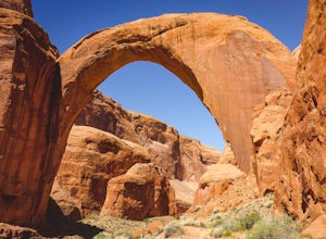
Backpack to Rainbow Bridge
5.017 mi / 2800 ft gainThis incredible trip isn't only about Rainbow Bridge. Honestly, the Bridge is just icing on the cake.The scenery is breathtaking along the way, changing and evolving as you pass through epic canyons and climb over rocky ledges to be rewarded with spanning vistas. It really is amazing. There's eve...Read more -
Kanab, Utah
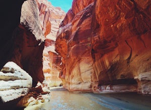
Hike through Paria Canyon
5.014.94 mi / 846 ft gainNo matter how far you plan on hiking, it is ideal to get an early start so you aren’t hiking too long under the desert sun. There is no shade on this hike except for the shadows offered from the steep walls of the canyon, so make sure you bring sunscreen! From the very start, you’ll get your fee...Read more -
Kanab, Utah
Wire Pass to Lee's Ferry
41.66 mi / 7969 ft gainWire Pass to Lee's Ferry is a point-to-point trail that takes you by a river located near Kanab, Utah.Read more -
Kanab, Utah
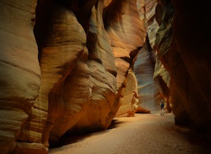
Hike Buckskin Gulch, Vermillion Cliffs Wilderness
4.715 miBuckskin Gulch is a natural wonder. At 15 miles long it is the longest slot canyon in the world. It sometimes is as narrow as 2ft. Because of the nature of this canyon and Utah topography this canyon is subject to deadly flash flood if it rains anywhere along the headwaters. Be sure to check in w...Read more -
Kanab, Utah
Buckskin Gulch to White House Trail
23.02 mi / 1929 ft gainBuckskin Gulch to White House Trail is a point-to-point trail that takes you by a river located near Kanab, Utah.Read more -
Kanab, Utah
Buckskin Gulch to Paria River
32.26 mi / 3179 ft gainBuckskin Gulch to Paria River is an out-and-back trail that takes you by a river located near Kanab, Utah.Read more -
Kanab, Utah
Buckskin Gulch Trail to Lees Ferry
45.82 mi / 9442 ft gainBuckskin Gulch Trail to Lees Ferry is a point-to-point trail that takes you by a river located near Marble Canyon, Arizona.Read more -
Kanab, Utah
Lower Hackberry Canyon Trail
11.8 mi / 1716 ft gainLower Hackberry Canyon Trail is an out-and-back trail that takes you by a river located near Kanab, Utah.Read more -
North Rim, Arizona
Nankoweap Trail
29.19 mi / 8428 ft gainNankoweap Trail is an out-and-back trail that takes you by a river located near North Rim, Arizona.Read more -
North Rim, Arizona
Widforss Trail
9.29 mi / 1490 ft gainWidforss Trail is an out-and-back trail that takes you through a nice forest located near Grand Canyon, Arizona.Read more -
North Rim, Arizona
Tiyo Point Trail
20.46 mi / 1811 ft gainTiyo Point Trail is an out-and-back trail that takes you past scenic surroundings located near North Rim, Arizona.Read more -
Kane County, Utah
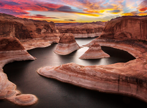
Reflection Canyon
5.015.24 mi / 1368 ft gainBackpacking Reflection Canyon is not for the faint of heart. It's an intense, challenging hike that takes you through slot canyons, climbing up and down shifty sandstones and traversing rugged terrains and ravines. Although the elevation gain is almost nothing, the up and down climbs from one rav...Read more -
North Rim, Arizona
Uncle Jim Trail
4.7 mi / 384 ft gainUncle Jim Trail is a loop trail where you may see beautiful wildflowers located near North Rim, Arizona.Read more -
North Rim, Arizona
Grand Canyon: Rim-to-Rim-to-Rim
4.745.6 mi / 10141 ft gainDay 1 Start at the North Rim of Grand Canyon National Park at the North Kaibab Trail. You have 14 miles and 5,761 feet of elevation to descend to the Bright Angel Campground, so bring those trekking poles if you have bad knees (like myself). Along the North Kaibab Trail a few noteworthy trail m...Read more -
North Rim, Arizona
North Kaibab Trail to Colorado River
28.35 mi / 9974 ft gainNorth Kaibab Trail to Colorado River is an out-and-back trail that takes you by a waterfall located near North Rim, Arizona.Read more -
North Rim, Arizona
Rainbow Falls and Cottonwood Canyon via North Kaibab Trail
17 mi / 7369 ft gainRainbow Falls and Cottonwood Canyon via North Kaibab Trail is an out-and-back trail that takes you by a waterfall located near North Rim, Arizona.Read more

