The Best Backpacking in Seattle
Looking for the best backpacking in Seattle? We've got you covered with the top trails, trips, hiking, backpacking, camping and more around Seattle. The detailed guides, photos, and reviews are all submitted by the Outbound community.
Top backpacking spots in and near Seattle
-
Brinnon, Washington
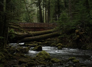
Hike Lower Big Quilcene River
13 mi / 1800 ft gainWhile this hike does not provide any sort of fantastic views, its does provide an easy ~13 mile roundtrip hike from the trailhead to a parking lot for the Upper Big Quilcene Trail which leads to Marmot Pass. Along the way you will cross several bridges, some large and wide, other simple log bridg...Read more -
Brinnon, Washington
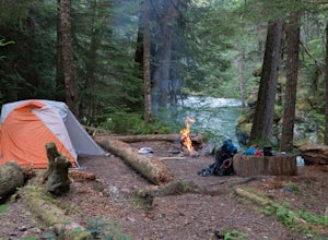
Camp at the Dose Forks
15 mi / 1200 ft gainThe Dose Forks Campground is an overlooked campsite deep within the Olympic National Park, making it a perfect weekend camping destination. A mild, 7.5 mile (one-way) trail delivers you to this enchanting area and is a must for those who love photographing forests. There are no reservation requir...Read more -
Brinnon, Washington
Main Fork Dosewallips River Trail
41.45 mi / 7618 ft gainMain Fork Dosewallips River Trail is an out-and-back trail that takes you by a lake located near Brinnon, Washington.Read more -
Brinnon, Washington
West Fork Dosewallips River Trail
32.86 mi / 5820 ft gainWest Fork Dosewallips River Trail is an out-and-back trail that takes you by a waterfall located near Brinnon, Washington.Read more -
Brinnon, Washington
Doseweallips Road to Constance Pass Trail
34.02 mi / 8816 ft gainDoseweallips Road to Constance Pass Trail is an out-and-back trail that takes you by a lake located near Brinnon, Washington.Read more -
North Bend, Washington
Hike Pratt Balcony
2.2 miThis one can be a bit tricky to find. The trailhead is unmarked and is a bit hidden around a curve of Middle Fork Road so it is easy to miss. At about 9.80 miles from the junction of 468th St. and Middle Fork Road, look for two signs on the right warning of upcoming gravel patches (probably will ...Read more -
North Bend, Washington
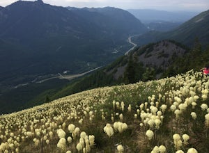
Hike to Bandera Mountain
4.48 mi / 3400 ft gainThis hike has unreal views of Mount Rainier. On a great clear spring day the mountain is out. It's right in your face. Its incredible. If you tackle this hike in the spring the bear grass and wildflowers are alive and blooming towards the top and it makes for some fantastic picture taking. Once a...Read more -
North Bend, Washington
Mason Lake via Ira Spring
4.26.88 mi / 2316 ft gainIra Spring trail offers up great views prior to reaching the ridge that you go over to reach Mason Lake. The lake itself is an amazing sight—beautiful water with rocks and trees along the shores, making this 6.5-mile roundtrip hike well worth it. The trail to Mason Lake, the Ira Spring trail, pr...Read more -
North Bend, Washington
Camp and Trail Run from Rainbow Lake
I backpacked to and setup basecamp at Rainbow Lake and then I ran over to Island Lake. After enjoying the peace and quite I ran up to the top of Bandera Mountain and enjoyed the views. Then, I ran back to basecamp and spent the night. The following morning I ran up to the top of Mount Defiance a...Read more -
Quilcene, Washington
Marmot Pass via Big Quilcene Trail
5.010.5 mi / 3481 ft gainThis trail has a nice, steady climb that's perfect for beginner or intermediate backpackers. The first 2.5 miles follow a forest trail along the Big Quilcene River. For the next 3 miles, the trail flows in and out of shaded trees, over a small talus field, and through a meadow before the final ac...Read more -
Quilcene, Washington
Backpack to Marmot and Constance Passes
24 mi / 5200 ft gainThe secret to this trip: Marmot Pass and Boulder Shelter, where you can camp on National Forest Service land. Multiple excellent, large backpacking sites sit just on the edge of the National Park, giving you great access to Mt. Constance and Mt. Deception, two of the tallest peaks in the Olympics...Read more -
Mason County, Washington
Hike to Lena Lake
4.55 mi / 1300 ft gainThe trail climbs gently up and is accessible almost every season, weather permitting. Snow shoes may be needed December-February, so make sure and check with the Hoodsport Ranger Station.Just 45 minutes north of Hoodsport (a darling small town on the shores of Puget Sound), this trailhead has spa...Read more -
Mason County, Washington
Climb the Brothers (South Climb)
4.517 mi / 6062 ft gainThe Brothers is a notable peak on the border of Olympic National Park. The dual summits are a distinguishing feature of the Olympic Range, viewed from Seattle. This is a challenging route, testing a climber's route finding skills, physical fitness, and mental fortitude. From the parking lot, you ...Read more -
North Bend, Washington
Rainy Lake Trail
4.09 mi / 3205 ft gainThis is an abandoned trail that heads south along Rainy Creek, off of the downstream section of the Middle Fork Snoqualmie Trail, and up to Rainy Lake. The lake is popular among fisherman, since it is home to lots of trout, but be warned -- route-finding skills are a must on this trip. I do my be...Read more -
Mason County, Washington
Upper Lena Lake
5.012.61 mi / 4239 ft gainThe hike to Upper Lena Lake is a beautiful one. It first takes you past Lena Lake, which is a very popular weekend destination for families. Luckily you're pushing on to Upper Lena Lake that sits in a peaceful alpine meadow with Mt. Lena and Mt. Bretherton towering above. The first part of the t...Read more -
Brinnon, Washington
Sunnybrook Meadows Trail
17 mi / 6004 ft gainSunnybrook Meadows Trail is an out-and-back trail where you may see beautiful wildflowers located near.Read more

