The Best Backpacking in Hoodsport
Looking for the best backpacking in Hoodsport? We've got you covered with the top trails, trips, hiking, backpacking, camping and more around Hoodsport. The detailed guides, photos, and reviews are all submitted by the Outbound community.
Top backpacking spots in and near Hoodsport
-
Hoodsport, Washington
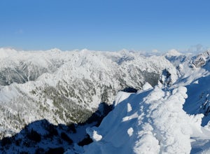
Snowshoe Mt. Ellinor's Winter Route
5 mi / 4500 ft gainYou can stat this adventure at one of two trailheads. I suggest using the lower of the two. The start of the trail ascends through a forest of old growth pines with periodic views of Mt Washington. Eventually, at a fork in the trail, you will see a sign marking the start of the winter route. You ...Read more -
Hoodsport, Washington
O'Neil Pass via North Fork of Skokomish Trail
37.76 mi / 9334 ft gainO'Neil Pass via North Fork of Skokomish Trail is a loop trail that takes you by a river located near Hoodsport, Washington.Read more -
Hoodsport, Washington
Wagonwheel Lake Trail
5.19 mi / 3104 ft gainWagonwheel Lake Trail is an out-and-back trail that takes you by a lake located near Lilliwaup, Washington.Read more -
Hoodsport, Washington
North Fork Skokomish River Trail
23.95 mi / 5213 ft gainNorth Fork Skokomish River Trail is an out-and-back trail that takes you by a lake located near Lilliwaup, Washington.Read more -
Hoodsport, Washington
Black and White Lakes Primitive Trail
14.68 mi / 4413 ft gainBlack and White Lakes Primitive Trail is a loop trail that takes you by a lake located near Lilliwaup, Washington.Read more -
Hoodsport, Washington
Four Stream Trail
7.16 mi / 1316 ft gainFour Stream Trail is an out-and-back trail that takes you by a lake located near Lilliwaup, Washington.Read more -
Mason County, Washington
Upper Lena Lake
5.012.61 mi / 4239 ft gainThe hike to Upper Lena Lake is a beautiful one. It first takes you past Lena Lake, which is a very popular weekend destination for families. Luckily you're pushing on to Upper Lena Lake that sits in a peaceful alpine meadow with Mt. Lena and Mt. Bretherton towering above. The first part of the t...Read more -
Mason County, Washington
Hike to Lena Lake
4.55 mi / 1300 ft gainThe trail climbs gently up and is accessible almost every season, weather permitting. Snow shoes may be needed December-February, so make sure and check with the Hoodsport Ranger Station.Just 45 minutes north of Hoodsport (a darling small town on the shores of Puget Sound), this trailhead has spa...Read more -
Mason County, Washington
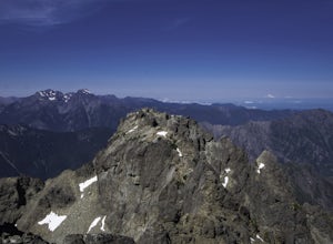
Climb the Brothers (South Climb)
4.517 mi / 6062 ft gainThe Brothers is a notable peak on the border of Olympic National Park. The dual summits are a distinguishing feature of the Olympic Range, viewed from Seattle. This is a challenging route, testing a climber's route finding skills, physical fitness, and mental fortitude. From the parking lot, you ...Read more -
Brinnon, Washington
Sunnybrook Meadows Trail
17 mi / 6004 ft gainSunnybrook Meadows Trail is an out-and-back trail where you may see beautiful wildflowers located near.Read more -
Jefferson County, Washington
Enchanted Valley LaCrosse Basin O'Neill Pass Loop
52.76 mi / 11654 ft gainEnchanted Valley LaCrosse Basin O'Neill Pass Loop Trail is a loop trail where you may see beautiful wildflowers located near Quinault, Washington.Read more -
Quinault, Washington
Backpack to Enchanted Valley Chateau
5.031.59 mi / 5052 ft gainThis backpacking trip can easily be done in 2 days, but some people prefer to stretch it out to 3. Luckily there are several different spots to stop and camp, so you can split up the distance however you are the most comfortable. The elevation over the course of the trail is minimal, which means ...Read more -
Brinnon, Washington
Main Fork Dosewallips River Trail
41.45 mi / 7618 ft gainMain Fork Dosewallips River Trail is an out-and-back trail that takes you by a lake located near Brinnon, Washington.Read more -
Brinnon, Washington
Doseweallips Road to Constance Pass Trail
34.02 mi / 8816 ft gainDoseweallips Road to Constance Pass Trail is an out-and-back trail that takes you by a lake located near Brinnon, Washington.Read more -
Brinnon, Washington
West Fork Dosewallips River Trail
32.86 mi / 5820 ft gainWest Fork Dosewallips River Trail is an out-and-back trail that takes you by a waterfall located near Brinnon, Washington.Read more -
Brinnon, Washington
Camp at the Dose Forks
15 mi / 1200 ft gainThe Dose Forks Campground is an overlooked campsite deep within the Olympic National Park, making it a perfect weekend camping destination. A mild, 7.5 mile (one-way) trail delivers you to this enchanting area and is a must for those who love photographing forests. There are no reservation requir...Read more

