The Best Backpacking in Jamestown
Looking for the best backpacking in Jamestown? We've got you covered with the top trails, trips, hiking, backpacking, camping and more around Jamestown. The detailed guides, photos, and reviews are all submitted by the Outbound community.
Top backpacking spots in and near Jamestown
-
Jamestown, Tennessee
Hicks Ridge, Wild Cat Den, Willie Lee, Pavilion, Teepee Loop and Proctor Ridge
12.5 mi / 1227 ft gainHicks Ridge, Wild Cat Den, Willie Lee, Pavilion, Teepee Loop and Proctor Ridge is a loop trail where you may see local wildlife located near Jamestown, Tennessee.Read more -
Jamestown, Tennessee
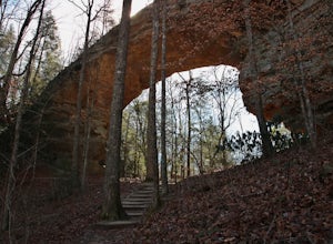
Hike to Twin Arches
2 mi / 700 ft gainThe trail starts the parking lot which has some nice bathrooms and a nice small picnic area that is open year round. From the trail-head you will follow the signs that will lead you a short mostly flat .7 mile hike to the first arch. Once you get to the first arch there is a small area with some ...Read more -
Oneida, Tennessee
Backpack to Angel Falls Overlook in the Big South Fork
4.06.4 mi / 800 ft gainStarting at a very small parking space, you head onto a fairly overgrown trail for half a mile. The trail then begins to thin out and is not as overgrown. Keeping a steady incline, you almost instantly feel the burn in your calves. At around 2 miles in, there is a single grave from a baby that l...Read more -
Oneida, Tennessee
Grand Gap Loop Trail
12.16 mi / 2316 ft gainGrand Gap Loop Trail is a loop trail that takes you through a nice forest located near Oneida, Tennessee.Read more -
Oneida, Tennessee
Honey Creek Loop Trail
4.22 mi / 709 ft gainHoney Creek Loop Trail is a loop trail that takes you by a waterfall located near Elgin, Tennessee.Read more -
Lancing, Tennessee
Camp at OBED Wild and Scenic River Area via the Point Trail
4 miYou will want to park at the Lilly Bluff parking lot. Your GPS won't know where this is, so here are the GPS coordinates N36° 06.162', W84° 43.280'.The trailhead is located on the North side of the parking lot. All you need to do is follow the sign for Point Trail. The trail culminates at an e...Read more -
Wartburg, Tennessee
Bird Mountain and North Bird Mountain Loop
10.56 mi / 3566 ft gainBird Mountain and North Bird Mountain Loop is a loop trail where you may see beautiful wildflowers located near Wartburg, Tennessee.Read more -
Wartburg, Tennessee
Squire Knob, The Garden Spot, Bald Knob, Bird Mountain and England Mountain
15.95 mi / 3596 ft gainSquire Knob, The Garden Spot, Bald Knob, Bird Mountain and England Mountain is a loop trail that takes you by a waterfall located near Wartburg, Tennessee.Read more -
Wartburg, Tennessee
Spicewood Branch Trail
7.32 mi / 1952 ft gainSpicewood Branch Trail is a loop trail that takes you by a waterfall located near Wartburg, Tennessee.Read more -
Wartburg, Tennessee
Emory Gap Trail
2.44 mi / 495 ft gainEmory Gap Trail is an out-and-back trail that takes you by a waterfall located near Wartburg, Tennessee.Read more -
Wartburg, Tennessee
Lone Mountain Trail
7.96 mi / 1581 ft gainLone Mountain Trail is a loop trail where you may see beautiful wildflowers located near Harriman, Tennessee.Read more -
Williamsburg, Kentucky
Sheltowee Trace Trail to KY 192
21.03 mi / 2136 ft gainSheltowee Trace Trail to KY 192 is a point-to-point trail that takes you by a river located near Corbin, Kentucky.Read more -
Sparta, Tennessee
Polly Branch Falls Trail
9.38 mi / 1119 ft gainPolly Branch Falls Trail is a loop trail that takes you by a waterfall located near Sparta, Tennessee.Read more -
Sparta, Tennessee
Virgin Falls State Natural Area Loop
5.04.46 mi / 400 ft gainBeginning at the Virgin Falls SNA parking area, the Virgin Falls trail is approximately a 9 mile round trip (excluding any side trails) which will allow you to experience three waterfalls: Big Branch Falls, Big Laurel Falls, and the namesake Virgin Falls. There is a fourth, Sheep Cave Falls, that...Read more -
Grandview, Tennessee
Hike to Piney Falls
5.01.5 mi / 500 ft gainThe gravel road heading to the trailhead is on the rougher side to take it slow. When you get to the trailhead it’s a small gravel pull off right off the road. There are no maps at the trailhead but there are only a few trails to take and they are marked with a blue marker. To get to the upper fa...Read more -
Andersonville, Tennessee
Norris Dam State Park Campground Trail
14.6 mi / 2310 ft gainNorris Dam State Park Campground Trail is a loop trail that takes you by a lake located near Rocky Top, Tennessee.Read more


