The Best Backpacking in Mouth of Wilson
Looking for the best backpacking in Mouth of Wilson? We've got you covered with the top trails, trips, hiking, backpacking, camping and more around Mouth of Wilson. The detailed guides, photos, and reviews are all submitted by the Outbound community.
Top backpacking spots in and near Mouth of Wilson
-
Mouth of Wilson, Virginia
Mount Rogers via Appalachian Trail
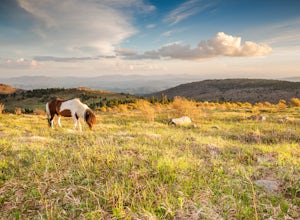
5.09.1 mi / 1549 ft gainFirst of all, who doesn't love wild ponies! There are tons of ponies here, and although they are wild, they are not afraid of people and you can get pretty close (just don't feed them!). Once you enter Grayson Highlands State Park, you will see a parking lot for Massie Gap a few miles in, par...Read more -
Mouth of Wilson, Virginia
Backpack the Grayson Highlands
4.89.1 mi / 1549 ft gainSpanning roughly 4500 acres, located in a portion of Jefferson National Forest, looming under the highest peak in Virginia lies the Grayson Highlands. A part of Virginia’s State Parks system and a United States National Landmark, located in Mouth of Wilson, Virginia, the Highlands are home to wil...Read more -
Mouth of Wilson, Virginia
Mount Rogers Loop
5.015.6 mi / 1079 ft gainFor an awesome 2-3 day trip, start hiking at the Massie Gap trailhead, which can be reached from Grayson Highlands State Park. Take the Rhododendron Trail up the ridge to connect with the AT, keeping an eye out for wild ponies in the Massie Gap area as they like to hang out here. Some of these po...Read more -
Troutdale, Virginia
Hike the Appalachian Trail from Elk Garden to Buzzard Rock
5.06.6 mi / 1000 ft gainStarting at the Elk Garden Parking Area hike the Appalachian Trail south (do not cross the road, follow the trail from the parking area). Hike along the trail following the white blazes and at 2.4 miles you'll reach a campsite on your left. This is a great place to camp overnight if you decide to...Read more -
Whitetop, Virginia
Virginia Creeper National Recreational Trail
5.033.25 mi / 2139 ft gainVirginia Creeper National Recreational Trail is a point-to-point trail that takes you by a lake located near Whitetop, Virginia.Read more -
Damascus, Virginia
Beargap Trail to Appalachian Trail to Virginia Creeper Loop
10.77 mi / 1998 ft gainBeargap Trail to Appalachian Trail to Virginia Creeper Loop is a loop trail that takes you by a river located near Damascus, Virginia.Read more -
Elk Creek, Virginia
Camp at Comers Rock Recreation Area
1 miI didn't have any issues putting "Comers Rock Recreation Area" into my phone's GPS (Waze) and arriving exactly where I was supposed to. When you turn off US 21 (aka the Grayson Turnpike/Elk Creek Parkway) to Jefferson National Forest Road 57, you'll see a sign a parking lot that says "road not su...Read more -
Hays, North Carolina
Hike along Basin Creek in Doughton Park
5.011 mi / 1800 ft gainA treasure in North Carolina that doesn't get as much attention as it should, Doughton Park has some of the best trails around. It is the largest park operated by the Blue Ridge Parkway and has over 30 miles of trails available. The parking area for the Basin Creek Trail is small, but rarely cro...Read more -
Shady Valley, Tennessee
Rich Knob via Appalachian Trail
6.97 mi / 1188 ft gainRich Knob via Appalachian Trail is an out-and-back trail that takes you through a nice forest located near Shady Valley, Tennessee.Read more -
Rural Retreat, Virginia
Crawfish/Channel Rock Trail Loop
15.66 mi / 1903 ft gainCrawfish/Channel Rock Trail Loop is a loop trail that takes you by a river located near Rural Retreat, Virginia.Read more -
Hays, North Carolina
Stone Mountain - Widow's Creek to Deep Gap
5.31 mi / 2123 ft gainStone Mountain - Widow's Creek to Deep Gap is a point-to-point trail that takes you through a nice forest located near Traphill, North Carolina.Read more -
Wytheville, Virginia
Lick Mountain Boundary Trail
7.62 mi / 1273 ft gainLick Mountain Boundary Trail is a loop trail that takes you by a river located near Wytheville, Virginia.Read more -
Seven Devils, North Carolina
Calloway Peak via Profile Trail
7.11 mi / 2493 ft gainCalloway Peak via Profile Trail is an out-and-back trail with waterfall views located near Banner Elk, North Carolina in Grandfather Mountain State Park.Read more -
Bland, Virginia
Garden Mountain, Chestnut Ridge, and Brushy Mountain via Appalachian Trail
36.71 mi / 8468 ft gainGarden Mountain, Chestnut Ridge, and Brushy Mountain via Appalachian Trail is a point-to-point trail that takes you through a nice forest located near Tazewell, Virginia.Read more -
Elizabethton, Tennessee
Little Stoney Creek to Chestnut Flats
6.7 mi / 1575 ft gainLittle Stoney Creek to Chestnut Flats is an out-and-back trail where you may see beautiful wildflowers located near Elizabethton, Tennessee.Read more -
36.1774619949846,-82.01167345047, Tennessee
Appalachian Trail: 19E to Hump Mountain
10.2 mi / 3287 ft gainAppalachian Trail: 19E to Hump Mountain is an out-and-back trail that provides a good opportunity to view wildlife located near Roan Mountain, Tennessee.Read more

