The Best Backpacking in Italy
Looking for the best backpacking in Italy? We've got you covered with the top trails, trips, hiking, backpacking, camping and more around Italy. The detailed guides, photos, and reviews are all submitted by the Outbound community.
Top backpacking spots in and near Italy
-
Bologna, Italy
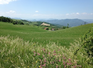
La Via Degli Dei: The Path of the Gods
81.46 mi / 13802 ft gainMake the usual 30 minute train ride from Bologna to Florence last five beautiful days by traversing and camping in the Apennine Mountain Range. The Path of the Gods begins in the main piazza of the ancient Italian city of Bologna (61 m/200 ft above sea level), ascends to 1200 m/3,940 ft, then br...Read more -
Auronzo di Cadore, Italy
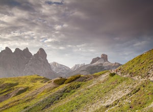
Hike the Tre Cime Di Lavaredo Loop
5.06.3 mi / 1105 ft gainThe famous Italy Dolomites are littered with numerous great hikes to showcase them, however, this trail is the cream of the crop. It will not disappoint. You have the option of hiking up to Rifugio Auronzo from Misurina, which is detailed out here. The other option that makes it easier if you're ...Read more -
Bognanco, Italy
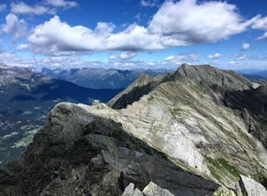
Hike to Gattascosa hut and Camoscellahorn
4.2 mi / 3290.7 ft gainThe path that I'm suggesting here can be completed in full if you feel trained for a climb of 1000m but it can also be cut in half at the Monscera pass if you prefer something simpler and lighter. In any case, your excursion will give you great reward. From Domodossola follow directions to Bognan...Read more -
Auronzo di Cadore, Italy
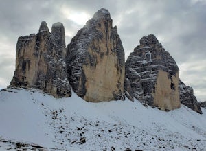
Hike the Tre Cime di Lavaredo Loop
6.75 mi / 1200 ft gainThis is a spectacular and majestic undertaking, completely different from hiking it in the summer. In the winter, you can hike or snowshoe and witness the amazing, expansive views of snowcapped mountain peaks. The contrast between the dark mountains and the pure white snow is breath-taking and ab...Read more -
Cortina d'Ampezzo, Italy
Croda Da Lago Circut
7.8 mi / 1148 ft gainBrass Tax Hiking tracks: 437, 434, 435 Distance: 7.8 miles / 12.5 km - 759 meter elevation change. Time: 7+ hours Difficulty: Moderate/difficult Stay: Rifugio Palmieri Things to Note: Trails in the Dolomites are defined by numbers. You will also notice in your planning that there are also tra...Read more -
Misurina, Italy
Photograph The Dolomites Near Misurina
The Dolomites in this area are absolutely stunning, and you can pair these massive mountains well in pictures with small towns like Auronzo, Reane, and Misurina. It may be a bit cold, but going in October or later will allow you to see the mountains with some snow sprinkled among the peaks. If y...Read more -
Illasi, Italy
Climb Monte Garzon and Ring the Bell
3 mi / 836.6 ft gainStart your adventure by parking along the road or by the church. Head north up what initially looks like a driveway, though you'll want to stay to the right and follow the path. From there keep following the path straight, and when in doubt follow the red/white blazes or the signs for the cross (...Read more -
Illasi, Italy
Hike or Bike La Vecia Via della Lana
30.1 miLa Vecia Via della Lana translates to "the Old Way of the Wool" which pretty much explains why the path was created. It was once a route that shepherds would use to transport livestock and goods from town to town. In modern times, the path is used for biking and hiking tourism. It spans from Soav...Read more

