The Best Camping in Wawona
Looking for the best camping in Wawona? We've got you covered with the top trails, trips, hiking, backpacking, camping and more around Wawona. The detailed guides, photos, and reviews are all submitted by the Outbound community.
Top camping spots in and near Wawona
-
Mariposa County, California
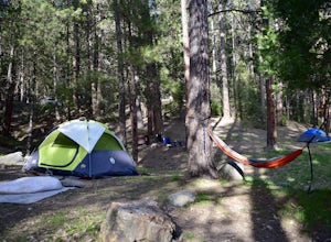
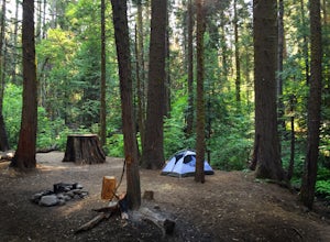
Camp at Wawona in Yosemite National Park
Wawona offers over 90 campsites in 3 loops, including 1 group site, 2 horse sites, and RV/ camper access.Every loop has at least 1 bathroom with flush toilets, but keep in mind that there are no showers at this campground.Pets are allowed, but must be kept on leash at all times.Each campground co...Read more -
Wawona, California
Buena Vista, Royal Arch, and Crescent Lakes Loop
26.49 mi / 5837 ft gainBuena Vista, Royal Arch, and Crescent Lakes Loop is a loop trail that takes you by a lake located near Yosemite Valley, California.Read more -
Wawona, California
Wawona to Half Dome to Yosemite Valley
33.37 mi / 8986 ft gainWawona to Half Dome to Yosemite Valley is a point-to-point trail that takes you by a waterfall located near Fish Camp, California.Read more -
Yosemite National Park, California
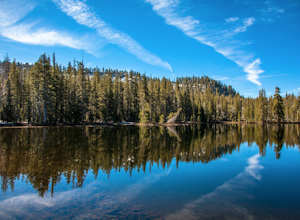
Backpack to Crescent Lake
20 mi / 4100 ft gainCrescent Lake is another beautiful spot a long the Beuna Vista loop. Starting at the Chilnualna Trailhead in Wawona, you start your journey climbing about 4.6 miles and 2,300 feet to the top of Chilnualna Falls (always a good place to rest). Beyond the falls, continue a long the trail and always ...Read more -
Yosemite National Park, California
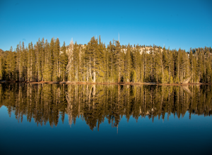
Buena Vista Lake via Chilnualna Falls Trailhead
24.64 mi / 5453 ft gainHiking and camping at Buena Vista Lake is a beautiful way to see the south side of Yosemite… the name says it all. With beautiful 360 degree views from Buena Vista Peak you get to look at the backside of Half Dome, up to Clouds Rest and all the domes and peaks in-between. You can reach the trail...Read more -
Yosemite National Park, California
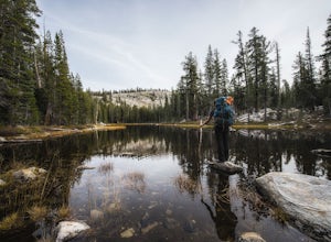
Backpack to Johnson Lake
24 mi / 4500 ft gainYour trek begins at the Chilnualna Falls trailhead in Wawona near the South Gate in Yosemite. The first suggestion I have is to check the weather in the area to make sure you won't be slowed down by rain or snow. It's about 12 miles from the trailhead to the lake and if you are a swift hiker and ...Read more -
Mariposa County, California
Hike to Alder Creek Falls
10 mi / 1000 ft gainThe trail leads from the parking area across the Mosquito Creek road and heads uphill north through an open pine forest with manzanita growing on dry slopes. The trail provides access to Alder Creek Falls a hidden gem within Yosemite's Wawona wilderness. I did the trail towards the end of Februar...Read more -
Oakhurst, California
Camp at Big Sandy Campground
This campground is a great location to stay if you wish to do a day trip into Yosemite National Park or Sequoia National Park. The campground operates on a first-come, first-serve basis. Each camp site comes equipped with a picnic table, fire ring, and grill. The campground provides bathrooms, bu...Read more -
Madera County, California
Crescent Lake to Buena Vista Lake
5.29 mi / 1099 ft gainCrescent Lake to Buena Vista Lake is a point-to-point trail where you may see wildflowers located near Yosemite Valley, California.Read more -
Oakhurst, California
Camp at Fresno Dome Campground
/ 6433 ft gainA great day hike from this campground is to the top of nearby Fresno Dome. Fresno Dome is a great location to picnic, watch the sunset, star gaze, or simply to relax and breathe some fresh air. The trailhead is conveniently in the campground. Fresno Dome Campground operates on a first-come, firs...Read more -
Oakhurst, California
Camp at Nelder Grove Campground in Sierra National Forest
0 mi / 0 ft gainSites are located along Willow Creek with plenty of shape. Right out of the campground you can hike nearby Bull Buck Trail and discover the giant sequoia trees. This is a first-come first-serve campground so arrive early.Directions: Take Hwy 41 north from Fresno; continue thru Oakhurst to Sky Ran...Read more -
Wawona, California
Buena Vista Crest Trail to Royal Arch Lake
30.03 mi / 3606 ft gainBuena Vista Crest Trail to Royal Arch Lake is a loop trail where you may see beautiful wildflowers located near Yosemite Valley, California.Read more -
YOSEMITE NATIONAL PARK, California
Dewey Point via McGurk Meadow Trailhead
5.07.51 mi / 300 ft gainBefore you start, be sure to visit the Yosemite Valley Visitor Center and grab an overnight permit. More info on this at nps.gov. This trail meanders through beautiful, dense meadows full of wildlife - watch for bears! When you're not hiking among the wildflowers and babbling brooks, you're enc...Read more -
Wawona, California
Mono Meadow Trail
5.77 mi / 1152 ft gainMono Meadow Trail is an out-and-back trail where you may see beautiful wildflowers located near Yosemite Valley, California.Read more -
Mariposa County, California
Backpack to Lower Ottoway Lake
32 mi / 2400 ft gainThe hike begins at Mono Meadows trailhead along Glacier Point Road, first descending 2.8 steep miles to Illilouette Creek. Above the Illilouette Junction, take in views of the Valley's granite domes before beginning the post-burn forested slog. The trail covers an additional 10 miles of relativel...Read more -
Bass Lake, California
Camp at Greys Mountain Campground
/ 5293 ft gainFrom Greys Mountain Campground, Sierra National Forest is your oyster! Enjoy hiking, swimming, fishing, mountain biking, boating, paddle boarding, kayaking, canoeing, and more. Each site is equipped with a picnic table and a fire ring. The campground has vault toilets and (sometimes) potable wate...Read more

