The Best Camping in Shasta County
Looking for the best camping in Shasta County? We've got you covered with the top trails, trips, hiking, backpacking, camping and more around Shasta County. The detailed guides, photos, and reviews are all submitted by the Outbound community.
Top camping spots in and near Shasta County
-
Redding, California
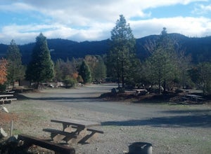
Camp at Shasta Campground
Shasta Campground offers 27 tent/trailer campsites, picnic tables, paved loop road, vault toilets, OHV staging area, potable water, and fire rings. To get to the campground head along Keswick Reservoir, below Shasta Dam. Take I-5 north from Redding about 10 miles to Shasta Dam Blvd. Follow Shas...Read more -
Redding, California
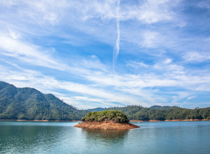
Houseboat Lake Shasta
1 mi / 1 ft gainLake Shasta sits at the foot of infamous Mt Shasta, past the major Northern California city of Redding. From the Bay Area you can count on at least a 3.5 hour drive to get to waters edge, but the drive goes by quickly just cruising on HWY 5. There are multiple Marinas on Shasta but the largest is...Read more -
Shasta County, California
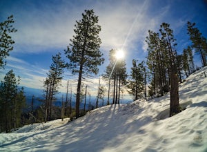
Hike to the top of South Fork Mountain
5 mi / 4181 ft gainStarting from the Kanaka Peak Trailhead, follow the Kanaka Peak Trail all the way, continuing on past the Peltier Trail Junction and the Kanaka Cutoff Trail Junction until the trail begins to head east (about 2-2.5 miles from the trailhead) and there is a gently sloping hill on your right that is...Read more -
Trinity Center, California
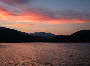
Camp at Hayward Flat on Trinity Lake
We drove all around Trinity Lake and this was the best campground we found! Located right on Trinity Lake you will find Hayward Flat Campground. From Weaverville California you will follow highway 3 north about 20 miles. Then take a right on Hayward Flat road two miles. Boom, you are there. The...Read more -
Trinity Center, California
Backpack Stony Ridge in the Trinity Alps
16.5 mi / 4500 ft gainThe Trinity Alps has miles and miles of beautiful trails, but one of the more stunning sections is the Four Lakes Loop. There are two main trail heads that access the trail. Long Canyon Trail and Stony Ridge Trail both are both beautiful but Stony Ridge is the more popular route yet strenuous. To...Read more -
Douglas City, California
Camp at Steel Bridge Campground
Steel Bridge is located along the Trinity River. About three miles east of Douglas City on State Highway 299, turn north onto Steel Bridge Road and go about 2 miles to the campground.This campground is open from Mid-May until winter weather forces closure. The campground is home to 12 camping s...Read more -
Trinity Center, California
Backpack Stuart Fork to Emerald and Sapphire Lake
25 mi / 4448 ft gainThe Stuart Fork to Emerald and Sapphire Lakes trail features many beautiful lakes, meadows, and an area that resembles a jungle. Dogs are able to use this trail. This trail can be done as a day hike, an overnight, or a three-day backpacking trip. If you choose to make it a three day, the meadows ...Read more -
Douglas City, California
Camp at Douglas City Campground
The campground amenities include 20 tent/trailer campsites, group picnic area, picnic tables, telephone, beach, paved loop road, flush and vault toilets, potable water, and fire rings. MAX trailer length is 28 feet.Douglas City is located along the Trinity River. Follow State Highway 299 to Dougl...Read more -
Trinity Center, California
Granite Lake via Swift Creek Trail
9.66 mi / 1982 ft gainGranite Lake via Swift Creek Trail is an out-and-back trail that takes you by a lake located near Trinity Center, California.Read more -
Trinity Center, California
Backpack to Bear Basin and The Four Lakes Loop
30.1 miDay 1 Swift Creek Trail Head to Bear BasinThe trip begins at the Swift Creek trailhead in the Trinity Alps Wilderness. Permits are very easy to get, just stop by the Ranger station in Weaverville, CA. They are free and can be self-issued in front of the ranger station, or you can go in if you wou...Read more -
Trinity Center, California
Backpack Swift Creek
18.1 mi / 3769 ft gainAfter the first set of switchbacks, you'll emerge in Mumford Meadows. A few switchbacks later and you'll be stunned by the huge granite cliffs. There some great spots to camp - if you cross the stream (perfect for filtering water) you'll find some more spots near the water. The furthest spot has ...Read more -
Trinity Center, California
Stuart Fork Trail to Emerald and Sapphire Lakes
5.027.06 mi / 4213 ft gainThe trail begins just past the Trinity Alps Resort, a private collection of cabins near Weaverville, CA. Hikers wanting an early start can spend the night at the Bridge Camp Campground, located next to the trailhead. The path starts out wide and level, following an old road to the wilderness bou...Read more -
Trinity Center, California
Stuart Fork to Alpine Lake
16 mi / 4265 ft gainNestled in the heights of the Trinity Alps, this hike to Alpine Lake is not for the faint of heart. Before embarking on this adventure call the Weaverville Ranger station to check snow levels as well as the flow of the Stuart Fork River. If you are too early in the summer season the snowpack wi...Read more -
Trinity Center, California
Hike to Boulder Lakes
3.9 mi / 859 ft gainThe upper lake (Little Boulder) is warm and perfect for swimming later in the summer. There are fairly large trout in this lake. The lower lake is bigger and has an abundance of campsites. If you want a bit more solitude, the trail continues further in two directions. Mosquitos can be a problem, ...Read more -
Junction City, California
Hike to East Weaver Lake
2.9 mi / 885 ft gainThe trail is used for hiking, trail running and snowshoeing. The last 30 minutes of your drive will be on a windy dirt road. 4WD is recommended. The trailhead on the top of the road features a fire lookout to explore off to the left, and the trail is on the right.Read more -
Trinity Center, California
Boulder Lakes
3.64 mi / 866 ft gainBoulder Lakes is an out-and-back trail that takes you by a lake located near Trinity Center, California.Read more

