The Best Camping in Julian
Looking for the best camping in Julian? We've got you covered with the top trails, trips, hiking, backpacking, camping and more around Julian. The detailed guides, photos, and reviews are all submitted by the Outbound community.
Top camping spots in and near Julian
-
Julian, California
Kelly Ditch Trail
11.76 mi / 2500 ft gainKelly Ditch Trail is an out-and-back trail where you may see beautiful wildflowers located near Julian, California.Read more -
Julian, California
Oriflamme Canyon Trail
16.08 mi / 2835 ft gainOriflamme Canyon Trail is a loop trail that takes you past scenic surroundings located near Julian, California.Read more -
Julian, California
Hike Stonewall Peak
4.73.82 mi / 820 ft gainThis hike is one of the most popular in the Cuyamaca Rancho State Park. When you reach Stonewall Peak's summit, enjoy the view of the surrounding park and nearby Lake Cuyamaca. The hike up the east side is a popular and relatively easy trail. Although you'll be gaining 800 feet, the hike is relat...Read more -
Julian, California
Camping at Paso Picacho
Paso Picacho, 5 miles north of Cuyamaca Rancho State Park, sits at an elevation of 5,000 feet. The most popular hikes start from this camp, including the 2 mile hike up Stonewall Peak (elevation 5,700 feet), and the 3.5 mile hike up Cuyamaca Peak (elevation 6,512 feet), both which offer breathtak...Read more -
Ranchita, California
Pinyon Ridge Trail to Mount Wilson
10.47 mi / 1552 ft gainPinyon Ridge Trail to Mount Wilson is an out-and-back trail where you may see wildflowers located near Ranchita, California.Read more -
Descanso, California
Harvey Moore Trail
9.59 mi / 1165 ft gainHarvey Moore Trail is a loop trail where you may see beautiful wildflowers located near Descanso, California.Read more -
Julian, California
Pictograph Trail
2.65 mi / 328 ft gainPictograph Trail is an out-and-back trail that takes you by a waterfall located near Mount Laguna, California.Read more -
Mount Laguna, California
Sunset to Big Laguna Loop
5.5 mi / 427 ft gainSunset to Big Laguna Loop is a loop trail that takes you by a lake located near Mount Laguna, California.Read more -
Mount Laguna, California
Lightning Ridge
1.64 mi / 233 ft gainLightning Ridge is a loop trail that is good for all skill levels located near Mount Laguna, California.Read more -
Borrego Springs, California
Maidenhair Falls via Hellhole Canyon Trail
5.06 mi / 1060 ft gainMaidenhair Falls via Hellhole Canyon Trail is an out-and-back trail that is moderately difficult located near Borrego Springs, California.Read more -
Mount Laguna, California
Monument Peak and Foster Point Loop Trail
7.94 mi / 1040 ft gainMonument Peak and Foster Point Loop Trail is a loop trail where you may see beautiful wildflowers located near Mount Laguna, California.Read more -
Borrego Springs, California
Camping in Anza-Borrego State Park
5.0With over 600,000 acres, Anza-Borrego Desert State Park is the largest state park in the contiguous United States. 500 miles of dirt roads, 12 wilderness areas and miles of hiking trails provide visitors with an unparalleled opportunity to experience the wonders of the Colorado Desert. The park i...Read more -
Mount Laguna, California
Pacific Crest Trail to Mount Laguna and Foster Point
5.95 mi / 623 ft gainPacific Crest Trail to Mount Laguna and Foster Point is an out-and-back trail where you may see beautiful wildflowers located near Mount Laguna, California.Read more -
Mount Laguna, California
Desert View Interpretive Trail
0.99 mi / 125 ft gainDesert View Interpretive Trail is a loop trail that provides a good opportunity to see wildlife located near Mount Laguna, California.Read more -
Julian, California
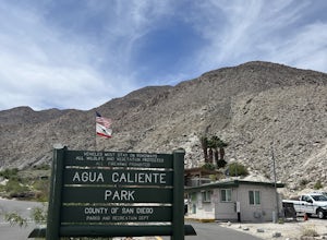
Agua Caliente Hot Spring
5.01.53 mi / 164 ft gainAgua Caliente Hot Spring is an out-and-back trail that takes you by a hot springs located near Julian, California.Read more -
Julian, California
Moonlight Canyon
1.71 mi / 338 ft gainMoonlight Canyon is a loop trail where you may see beautiful wildflowers located near Mount Laguna, California.Read more


