The Best Camping in Three Rivers
Looking for the best camping in Three Rivers? We've got you covered with the top trails, trips, hiking, backpacking, camping and more around Three Rivers. The detailed guides, photos, and reviews are all submitted by the Outbound community.
Top camping spots in and near Three Rivers
-
Sequoia National Park, California
Potwisha Campground Trail
1.6 mi / 223 ft gainPotwisha Campground Trail is an out-and-back trail that takes you by a river located near Three Rivers, California.Read more -
Sequoia National Park, California
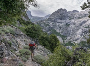
Backpack Bearpaw Meadow to Redwood Meadow
21.3 mi / 5400 ft gainRedwood Meadow is absolutely gorgeous - an amazing reward for your backpacking efforts. This trail is a great backpacking route to take in the early spring when elevated trails are still covered in snow. The trail progresses from the foothills to a giant sequoia grove. The rivers can be a bit cha...Read more -
Sequoia National Park, California
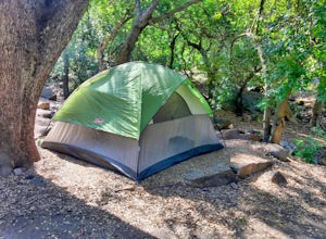
Camp at Buckeye Flat in Sequoia National Park
Entering Sequoia National Park at the Ash Mountain Entrance near the small city of Three Rivers, follow Highway 198 (Generals Highway) through the park until you see a sign for Buckeye Flat Campground off to the right. The campground sign is immediately after you see signs for Hospital Rock. Foll...Read more -
Springville, California
Cahoon Rock from South Fork Campground
28.22 mi / 6880 ft gainCahoon Rock from South Fork Campground is an out-and-back trail that takes you by a river located near Three Rivers, California.Read more -
Springville, California
Ladybug Camp Trail
7.54 mi / 1827 ft gainLadybug Camp Trail is an out-and-back trail that takes you by a river located near Three Rivers, California.Read more -
Sequoia National Park, California
Backpack the High Sierra Trail
5.071 miThe High Sierra Trail begins at Crescent Meadow in Sequoia National Park, on the West side of the Sierra Nevada range, and ends at Whitney Portal on the East, traversing the highest and most beautiful part of the Sierras. From deep river canyons to high alpine peaks, lakes, and meadows, this hike...Read more -
Sequoia National Park, California
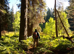
Hike Crescent Meadow
4.51.6 miCrescent Meadow is a collection of loops in the Giant Forest in Sequoia National Park. The trailhead is located just past the tunnel log east of General's Highway 198. The main loop is 1.6mi total. However you can take any of the loops to the General Sherman tree 3mi, Tharp's Log trail 0.5mi, or ...Read more -
Sequoia National Park, California
High Sierra Trail: Ninemile Creek to Bearpaw Meadow
21.38 mi / 4341 ft gainHigh Sierra Trail: Ninemile Creek to Bearpaw Meadow Trail is an out-and-back trail where you may see beautiful wildflowers located near Three Rivers, California.Read more -
Three Rivers, California
Paradise Ridge Trail
5.69 mi / 2395 ft gainParadise Ridge Trail is an out-and-back trail that takes you through a nice forest located near Three Rivers, California.Read more -
Three Rivers, California
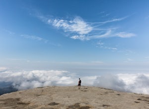
Hike Little Baldy
5.03.5 mi / 700 ft gainA short hike with impressive views of Sequoia National Park, the Little Baldy trail is the less touristy version of Moro Rock. When we hiked it on a beautiful Sunday morning in the summer, we had the entire summit to ourselves. Even if other hikers had been up there, it would have still felt em...Read more -
Three Rivers, California
Muir Grove Trail
3.73 mi / 623 ft gainMuir Grove Trail is an out-and-back trail that takes you by a river located near Stony Creek Village, California.Read more -
Sequoia National Park, California
Wolverton to Panther Gap to Mehrten Meadow
7.82 mi / 1844 ft gainWolverton to Panther Gap to Mehrten Meadow is an out-and-back trail where you may see wildflowers located near Three Rivers, California.Read more -
Sequoia National Park, California
Moose Lake via Watchtower and Pear Lakes Trails
16.09 mi / 4639 ft gainMoose Lake via Watchtower and Pear Lakes Trails is an out-and-back trail that takes you by a lake located near Three Rivers, California.Read more -
Sequoia National Park, California
Heather Lake via Hump Trail (Winter Route)
7.63 mi / 2365 ft gainHeather Lake via Hump Trail (Winter Route) is an out-and-back trail that takes you by a lake located near Three Rivers, California.Read more -
Sequoia National Park, California
Hike to Emerald Lake, Sequoia National Park
4.510.4 mi / 2200 ft gainBegin this hike at the Alta Peak Trailhead in the Sequoia National Park. The trail initially takes you east-southeast through a loosely forested area that is stark and arid. Around 1.5 miles in you'll cross a small creek, but this creek may dry up in the late spring/summer. Shortly after the cree...Read more -
Sequoia National Park, California
Hike to Pear Lake via the Lakes Trail
5.012.4 mi / 2300 ft gainThe Lakes Trail to Pear Lake can be done as either an overnight stay or a day hike. For overnight, you'll need to get a permit but there are beautiful camping spots available at both Emerald Lake and Pear Lake. As a day hike, plan to spend all day since you'll undoubtedly pause at each lake for...Read more


