The Best Camping in Bridgeport
Looking for the best camping in Bridgeport? We've got you covered with the top trails, trips, hiking, backpacking, camping and more around Bridgeport. The detailed guides, photos, and reviews are all submitted by the Outbound community.
Top camping spots in and near Bridgeport
-
Bridgeport, California
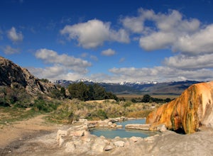
Travertine Hot Springs
4.00.16 mi / 30 ft gainAfter you’ve bagged an Eastern Sierra peak, you deserve a little soaking to soothe your aching feet and tired muscles. Luckily, our great Mother Earth provides what you need. Travertine Hot Springs sits only a few dirt miles from highway 395. Before you head out, grab some local brews from the g...Read more -
Bridgeport, California
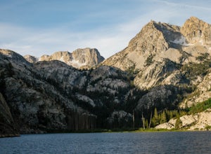
Hike to Peeler Lake
11 mi / 2400 ft gainThis trip can be done as a day trip or backpacking trip. It is around an 11 mile out-and-back trip.Park at Twin Lakes in Bridgeport, CA. There is a $10 fee and it can take a while on busy weekends. A permit is required to stay overnight in Hoover Wilderness. The trailhead can be hard to find; it ...Read more -
Bridgeport, California
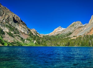
Backpack to Green Lake and Virginia Pass
17 mi / 4452 ft gainDay 1 Green Creek Trailhead to Green Lake When we went on this hike, it was primarily to explore the area and see if it would be a feasible entrance to Northern Yosemite for extended backpacking trips. However, it also is a great two night trip to a lovely area of the Hoover Wilderness. Best...Read more -
Bridgeport, California
Twin Lakes to Peeler Lake
15.76 mi / 2923 ft gainTwin Lakes to Peeler Lake is an out-and-back trail where you may see wildflowers located near Bridgeport, California.Read more -
Bridgeport, California
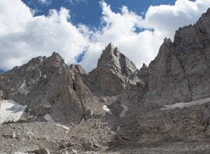
Climb Matterhorn Peak via the East Couloir
10 mi / 6000 ft gainMatterhorn Peak in the northeastern Yosemite Wilderness is an SPS Emblem Peak and many regard it as the beginning of the High Sierra, as there are no peaks higher to the north in the Sierra Nevada.There are many routes to the summit, but the shortest and most direct (though not easiest) begins at...Read more -
Bridgeport, California
Virginia Lakes Trail
4.09.22 mi / 2464 ft gainIf you are looking for a hike with a view every half mile or so, then Virginia Lakes Trail is one to mark on your must-see list. You start at the parking lot near the first lake where bathrooms are available onsite. Try to hike right before the first snow in November so you can see the fall col...Read more -
Lee Vining, California
Backpack Virginia Lakes to Green Creek
10.5 mi / 1234 ft gainKeep in mind that this is a point to point hike, so you will need to park a vehicle at Green Creek trailhead in Bridgeport as well as your start point at Virginia Lakes Resort.Starting at 9,886' at The Virginia Lakes Trailhead, you will begin by heading Northwest towards Virginia Pass. During yo...Read more -
Lee Vining, California
Camp at Mono Lake
5.0Many people visit Mono Lake for a quick photo opportunity of the South Tufa. When I discovered camping was allowed on the North side of the lake, I knew I had to experience it and share.You head East on Cemetery Rd. just North of Lee Vining. This road turns into a dirt road, which will require yo...Read more -
Mono County, California
Leavitt Lake in Stanislaus National Forest
4.07.44 mi / 1385 ft gainSituated on the eastern edge of Emigrant Wilderness, Leavitt Lake is a great introduction to backpacking in the Sierra Nevada. Leavitt Lake is located at the end of Forest Service Route 077 off of Highway 108. It is actually possible to drive to Leavitt Lake, but a high clearance vehicle is requi...Read more -
Lee Vining, California
Twenty Lakes Basin and Saddlebag Lake Loop
7.8 mi / 804 ft gainTwenty Lakes Basin and Saddlebag Lake Loop is a loop trail that takes you by a lake located near Lee Vining, California.Read more -
Lee Vining, California
Conness and Cascade Lakes from Saddlebag Lake
6.09 mi / 1070 ft gainConness and Cascade Lakes from Saddlebag Lake is an out-and-back trail where you may see local wildlife located near Lee Vining, California.Read more -
Lee Vining, California
White Mountain via Sawmill Walk-in Campground
6.7 mi / 1788 ft gainWhite Mountain via Sawmill Walk-in Campground is an out-and-back trail that takes you past scenic surroundings located near Lee Vining, California.Read more -
Lee Vining, California
Camp at Junction Campground, Mono County
Junction campground is by far one of my favorite campsites when I am visiting the High Sierra and Tuolumne Meadows. The only downside is, you can only camp certain months; usually from June through October when highway 120 is open. The Junction campground is far away from the crowds of Yosemite ...Read more -
Arnold, California
PCT: CA Section J - Sonora Pass to Echo Lake
73.27 mi / 11811 ft gainPCT: CA Section J - Sonora Pass to Echo Lake is a point-to-point trail where you may see wildflowers located near Coleville, California.Read more -
Highway 108, California
Backpack to Blue Canyon Lake
5.03.6 mi / 1280 ft gainTrailhead Coordinates: 38º 19'08.46"N 119º39'49.26"W Elev 8897ftThe trail is kind of tricky to find. It is West of the PCT trailhead at Sonora Pass and it is not marked. You park along the side of Hwy 108 and scramble down an embankment where a creek flows at the bottom. Cross this creek and you ...Read more -
Coleville, California
Hike to Tamarack Lake, Carson-Iceberg Wilderness
4.010 mi / 2000 ft gainThe trailhead begins at the end of Golden Gate Rd in Coleville, Ca on highway 396. There are very limited signs, so maps are necessary! Depending on how fast of a hiker you are, you can most likely reach the lake in 6 hours with minimal breaks. If you cannot start in the morning, there are beauti...Read more

