The Best Camping in Big Bear
Looking for the best camping in Big Bear? We've got you covered with the top trails, trips, hiking, backpacking, camping and more around Big Bear. The detailed guides, photos, and reviews are all submitted by the Outbound community.
Top camping spots in and near Big Bear
-
Big Bear, California
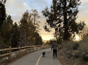
Alpine Pedal Path
5.05.08 mi / 292 ft gainAlpine Pedal Path is an out-and-back trail that takes you by a lake located near Big Bear Lake, California.Read more -
Big Bear, California
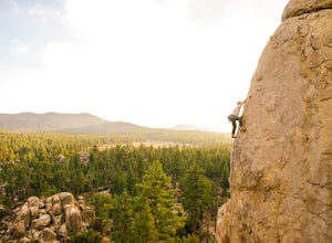
Rock Climb Holcomb Valley
5.0Most of the drive to Holcomb Valley is done on regular paved roads until about the last hour when you get above Big Bear Lake and you start your journey on dirt roads. The road is extremely bumpy and has lots of pot holes but there are generally quite a few cars up there that don't have 4 wheel d...Read more -
Big Bear, California
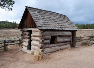
Camp at Holcomb Valley Campground
This campground is awesome! With great views, plenty of space and clean bathrooms it'll have you in for a treat! Whether it be a multiple day trip or just one night this campground is awesome. Read below for information if you are looking for a trip in the mountains! Cost: This campground is a bi...Read more -
Big Bear, California
Holcomb Valley Campground + 3N's
2.7 mi / 203 ft gainHolcomb Valley Campground + 3N's is an out-and-back trail that is good for all skill levels located near Big Bear City, California.Read more -
San Bernardino County, California
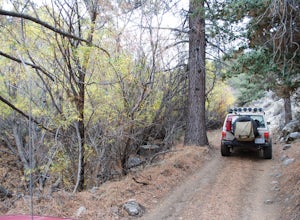
Off-Road Jacoby Canyon
2.9 miThis is now my favorite trail in the San Bernardino National Forest. Ranging from desert scenes at the bottom and pine trees at the top, you experience such high levels of outdoors feel you can't resist. This trail has so many awesome spots for camping and off-roading that it has a great mix for ...Read more -
Big Bear, California
Holcomb Creek via the PCT
12.98 mi / 971 ft gainHolcomb Creek via the PCT is a point-to-point trail where you may see wildflowers located near Big Bear City, California.Read more -
Big Bear, California
Holcomb Valley OHV Road
10.83 mi / 1135 ft gainHolcomb Valley OHV Road is a heavily trafficked point-to-point trail located near Fawnskin, California.Read more -
Angelus Oaks, California
South Fork Trail to Dry Lake
10.86 mi / 2411 ft gainSouth Fork Trail to Dry Lake is an out-and-back trail that takes you by a river located near Angelus Oaks, California.Read more -
Angelus Oaks, California
South Fork to Dollar Lake Trail
11.3 mi / 449 ft gainSouth Fork to Dollar Lake Trail is an out-and-back trail that takes you by a lake located near Banning, California.Read more -
Angelus Oaks, California
Shields Peak Trail
14.47 mi / 4219 ft gainShields Peak Trail is an out-and-back trail that takes you by a river located near Angelus Oaks, California.Read more -
Angelus Oaks, California
San Gorgonio Mountain from Fish Creek
19.87 mi / 4203 ft gainSan Gorgonio Mountain from Fish Creek is an out-and-back trail that takes you by a lake located near Whitewater, California.Read more -
Forest Falls, California
Summit Mt. San Bernardino from Angelus Oaks
16 mi / 4775 ft gainThe trailhead is somewhat 'interesting' to get to given the dirt roads are in questionable shape and some of the roads in Angelus Oaks are not easily identifiable but I didn't have any problems finding it by closely following Google Maps. Trailhead parking requires an Adventure Pass parking pe...Read more -
Forest Falls, California
San Bernardino Peak via Momyer Creek Trail
16.3 mi / 5735 ft gainSan Bernardino Peak via Momyer Creek Trail is an out-and-back trail that takes you by a river located near Forest Falls, California.Read more -
Forest Falls, California
Momyer to San Gorgonio
25.19 mi / 7539 ft gainMomyer to San Gorgonio is an out-and-back trail where you may see beautiful wildflowers located near Pismo Beach, California.Read more -
Forest Falls, California
Momyer Creek and Falls Creek Loop
19.88 mi / 6476 ft gainMomyer Creek and Falls Creek Loop is a loop trail that takes you by a waterfall located near Forest Falls, California.Read more -
Forest Falls, California
Vivian Creek Trail to San Gorgonio Peak
17.83 mi / 5627 ft gainVivian Creek Trail to San Gorgonio Peak is an out-and-back trail that takes you by a waterfall located near Forest Falls, California.Read more

