The Best Camping in Santa Barbara County
Looking for the best camping in Santa Barbara County? We've got you covered with the top trails, trips, hiking, backpacking, camping and more around Santa Barbara County. The detailed guides, photos, and reviews are all submitted by the Outbound community.
Top camping spots in and near Santa Barbara County
-
Santa Barbara, California
Forbush Flat and Cottam Camp via Blue Canyon Trail
6.98 mi / 1955 ft gainForbush Flat and Cottam Camp via Blue Canyon Trail is an out-and-back trail that is moderately difficult located near Santa Barbara, California.Read more -
Carpinteria, California
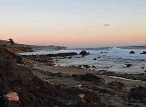
Camp at Carpinteria State Beach
3.7There are 2 campgrounds close to Rincón, but Carpinteria State Beach is a little bigger and easier to find a spot. There are 4 campgrounds: Santa Cruz, Anacapa, San Miguel and Santa Rosa. Most of them are RV sites, but if you stay at Santa Cruz Campground you can set your tent right at the beach,...Read more -
Carpinteria, California
Camp and Explore in Santa Cruz Campground
5.0/ 4 ft gainSanta Cruz Campground is nestled in Carpinteria State Beach, an easy drive from Santa Barbara, Ventura, or the greater LA area. Over a mile of beach front access allows for swimming, surfing, fishing, tide pool exploration, and picnicking. There is an abundance of wildlife to see: seals, sea lio...Read more -
Santa Barbara, California
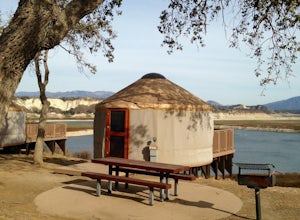
Camp at Lake Cachuma
The campground here is extremely well developed and tightly run (for better or worse). The sites afford very little privacy: I recommend looking for the "Prime" campsites along the bluff, or choosing a weekday. If you can afford to spend a little extra, the park offers yurt rentals, which have th...Read more -
Santa Barbara, California
Lake Cachuma Campground
2.48 mi / 154 ft gainLake Cachuma Campground is a loop trail that is good for all skill levels located near Santa Barbara, California.Read more -
Ojai, California
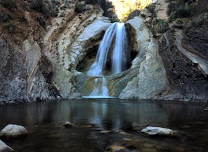
Matilija Falls
5.04.84 mi / 950 ft gain...If you've read most of my blogs, you'll probably notice I have a fascination for waterfalls! I've done this hike multiple times, but it wasn't until this day where I saw these falls truly in action and what they're meant to look like. Getting here, you'll drive 13.4 miles north on highway 33 f...Read more -
Goleta, California
Camp at El Capitan State Beach
4.7This popular campground of 142 sites is equipped with fire rings and a picnic area, in addition to restrooms and showers. There are group campsites available, as well. Click here for more info/ reservations.Read more -
Goleta, California
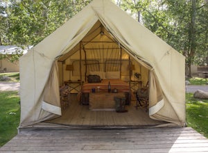
Camp at El Capitan Canyon
5.0El Capitan Canyon is a gorgeous collection of permanent tents, yurts and cabins located across the highway from El Capitan State Beach and its campground. It's also the perfect place to ease your friends or loved ones into the world of camping. We all have that special person in our life who we'...Read more -
Ojai, California
Camp at Rose Valley
5.0Close to Ventura and Ojai, California, this spot is an easy weekend getaway from the hectic coast of Ventura. Follow Highway 33 east toward Ojai. This road will lead into the Los Padres National Forest and become very curved and sleep as it gets closer to Rose Valley. The sign for the Park with b...Read more -
Goleta, California
Camp at Refugio Campground
4.0/ 3 ft gainRefugio State Beach is a great location for fishing, hiking, and picnicking. Lucky beach-goers will spot sea otters, dolphins, seals, and whales. Both sides of the lagoon are perfect for exploring. Heading north will take you to a nice viewpoint with a picnic table above a surfing location. The R...Read more -
Ojai, California
Chorro Grande Trail
9.88 mi / 3284 ft gainChorro Grande Trail is an out-and-back trail where you may see beautiful wildflowers located near Ojai, California.Read more -
Maricopa, California
Deal Trail
11.14 mi / 1581 ft gainDeal Trail is an out-and-back trail that takes you by a river located near Ojai, California.Read more -
Maricopa, California
Camp and Boulder at Pine Mountain
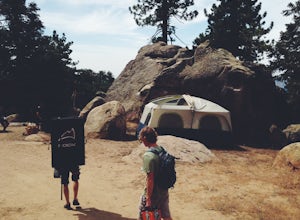
Pine Mountain is closed intermittently for the winter season due to snowfall, usually from November through February. Outside of those months, take the Highway 33 north out of Ojai, heading north for about an hour and a half. You’ll see a large turnout as well as a sign reading “Pine Mt Road” on ...Read more -
Ventura, California
Hike the Potato Harbor Trail on Santa Cruz Island
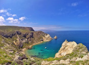
5.0As California’s largest island, Santa Cruz Island of the Channel Islands is the perfect little getaway from Los Angeles. Getting to the island is possible only by a one hour boat ride through Island Packers, click here to find out more about them. Be sure to pack light since you’ll be carrying ev...Read more -
Ventura, California
Scorpion Bay to Cavern Point Loop
1.69 mi / 269 ft gainScorpion Bay to Cavern Point Loop is a loop trail that takes you by a river located near Ventura, California.Read more -
Ojai, California
Shelf Road Trail
3.52 mi / 338 ft gainShelf Road Trail is an out-and-back trail that takes you past scenic surroundings located near Ojai, California.Read more


