The Best Camping in Livermore
Looking for the best camping in Livermore? We've got you covered with the top trails, trips, hiking, backpacking, camping and more around Livermore. The detailed guides, photos, and reviews are all submitted by the Outbound community.
Top camping spots in and near Livermore
-
Livermore, California
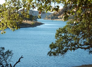
East Shore and Heron Bay Trail to Venadas Group Camp
12.28 mi / 2395 ft gainEast Shore and Heron Bay Trail to Venadas Group Camp is a loop trail that takes you by a lake located near Livermore, California.Read more -
Livermore, California
Del Valle Regional Park
4.0Looking for a quick summer escape filled with stand up paddling, canoeing, fishing, hiking, and picnics? Look no further than Del Valle Regional Park. Consistently considered one of the best campgrounds in the Bay Area, the centerpiece of Del Valle is a 5-mile long lake that allows swimming, fish...Read more -
Livermore, California
East Shore, Ridgeline, East Ridge Loop
5.27 mi / 656 ft gainEast Shore, Ridgeline, East Ridge Loop is a loop trail that takes you by a lake located near Livermore, California.Read more -
Livermore, California
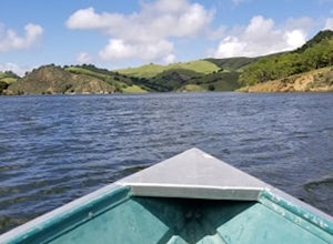
Paddle Lake Del Valle
4.0Lake Del Valle is a reservoir located in Livermore, California. The lake has boat motor boats, pedal boats, patio boats, canoes, and row boats available for rent. There is a dock and rental house in the marina.The lake is also a popular destination for picnics, barbecues, and camping. Parking fi...Read more -
Livermore, California
Condor, Volvan, Stone Corral, Coyote Loop
4.54.38 mi / 620 ft gainThis regional preserve is perfect for day hikes. There are also designated campsites and even a backpack campsite. Horses and dogs are welcome in the preserve. There are many different clearly marked trails that one can choose from. A good 4.5 mile loop is to start at the Park Residence entrance...Read more -
Sunol, California
Little Yosemite via Canyon View Trail
4.03.01 mi / 705 ft gainPlease note this is a fragile ecosystem and watershed. There is NO swimming allowed in Alameda Creek and trespassing is prohibited on Water Department lands that are not accessible to the public. You can learn more about the restrictions and the area at ebparks.org. After entering the kiosk you...Read more -
Fremont, California
Rose Peak From Sunol
18.64 mi / 3714 ft gainRose Peak From Sunol is an out-and-back trail where you may see beautiful wildflowers located near Sunol, California.Read more -
Sunol, California
Camp Ohlone Road to Little Yosemite, Geary Road, Backpack Road, McCorkle
5.75 mi / 1109 ft gainCamp Ohlone Road to Little Yosemite, Geary Road, Backpack Road, McCorkle is a loop trail that takes you by a lake located near Sunol, California.Read more -
Brentwood, California
Miwok Trail and Hardy Canyon Loop Trail
4.61 mi / 1027 ft gainMiwok Trail and Hardy Canyon Loop Trail is a loop trail that takes you by a river located near Brentwood, California.Read more -
Fremont, California
Mission Peak Loop from Stanford Avenue Staging Area
5.97 mi / 2083 ft gainMission Peak Loop from Stanford Avenue Staging Area is a loop trail where you may see beautiful wildflowers located near Milpitas, California.Read more -
Danville, California
Rock City to the Summit of Mount Diablo
7.77 mi / 2382 ft gainRock City to the Summit of Mount Diablo is an out-and-back trail where you may see wildflowers located near Danville, California.Read more -
Walnut Creek, California
Camp at Juniper Campground in Mount Diablo SP
Mount Diablo's summit in Mount Diablo State Park rises to 3,848ft, with Juniper Campground in Mount Diablo SP is at approximately 3,000ft in elevation. Juniper Campground overlooks the valley below and some of the San Francisco Bay. Reservations for Juniper Campground can be made at Reserveamer...Read more -
Walnut Creek, California
Mount Diablo North Peak Trail
6.18 mi / 2133 ft gainMount Diablo North Peak Trail is an out-and-back trail where you may see beautiful wildflowers located near Walnut Creek, California.Read more -
Alamo, California
Green Valley to Wall Point Road Loop
7.09 mi / 1375 ft gainGreen Valley to Wall Point Road Loop is a loop trail where you may see beautiful wildflowers located near Diablo, California.Read more -
Alamo, California
Pine Creek and Wall Point Trail
4.05 mi / 574 ft gainPine Creek and Wall Point Trail is a loop trail that takes you by a river located near Alamo, California.Read more -
Castro Valley, California
Aaron Alcorn Castro Valley to Brentwood Memorial Trail
58.54 mi / 6755 ft gainAaron Alcorn Castro Valley to Brentwood Memorial Trail is a point-to-point trail that takes you past scenic surroundings located near Castro Valley, California.Read more


