The Best Camping in Olympic Valley
Looking for the best camping in Olympic Valley? We've got you covered with the top trails, trips, hiking, backpacking, camping and more around Olympic Valley. The detailed guides, photos, and reviews are all submitted by the Outbound community.
Top camping spots in and near Olympic Valley
-
Alpine Meadows, California
Alpine Meadows to Squaw Valley
11.4 mi / 2562 ft gainAlpine Meadows to Squaw Valley is a point-to-point trail that takes you through a nice forest located near Olympic Valley, California.Read more -
Tahoe City, California
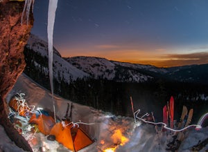
Ride Twin Peaks in Lake Tahoe's Backcountry
This trip is best done in two days with an approach day and then a descent day. Get started at the base of the Sherwood Chair on the backside of the Alpine ski area. Head up, outside of the ski area boundary toward the high ridge.Once on the ridge, you follow it south for a few miles until reachi...Read more -
Tahoe City, California
Truckee River Trail
7.6 mi / 289 ft gainTruckee River Trail is a point-to-point trail that takes you by a lake located near Tahoe City, California.Read more -
Tahoe City, California
Camp at William Kent Campground
/ 6282 ft gainWilliam Kent Campground is a few miles south of Tahoe City on Lake Tahoe's western shore. Access to the lake is just a short walk from the campground. The campground provides bathrooms, campfire rings, a trash dump station, firewood vendor, grills, picnic tables, and food storage lockers. Pets ar...Read more -
Tahoe City, California
Camp at Kaspian Campground
/ 6298 ft gainKaspian Campground is a short walk from the shores of Lake Tahoe, less than 10 miles from popular Meeks Bay. The campsites are relatively private and are surrounded by pine and fir trees. Each campsite has a fire ring, grill, and picnic table. The campground provides bathrooms, potable water, and...Read more -
Truckee, California
Jackass Spur Mountain Biking Trail
4.33 mi / 604 ft gainJackass Spur Mountain Biking Trail is a loop trail where you may see beautiful wildflowers located near Truckee, California.Read more -
Truckee, California
Split Rock Loop Trail
2.6 mi / 121 ft gainSplit Rock Loop Trail is a loop trail that takes you by a lake located near Truckee, California.Read more -
Tahoe Vista, California
Hike to the Martis Peak Fire Lookout
5.07.5 mi / 1700 ft gainThis hike leads to a 100 year old fire lookout near the summit of Martis Peak with incredible views of North Lake Tahoe. There are two options to get to the peak: Martis Peak Road - to get to this trailhead from Truckee, head south on Highway 267 for about 8 miles and look for a large pull off on...Read more -
Tahoe Vista, California
Tahoe Rim Trail (TRT) Complete Loop
164.36 mi / 1358 ft gainTahoe Rim Trail (TRT) Complete Loop is a loop trail that takes you by a lake located near South Lake Tahoe, California.Read more -
Olympic Valley, California
Tahoe Rim Trail (TRT): Barker Pass to Tahoe City
15.4 mi / 1909 ft gainTahoe Rim Trail (TRT): Barker Pass to Tahoe City is a point-to-point trail that takes you by a lake located near Homewood, California.Read more -
Olympic Valley, California
Barker Pass to Twin Peaks
10.77 mi / 2169 ft gainBarker Pass to Twin Peaks is an out-and-back trail where you may see wildflowers located near Homewood, California.Read more -
Olympic Valley, California
Barker Pass to Echo Lakes
30.96 mi / 4242 ft gainBarker Pass to Echo Lakes is a point-to-point trail that takes you by a lake located near Homewood, California.Read more -
Olympic Valley, California
Barker Pass to Middle Velma Lake via PCT
29.4 mi / 3638 ft gainBarker Pass to Middle Velma Lake via PCT is an out-and-back trail that takes you by a lake located near Homewood, California.Read more -
Soda Springs, California
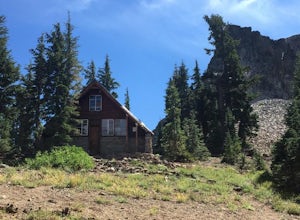
Hike to the Peter Benson Hut
5.011.6 mi / 1800 ft gainDrive to the top of Donner Summit via the Old Hwy 40 and park at the Donner Summit PCT trailhead, just past the Sugar Bowl Academy Building. Begin hiking up-hill through a somewhat forested area for about 2 miles. Shortly after you pass the trail sign for the Mt. Judah Loop, you will come to a sm...Read more -
Nevada County, California
PCT: CA Section L - Highway 80 to Highway 49
37.02 mi / 5036 ft gainPCT: CA Section L - Highway 80 to Highway 49 is a point-to-point trail that takes you through a nice forest located near Soda Springs, California.Read more


