The Best Camping in Palmdale
Looking for the best camping in Palmdale? We've got you covered with the top trails, trips, hiking, backpacking, camping and more around Palmdale. The detailed guides, photos, and reviews are all submitted by the Outbound community.
Top camping spots in and near Palmdale
-
Palmdale, California
Mount Pacifico Loop Trail
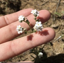
11.85 mi / 2598 ft gainMount Pacifico Loop Trail is a loop trail where you may see beautiful wildflowers located near Acton, California.Read more -
Santa Clarita, California
PCT: CA Section E - Agua Dulce to Tehachapi Pass
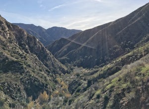
109.33 mi / 19902 ft gainPCT: CA Section E - Agua Dulce to Tehachapi Pass is a point-to-point trail that takes you by a river located near Acton, California.Read more -
Santa Clarita, California
Grass Mountain via San Francisquito Canyon Road
4.55 mi / 1286 ft gainGrass Mountain via San Francisquito Canyon Road is a loop trail where you may see beautiful wildflowers located near Santa Clarita, California.Read more -
Pearblossom, California
Camp at Horse Flats Campground
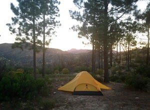
3.0The Horse Flats Campground is located 29 miles up Highway 2 from Interstate 210. You will turn left at the Santa Clara Divide Road(this intersection is also known as 3 Points). 3 miles down the road you will turn left to enter the campground. I have camped here a few times and its always been pre...Read more -
Pearblossom, California
Mt. Hillyer Trail from Horse Flats Campground
3.33 mi / 541 ft gainMt. Hillyer Trail from Horse Flats Campground is an out-and-back trail where you may see beautiful wildflowers located near Mount Wilson, California.Read more -
Lancaster, California
Saddleback Butte State Park Loop
0.58 mi / 46 ft gainSaddleback Butte State Park is a state park in the Antelope Valley of the western Mojave Desert. It’s oftentimes looked over, but you’d be surprised what you can find there. Definitely a place to stop. It is located east of Lancaster. It can get hot so make sure to bring lots of water and wear su...Read more -
Palmdale, California
Camp at Chilao Campground
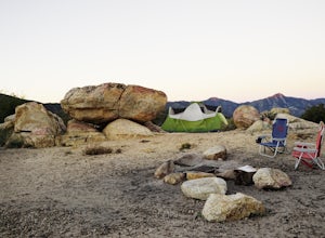
4.3While not as popular as shady Buckhorn Campground up the road, Chilao offers the better views and greater chances of scoring a peaceful and private campsite. There are two campsites located here (and two group camps down in the valley). Sites are first come, first serve, and cost $12 (bring exact...Read more -
Palmdale, California
Camp at Manzanita Loop in Chilao Campground
5.0Chilao Camp is located at an elevation of 5,300 feet, in the San Gabriel Mountains, and is divided into two different loops called the Manzanita and Pine.This specific adventure is for the Manzanita Loop, which is pretty much known as the more scenic loop, mainly because the area overlooks the Bi...Read more -
Pearblossom, California
Hike to the Cooper Canyon Trail Camp
5 mi / -765 ft gainThere's a small parking lot just below Cloudburst Summit on the way to Waterman Mountain. Start your adventure there. I'd be hard pressed to say it's more than 15 yards from the sign for the summit (7018' AMSL). There's a fire road, if you're newer to altitude and don't know how to read a map (or...Read more -
Pearblossom, California
Cooper Canyon via Cloudburst Summit
7.64 mi / 1739 ft gainCooper Canyon via Cloudburst Summit is an out-and-back trail that takes you by a waterfall located near Palmdale, California.Read more -
Pearblossom, California
Cooper Canyon Falls Trail
6.29 mi / 1309 ft gainCooper Canyon Falls Trail is a loop trail that takes you by a waterfall located near Mount Wilson, California.Read more -
Pearblossom, California
Burkhart Trail to Cooper Canyon Falls
5.04.77 mi / 981 ft gainBurkhart Trail to Cooper Canyon Falls is an out-and-back trail that takes you by a waterfall located near Mount Wilson, California.Read more -
Los Angeles County, California
Hike to Trail Canyon Falls
4.04 mi / 800 ft gainTo get to the trail, take Big Tujunga Canyon Road until you see signs for Trail Canyon Road. The entry point is easy to miss, but keep an eye out for a stop sign and cars parked at the bottom of a dirt path. Drive up the dirt path for direct parking at the trailhead (4x4 is definitely recommended...Read more -
Los Angeles County, California
Trail Canyon Falls
4.63 mi / 935 ft gainTrail Canyon Falls is an out-and-back trail that takes you by a waterfall located near Sunland, California.Read more -
Pearblossom, California
Islip Saddle to Mt Islip via Little Jimmy Campground
6.59 mi / 1568 ft gainIslip Saddle to Mt Islip via Little Jimmy Campground is an out-and-back trail where you may see beautiful wildflowers located near Mount Wilson, California.Read more -
Pearblossom, California
Mount Islip, Middle Hawkins, Mount Hawkins, and Baden Powell via PCT
19.26 mi / 4685 ft gainMount Islip, Middle Hawkins, Mount Hawkins, and Baden Powell via PCT is an out-and-back trail that provides a good opportunity to view wildlife located near Pearblossom, California.Read more


