The Best Camping in Paicines
Looking for the best camping in Paicines? We've got you covered with the top trails, trips, hiking, backpacking, camping and more around Paicines. The detailed guides, photos, and reviews are all submitted by the Outbound community.
Top camping spots in and near Paicines
-
Paicines, California
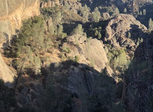
Camp in Pinnacles National Park
4.0/ 1819 ft gainPinnacles Campground is accessible from the east side of the park, and you generally lose cell service about 20 minutes before the park entrance. The campground offers tent camping, group camping, and a handful of RV sites. The tent and group sites have individual picnic tables and fire rings, an...Read more -
Paicines, California
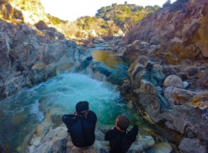
Laguna Falls
5.05 mi / 873 ft gainLaguna Falls is an out-and-back trail that takes you by a waterfall located near King City, California.Read more -
Greenfield, California
Jack's Cabin
11.13 mi / 3130 ft gainJack's Cabin is an out-and-back trail that takes you by a river located near Greenfield, California.Read more -
Greenfield, California
Adventure at Arroyo Seco
4.6This off-the-beaten-trail adventure has a little bit of everything for everyone, and is as challenging as you make it. Many just make it about a mile down to the river for a leisurely day of relaxing, swimming, sunbathing, and enjoying a few cold beverages. Others embark on a 7+ mile adventure up...Read more -
Gilroy, California
Redfern Pond via Hunting Hollow
5.07 mi / 1263 ft gainHenry W. Coe State Park, northern California's largest, provides outdoor enthusiasts with over 89,000 acres of land to explore, as well as 22,000 acres of designated wilderness area. With all of this space, the outdoor adventures are seemingly endless. We recommend a multi-day backpacking trip to...Read more -
Gilroy, California
Coit Lake Loop Trail
22.82 mi / 4226 ft gainCoit Lake Loop Trail is a loop trail where you may see beautiful wildflowers located near Gilroy, California.Read more -
Gilroy, California
Steer Ridge Loop at Hunting Hollow
7.23 mi / 1742 ft gainSteer Ridge Loop at Hunting Hollow is a loop trail that is used by hikers, mountain bikers, and equestrians located near Gilroy, California.Read more -
Gilroy, California
Pacheco Falls Loop via Coyote Creek/Hunting Hollow
22.73 mi / 5007 ft gainPacheco Falls Loop via Coyote Creek/Hunting Hollow is a loop trail that takes you by a lake located near Gilroy, California.Read more -
Gilroy, California
Coyote Lake County Park Campgrounds Trail
10.55 mi / 1565 ft gainCoyote Lake County Park Campgrounds Trail is a loop trail that takes you by a lake located near San Martin, California.Read more -
Gilroy, California
Merry-Go-Round, Bayview, and Sprig Trails Loop
7.97 mi / 1896 ft gainMerry-Go-Round, Bayview, and Sprig Trails Loop is a loop trail that is moderately difficult located near Gilroy, California.Read more -
Greenfield, California
Junipero Serra Peak
11.15 mi / 3691 ft gainJunipero Serra Peak is an out-and-back trail that takes you by a river located near Greenfield, California.Read more -
Sand City, California
Bikepack Highway 1: Monterey to San Luis Obispo
130 mi / 9000 ft gainPlease be aware that this is NOT a route for beginning cyclist. It is a very hilly route and you will be sharing the road with cars for the entire route, the shoulder is sometimes very slim. This should not scare you from doing the trip, just be aware of the risks and dangers you might be facing....Read more -
Watsonville, California
Sprig Trail, Merry-Go-Round, and Tan Oak Trail Loop
8.52 mi / 62 ft gainSprig Trail, Merry-Go-Round, and Tan Oak Trail Loop is a loop trail where you may see wildflowers located near Gilroy, California.Read more -
Watsonville, California
Mount Madonna Meadow Trail Loop
2.41 mi / 476 ft gainMount Madonna Meadow Trail Loop is a loop trail where you may see beautiful wildflowers located near Watsonville, California.Read more -
Watsonville, California
Camp at Sunset State Beach
4.5Campsites here come with a fire ring and picnic table, as well as bathroom and shower access. These sites are particularly recommended for families and large groups. Make a reservation here.Read more -
Carmel-by-the-Sea, California
Pat Springs via Skinners Ridge
3.513.18 mi / 3645 ft gainBackpacking to Pat Springs is a way to see Big Sur and the San Lucia mountains from a perspective that few get to experience. The Ventana Wilderness is rugged and remote, yet Pat Springs is one of the most beautiful campgrounds around that will allow you to take in this amazing terrain. To get ...Read more

