The Best Camping in Kern County
Looking for the best camping in Kern County? We've got you covered with the top trails, trips, hiking, backpacking, camping and more around Kern County. The detailed guides, photos, and reviews are all submitted by the Outbound community.
Top camping spots in and near Kern County
-
Kern County, California
PCT: CA Section F - Tehachapi Pass to Walker Pass
83.69 mi / 15377 ft gainPCT: CA Section F - Tehachapi Pass to Walker Pass is a point-to-point trail where you may see wildflowers located near Mojave, California.Read more -
Bakersfield, California
Rancheria OHV Road
33.6 mi / 7752 ft gainRancheria OHV Road is a point-to-point trail where you may see local wildlife located near Bakersfield, CaliforniaRead more -
Bakersfield, California
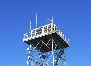
Oak Flat Lookout
4.0/ 80 ft gainSpend a few nights under the stars in a unique piece of outdoor history. The Oak Flat Lookout, constructed in 1934, was once staffed by rangers providing critical wild life management services on watch for wildfires in the surrounding Sequoia National Forest through the 1980s. The Oak Flat lookou...Read more -
Lake Hughes, California
Hike the Pacific Crest Trail from Horse Trail to Bear Campground
11.63 mi / 2396 ft gainThis is part of the Pacific Crest Trail. If you're through-hiking or sectional hiking, you'll have to hit it eventually. Try and avoid it in the late summer or early fall because of heat, and gnats. Find a way to check the bug report, we got marauded by gnats 90% of the way (early October) and ap...Read more -
Lake Hughes, California
Shake Road Loop
3.88 mi / 722 ft gainShake Road Loop is a loop trail where you may see beautiful wildflowers located near Lake Hughes, California.Read more -
Weldon, California
Dove Spring Canyon OHV Trail
15.04 mi / 1460 ft gainDove Spring Canyon OHV Trail is a point-to-point trail that provides a good opportunity to view wildlife located near Weldon, California.Read more -
Lake Isabella, California
Isabella Lake
1.06 mi / 43 ft gainIsabella Lake is a loop trail that is good for all skill levels located near Lake Isabella, California.Read more -
Frazier Park, California
Mount Pinos via McGill Trail
4.015.99 mi / 3196 ft gainMount Pinos via McGill Trail is an out-and-back trail that provides a good opportunity to view wildlife located near Frazier Park, California.Read more -
Cantil, California
Ricardo Camp South Loop Trail
1.11 mi / 220 ft gainRicardo Camp South Loop Trail is a loop trail where you may see beautiful wildflowers located near California City, California.Read more -
Kern County, California
Red Cliffs Trail
1 mi / 101 ft gainRed Cliffs Trail Is a loop trail that is moderately difficult located near is a loop trail that is good for all skill levels located near Cantil, CaliforniaRead more -
Santa Clarita, California
Grass Mountain via San Francisquito Canyon Road
4.55 mi / 1286 ft gainGrass Mountain via San Francisquito Canyon Road is a loop trail where you may see beautiful wildflowers located near Santa Clarita, California.Read more -
Kern County, California
Camp Under Red Rock Canyon
Red Rock Canyon is a must stop for those driving along Highway 14 between the Owens and Antelope Valleys. The park is located where the southernmost tip of the Sierra Nevada converge with the El Paso Range and features scenic desert cliffs, buttes, and spectacular rock formations. Each tributary ...Read more -
Castaic, California
Hiking the Piru Creek Gorge Trail
Take the I-5 exit North of Castaic, CA at Templin Hwy. Turn onto Golden State Hwy heading the only direction it goes from the exit, North. When it dead-ends in a few miles at the National Forest Gate, you are at Frenchman's Flat.You can camp here, or hang with the day hikers. Heading North along ...Read more -
Frazier Park, California
Hike to Conder Observatory (Mt. Piños) from the Nordic Ski Hut
3.32 mi / 457 ft gainAny drive up the I-405N or I-5N is going to result in some pain: Either you leave early enough to avoid traffic, or you are sitting in some slowness for a while. But once you turn onto Frazier Mountain Road from the interstate, you are in a completely different world. It could be 85° in Los Angel...Read more -
Frazier Park, California
Mount Pinos Trail
3.52 mi / 561 ft gainMount Pinos Trail is an out-and-back trail where you may see beautiful wildflowers located near Frazier Park, California.Read more -
Frazier Park, California
Eagle Pass Ridge
1.26 mi / 220 ft gainEagle Pass Ridge is an out-and-back trail that takes you by a river located near Frazier Park, California.Read more


