The Best Camping in Maricopa
Looking for the best camping in Maricopa? We've got you covered with the top trails, trips, hiking, backpacking, camping and more around Maricopa. The detailed guides, photos, and reviews are all submitted by the Outbound community.
Top camping spots in and near Maricopa
-
Frazier Park, California
Eagle Pass Ridge
1.26 mi / 220 ft gainEagle Pass Ridge is an out-and-back trail that takes you by a river located near Frazier Park, California.Read more -
Santa Barbara County, California
Santa Barbara Canyon to Big Pine Mountain
41.18 mi / 7694 ft gainSanta Barbara Canyon to Big Pine Mountain is an out-and-back trail that takes you by a river located near New Cuyama, California.Read more -
Frazier Park, California
Mount Pinos Trail
3.52 mi / 561 ft gainMount Pinos Trail is an out-and-back trail where you may see beautiful wildflowers located near Frazier Park, California.Read more -
Frazier Park, California
Hike to Conder Observatory (Mt. Piños) from the Nordic Ski Hut
3.32 mi / 457 ft gainAny drive up the I-405N or I-5N is going to result in some pain: Either you leave early enough to avoid traffic, or you are sitting in some slowness for a while. But once you turn onto Frazier Mountain Road from the interstate, you are in a completely different world. It could be 85° in Los Angel...Read more -
Frazier Park, California
Mount Pinos via McGill Trail
4.015.99 mi / 3196 ft gainMount Pinos via McGill Trail is an out-and-back trail that provides a good opportunity to view wildlife located near Frazier Park, California.Read more -
Maricopa, California
Dry Canyon OHV Road
6.17 mi / 459 ft gainDry Canyon OHV Road is an out-and-back trail that takes you through a nice forest located near Ojai, California.Read more -
Maricopa, California
Deal Trail
11.14 mi / 1581 ft gainDeal Trail is an out-and-back trail that takes you by a river located near Ojai, California.Read more -
New Cuyama, California
Selby Campground Loop Trail
4.4 mi / 1194 ft gainSelby Campground Loop Trail is a loop trail where you may see beautiful wildflowers located near New Cuyama, California.Read more -
Maricopa, California
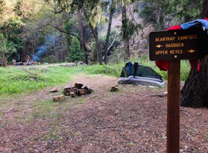
Backpack to Bear Trap Campground
4.8 mi / 1200 ft gainThere's no better feeling then camping out and having a whole site to you and your friends...wouldn't you agree?!?! ...Deep in the Sespe Wilderness in Ojai, California sits a tucked away, well-managed campsite called "Bear Trap Campground". This campsite can be reached at any point of the year an...Read more -
Maricopa, California
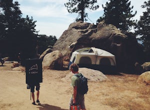
Camp and Boulder at Pine Mountain
Pine Mountain is closed intermittently for the winter season due to snowfall, usually from November through February. Outside of those months, take the Highway 33 north out of Ojai, heading north for about an hour and a half. You’ll see a large turnout as well as a sign reading “Pine Mt Road” on ...Read more -
Maricopa, California
Reyes Peak Trail
1.8 mi / 541 ft gainReyes Peak Trail is an out and back trail where you may see wildflowers located near Ojai, CaliforniaRead more -
Ojai, California
Chorro Grande Trail
9.88 mi / 3284 ft gainChorro Grande Trail is an out-and-back trail where you may see beautiful wildflowers located near Ojai, California.Read more -
Los Olivos, California
Nyra to Fish Camp
5.43 mi / 630 ft gainNyra to Fish Camp is an out-and-back trail that provides a good opportunity to view wildlife located near Santa Barbara, California.Read more -
Los Olivos, California
Manzana Creek and Eastern Hurricane Deck Loop
24.39 mi / 4685 ft gainManzana Creek and Eastern Hurricane Deck Loop is a loop trail where you may see wildflowers located near Los Olivos, California.Read more -
Los Olivos, California
Manzanita Creek Trail to Dabney Cabin
12.74 mi / 1207 ft gainManzanita Creek Trail to Dabney Cabin is an out-and-back trail that is moderately difficult located near Los Olivos, California.Read more -
Los Olivos, California
Manzana Trail To Potrero Camp
2.59 mi / 558 ft gainManzana Trail To Potrero Camp is an out-and-back trail where you may see wildflowers located near Los Olivos, California.Read more


